
more stats
3.0 miles
Distance
57 ft
Climb
-1,837 ft
Descent
00:30:30
Avg time
-1,781 ft
Altitude change
1,416 ft
Altitude min
3,199 ft
Altitude max
3,197 ft
Altitude start
1,417 ft
Altitude end
-11.1%
Grade
-82.4%
Grade max
13.2%
Grade min
1,286 ft
Distance climb
3 miles
Distance down
157 ft
Distance flat
00:30:30
Avg time

Farniole Details

  • Activities
    • Mountain Bike
    • E-Bike
    • Horse
    • Hike
    • Trail Running
  • Riding Area
  • Ref Number
    #231
  • AKA
    Campo dei peri
  • Difficulty Rating
  • Local Popularity
    60 in Mountain Biking [+]
    • 50 in E-Biking
    • 80 in Trail Running
    • 95 in Hiking
    • 5 in Horseback
  • Global Ranking
    #79209 in Mountain Biking [+]
    • #49143 in E-Biking
    • #111306 in Trail Running
    • #94603 in Hiking
    • #23049 in Horseback
  • National Ranking
    #6,599 in Mountain Biking · Italy [+]
    • #5,859 in E-Biking
    • #3,533 in Trail Running
    • #3,002 in Hiking
    • #727 in Horseback
  • Trail Type
    Singletrack
  • Bike Type
    AM, XC
  • Direction
    Downhill Primary
    Popular Direction Shown
  • Physical Rating
    Hard
  • Trail Visibility
    Always easy to follow
  • Dogs Allowed
    Yes
  • eBike Allowed
    Yes up to Class 1
  • TTFs on Trail
    Drop, Rock Face, Rock Garden, Roller Coaster

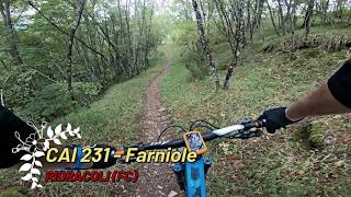
Uno dei trail più famosi della Diga di Ridracoli, si imbocca svoltando a destra poco dopo l'inizio del trail Pratalino. Percorre tratti di una antica strada romanica ed alterna rock Garden a tratti più flow con sponde naturali ,divertimento assicurato

Tags
DropsRock gardensRock slabsRollers

Recent Activity on Trail

Past Week
  • 0 rides
  •  
6 Months
  • 3 rides
  • 21 miles avg distance
All
  • 30 rides
  • Last: Oct 24, 2026
update trails status or condition

Farniole Trail Reports

statusdatedescription
Oct 10, 2026 @ 10:42am (Europe/San_Marino)
Oct 10, 2026
Tutto pulito
Apr 11, 2026 @ 2:29pm (Europe/Rome)
Apr 11, 2026
Un po’ di alberi caduti dopo la prima parte, non in punti pericolosi/ciechi ma un po’ scomodi da passare
Mar 23, 2026 @ 10:07am (Europe/Rome)
Mar 23, 2026
Minor erosion (trail braiding, small ruts developing, brake bumps)
Mar 23, 2026 @ 10:05am (Europe/Rome)
Mar 23, 2026
Feb 28, 2026 @ 10:00am (Europe/Rome)
Feb 28, 2026
more »
Status:
on Oct 10, 2026
Ideal
Avg: 4.29 (5 votes)
Your vote: 0

view (247)
close
      Directions to farniole trailhead (43.861570, 11.861450)

      Photos

      10 more »
      mtb
      106 |
      Aug 14, 2023 @ 2:03pm
      Aug 14, 2023
      mtb
      97 |
      Sep 16, 2022 @ 3:37pm
      Sep 16, 2022
      mtb
      115 |
      Sep 16, 2022 @ 3:37pm
      Sep 16, 2022
      mtb
      88 |
      Sep 16, 2022 @ 3:36pm
      Sep 16, 2022

      Videos

      2 more »
      CAI 231 - Farniole, Ridracoli (FC) 10-10-2026
      mtb
      20:06 | 23 | Oct 17, 2026 , Bagno di Romagna
      Farniole, Ridracoli (FC) 18-08-2022
      mtb
      4:22 | 87 | Mar 30, 2023 , Bagno di Romagna
      4.6 ★★★★★
      5 Ratings
      5 ★ 60%
      4 ★ 40%
      3 ★
      2 ★
      1 ★

      1 Review & Comments

      FranckG31
      Very rocky but very nice. Some steep technical sections.
      Very steep stair with wood logs at the end. Very narrow also with a wooden guardrail.

      We hope you've been enjoying Trailforks!

      Create a FREE account to view all trail reviews and much more.

      • By gpaolocontiTF Pro & contributors
      • #184566 - 1,248 views

      Frequently Asked Questions

      ▼ Where is Farniole located?
      Farniole is located in Bagno di Romagna, Italy. It is part of the Bagno di Romagna trail network. The trailhead is located at coordinates 43.86157, 11.86145.
      ▼ How hard is Farniole?
      Farniole is rated as Blue difficulty. The physical rating is Hard. The average grade is 11.1%.
      ▼ What is the elevation gain for Farniole?
      Farniole has 57 ft of elevation gain. The trail has 1,837 ft of elevation descent. The elevation ranges from 1,416 ft to 3,199 ft.
      ▼ Is Farniole a point to point trail?
      Farniole is not a point to point trail. The direction is Downhill Primary. The trail type is singletrack.
      ▼ How long is Farniole?
      Farniole is 3.0 miles long. The trail type is singletrack.
      ▼ Are dogs allowed on Farniole?
      Yes, dogs are allowed on Farniole. Please keep dogs on a leash where required and clean up after them.
      ▼ How do I access Farniole? Where is the closest parking trailhead?
      The closest parking and trailhead locations to Farniole are: View all parking locations in the area.
      ▼ How long does it take to ride Farniole?
      Based on recorded activities, it takes an average of 31 minutes to ride Farniole. The trail is 3.0 miles long. Actual times will vary based on fitness level, conditions, and pace. View recent activity logs for more details.
      ▼ How busy is Farniole?
      Farniole is a moderately popular trail. There have been 252 recorded activities on this trail. The trail has received 247 check-ins. View recent activity on this trail.

      Hit the Trail

      Open in App

      Get this trail on your phone instantly.

      open trail in app

      Download Trail

      Save to wishlist, Garmin & download.
      save the trail

      Find Related Routes

      Find routes and users activities that include this trail.
      find routes for this trail

      You must enter a description before submitting.

