

more stats
3,215 ft
Distance
18 ft
Climb
-490 ft
Descent
00:07:32
Avg time
-471 ft
Altitude change
3,170 ft
Altitude min
3,649 ft
Altitude max
3,645 ft
Altitude start
3,173 ft
Altitude end
-14.7%
Grade
-55.7%
Grade max
22%
Grade min
325 ft
Distance climb
2,359 ft
Distance down
463 ft
Distance flat
00:07:32
Avg time

Ffargartner Trail Details

  • Activities
    • Mountain Bike
    • E-Bike
  • Riding Area
  • Ref Number
    T19
  • Difficulty Rating
  • Voted Difficulty
    Proline (1 vote)
  • Local Popularity
    80 in Mountain Biking heatmap [+]
    • 70 in E-Biking
  • Global Ranking
    #545 in Mountain Biking [+]
    • #28835 in E-Biking
  • National Ranking
    #9 in Mountain Biking · Austria [+]
    • #198 in E-Biking
  • Trail Type
    Singletrack
  • Direction
    Downhill Only
    Popular Direction Shown
  • Climb Difficulty
    Blue
  • Physical Rating
    Hard
  • Trail Visibility
    Always easy to follow
  • eBike Allowed
  • TTFs on Trail
    Berm, Drop, Gap Jump, Rock Face, Rock Garden, Skinny

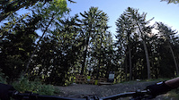
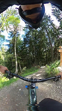
The Ffargartner Trail is truly unique. The dreamlike combination of natural very technical sections with enough drops and doubles combined with a thoughtful line choice of the trail, makes this trail at the same time rare and unique. Here, the absolute pros and experts get their money's worth.

Access Info

From the start of the Ffargartner Trail simply follow the trial course to the end of the trail.

Recent Activity on Trail

Past Week
  • 1 rides
  • 16 miles average
6 Months
  • 44 rides
  • 19 miles avg distance
All
  • 109 rides
  • Last: Nov 15, 2026
c1c2c3c4
January
February
March
April
May
June
July
August
September
October
November
December
update trails status or condition

Ffargartner Trail Trail Reports

statusdatedescription
Nov 15, 2026 @ 7:49pm (Europe/Vienna)
3 hours
reporter Season is over, see you 2027!
Aug 1, 2026 @ 8:43pm (Europe/Vienna)
Aug 1, 2026
perfect today, super flow
Apr 16, 2026 @ 10:27pm (Europe/Vienna)
Apr 16, 2026
reporter Trail is open.
Nov 9, 2025 @ 6:39pm (Europe/Vienna)
Nov 9, 2025
reporter Season ist over. See you 2026.
Apr 22, 2025 @ 10:48pm
Apr 22, 2025
Achtung: Ab 01.05.2025 sind die Trails kostenpflichtig. Ein Trailticket muss gekauft werden. Attention: From 01.05.2025 the trails are subject to...
more »
Status:
on Nov 15, 2026
Avg: 4.6 (14 votes)
Your vote: 0

view (546)
close
      Directions to ffargartner-trail trailhead (46.531880, 13.903040)

      Photos

      25 more »
      mtb
      186 |
      Nov 4, 2025 @ 1:25am
      Nov 4, 2025
      mtb
      162 |
      Nov 4, 2025 @ 1:24am
      Nov 4, 2025
      mtb
      167 |
      Nov 4, 2025 @ 1:24am
      Nov 4, 2025
      mtb
      172 |
      Nov 4, 2025 @ 1:23am
      Nov 4, 2025

      Videos

      2 more »
      ffargartner
      mtb
      2:36 | 371 | Oct 5, 2023 , Villach
      ffargartner
      mtb
      0:26 | 188 | Sep 20, 2023 , Villach

      Routes with this trail

      more »
      29 miles • 5,894 ft • 27 • Loop • Race •
      Route of the Austrian Enduro Championship 2026
      4.9 ★★★★★
      14 Ratings
      5 ★ 86%
      4 ★ 14%
      3 ★
      2 ★
      1 ★

      8 Reviews & Comments

      crisotop crisotop
      Zu geil, selbst im feuchten funktioniert der Trail super - danke für das Schmuckstück
      moust moust
      what a gem - probs to the builders
      super fun line if you know the lines and takeoff directions ! 10/10
      FloImSchnee
      Großartiger Weg, schön abwechslungsreich, und mit einigen Sprüngen die (zumindest für mich) nicht beim ersten Mal direkt hinhauen.
      Und auch mal mit ein paar "technischen" Passagen drin, die man selten auf "gebauten" Wegen findet, sondern sonst nur auf Wanderwegen.

      Besten Dank dafür, hatte eine riesen Gaudi.

      (zur Schwierigkeit: Proline halte ich allerdings doch für übertrieben. Je nach persönlichen Vorlieben sehe ich den bei schwarz oder vielleicht Doppelschwarz)

      We hope you've been enjoying Trailforks!

      Create a FREE account to view all trail reviews and much more.

      • By lakebiketrailsTF Pro lakebike & contributors
      • #673061 - 1,463 views

      Frequently Asked Questions

      ▼ Where is Ffargartner Trail located?
      Ffargartner Trail is located in Trailcenter Faaker See, Villach, Austria. It is part of the Trailcenter Faaker See trail network. The trailhead is located at coordinates 46.53188, 13.90304.
      ▼ How hard is Ffargartner Trail?
      Ffargartner Trail is rated as Black difficulty. The physical rating is Hard. The average grade is 14.7%. The climb difficulty is rated Blue.
      ▼ What is the elevation gain for Ffargartner Trail?
      Ffargartner Trail has 18 ft of elevation gain. The trail has 490 ft of elevation descent. The elevation ranges from 3,170 ft to 3,649 ft.
      ▼ Is Ffargartner Trail a point to point trail?
      Yes, Ffargartner Trail is a point to point trail. The direction is Downhill Only. The trail type is singletrack.
      ▼ How long is Ffargartner Trail?
      Ffargartner Trail is 3,215 ft long. The trail type is singletrack.
      ▼ Are dogs allowed on Ffargartner Trail?
      There is no information about dogs being allowed on Ffargartner Trail. Check with local trail managers or the trail page for the latest access rules.
      ▼ When is the best time of year to ride Ffargartner Trail?
      Based on activity log data, the most popular months to ride Ffargartner Trail are:
      • October (22 activities)
      • August (21 activities)
      • April (13 activities)
      Check the reports page for current trail conditions.
      ▼ How do I access Ffargartner Trail? Where is the closest parking trailhead?
      The closest parking and trailhead locations to Ffargartner Trail are: View all parking locations in the area.
      ▼ How long does it take to ride Ffargartner Trail?
      Based on recorded activities, it takes an average of 8 minutes to ride Ffargartner Trail. The trail is 3,215 ft long. Actual times will vary based on fitness level, conditions, and pace. View recent activity logs for more details.
      ▼ How busy is Ffargartner Trail?
      Ffargartner Trail is a very popular trail. There have been 394 recorded activities on this trail. The trail has received 546 check-ins. View recent activity on this trail.

      Hit the Trail

      Open in App

      Get this trail on your phone instantly.

      open trail in app

      Download Trail

      Save to wishlist, Garmin & download.
      save the trail

      Find Related Routes

      Find routes and users activities that include this trail.
      find routes for this trail

      You must enter a description before submitting.

