

Open in App
Get this trail on your phone instantly.

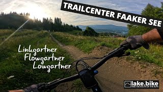
The Linkgartner Trail is for more experienced riders the ideal connection between the main transfer via the forest road and the entrance of the Flowgartner Trail. The name Linkgartner was created because of the idea of connection. The trail itself was dug by hand and made as easy as possible for a natural red trail, according to the terrain.
From the start of the trail, always follow the Linkgartner Trail T47 signs to the end of the trail.
| c1 | c2 | c3 | c4 |
|---|---|---|---|
January | February | March | April |
May | June | July | August |
September | October | November | December |

Service Road Atlas is a free to use, community-driven service for viewing and creating reports on the numerous back-country service roads around B.C. and Alberta.
Save the current map location and zoom level as your default home location whenever this page is loaded.
Save
No reviews yet, be the first to write a review or ask a question.
Use trail reports to comment on trail conditions.
We hope you've been enjoying Trailforks!
Create a FREE account to view all trail reviews and much more.
 lakebike & contributors
You must enter a description before submitting.

