
more stats
5.7 miles
Distance
461 ft
Climb
-464 ft
Descent
1,640 ft
High Point
-1 ft
Altitude change
1,555 ft
Altitude min
1,599 ft
Altitude start
1,598 ft
Altitude end
-23.4%
Grade max
18%
Grade min
1 mile
Distance climb
1 mile
Distance down
3 miles
Distance flat

Flowdag Details

  • Activities
    • Mountain Bike
    • E-Bike
    • Winter Fat Bike
    • Hike
    • Trail Running
    • Snowshoe
  • Riding Area
    Heal Creek Bike Park
    Rhinelander, Wisconsin
  • Difficulty Rating
  • Local Popularity
    100 in Mountain Biking [+]
    • 90 in E-Biking
    • 5 in Trail Running
    • 95 in Hiking
    • 5 in Snowshoeing
    • 5 in Winter Fat Biking
  • Global Ranking
    #150511 in Mountain Biking [+]
    • #332999 in Hiking
  • Hiking SAC Scale
    T1 Hiking
  • Trail Type
    Singletrack
  • Bike Type
    AM, XC, Fat
  • Direction
    Both Directions[+]
    • Both Directions for E-Biking
    • Both Directions for Trail Running
    • Both Directions for Hiking
  • Climb Difficulty
    Green
  • Physical Rating
    Moderate
  • Trail Visibility
    Always easy to follow
  • Dogs Allowed
    Yes
  • eBike Allowed
    Yes up to Class 1
  • TTFs on Trail
    A-Frame, Berm, Bridge, Drop, Jump, Rock Garden, Roller Coaster
  • Land Owner

Preferred trail direction is counterclockwise for biking, clockwise for hikers. The first 2.8 miles from the trailhead and traveling counterclockwise, goes along the Northwood Golf Club and riders may see golfers on the course. All trail features have ride arounds. There are two pit toilets accessible from the trail.

Access Info

Trail begins at the northeast corner of the Northwood Golf Club parking lot.

Local Trail Association

Recent Activity on Trail

Past Week
  • 2 rides
  • 6 miles average
6 Months
  • 65 rides
  • 10 miles avg distance
All
  • 119 rides
  • Last: Sep 18, 2026
c1c2c3c4
January
February
March
April
May
June
July
August
September
October
November
December
update trails status or condition

Flowdag Trail Reports

Status:
on Jul 6, 2026
Ideal
Avg: 5 (2 votes)
Your vote: 0

view (232)
close
      Directions to flowdag trailhead (45.616340, -89.480710)

      Photos

      No photos have been added for Flowdag yet, add a photo.

      Videos

      2 more »
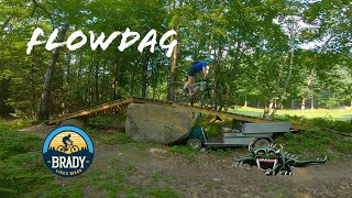
      Heal Creek Mountain Bike Trails, Rhinelander,...
      mtb
      3:47 | 219 | Apr 2, 2026 , Rhinelander
      Flowdag Trail
      mtb
      39:16 | 241 | Sep 11, 2025 , Rhinelander

      Routes with this trail

      12 miles 844 ft 3 Loop
      This route connects 3 cross country loops and is mostly fast flow trail with periods of technical riding...
      17 miles 1,199 ft 15 Loop
      All the cross country trails are incorporated into this route.
      5.0
      2 Ratings
      5 100%
      4
      3
      2
      1

      4 Reviews & Comments

      Jduppler
      Great XC trail system. Very flowy so very aptly named. Well groomed and some great berms. Great job trail designers and builders!
      Kelly55423 Kelly55423
      Did this on my 11th or so mtb ride, and wouldn't start here for sure if your cardio fitness isn't up to snuff (like me). Just hop off the bike when you need to! Wouldn't take a true beginner on this. My friend said it's an intermediate trail, not really beginner/easy.
      trusstruss
      Rasta are Northwoods heroes. Great vision and obviously knew how to choose their spot carefully (hopefully there won’t be spats with the golf course over the parking lot). Flowdag (brilliant name!) is an ideal beginner trail and should convert novices to the sport. Great use of the natural terrain. All the trails here (so far) are professionally machine made in the modern style. The Trailforks mapping is incomplete as there’s a great blue trail (not quite finished) called Swingtime (I think) and a section of completed downhill jump lines with a return so you can do laps. With more loops to come, according to the trail builders, who I spoke with. Can’t wait to see it all done—it will be the place to ride in the area.

      We hope you've been enjoying Trailforks!

      Create a FREE account to view all trail reviews and much more.

      • By oleslewfoot33TF Pro & contributors
      • #853324 - 559 views

      Frequently Asked Questions

      Where is Flowdag located?
      Flowdag is located in Heal Creek Bike Park, Rhinelander, Wisconsin, United States. It is part of the Heal Creek Bike Park trail network. The trailhead is located at coordinates 45.61634, -89.48071.
      How hard is Flowdag?
      Flowdag is rated as Green difficulty. The physical rating is Moderate. The climb difficulty is rated Green.
      What is the elevation gain for Flowdag?
      Flowdag has 461 ft of elevation gain. The trail has 464 ft of elevation descent. The elevation ranges from 1,555 ft to 1,640 ft.
      Is Flowdag a point to point trail?
      Flowdag is not a point to point trail. The direction is Both Directions. The trail type is singletrack.
      How long is Flowdag?
      Flowdag is 5.7 miles long. The trail type is singletrack.
      Are dogs allowed on Flowdag?
      Yes, dogs are allowed on Flowdag. Please keep dogs on a leash where required and clean up after them.
      How do I access Flowdag? Where is the closest parking trailhead?
      The closest parking and trailhead locations to Flowdag are: View all parking locations in the area.
      How busy is Flowdag?
      Flowdag is a very popular trail. There have been 206 recorded activities on this trail. The trail has received 232 check-ins. View recent activity on this trail.

      Hit the Trail

      Open in App

      Get this trail on your phone instantly.

      open trail in app

      Download Trail

      Save to wishlist, Garmin & download.
      save the trail

      Find Related Routes

      Find routes and users activities that include this trail.
      find routes for this trail

      You must enter a description before submitting.