
more stats
1.2 miles
Distance
29 ft
Climb
-1,129 ft
Descent
00:12:17
Avg time
-1,101 ft
Altitude change
3,260 ft
Altitude min
4,360 ft
Altitude max
4,360 ft
Altitude start
3,261 ft
Altitude end
-17.9%
Grade
-77.5%
Grade max
27.3%
Grade min
269 ft
Distance climb
1 mile
Distance down
00:12:17
Avg time

Trail Details

  • Activities
    • Mountain Bike
    • E-Bike
    • Adaptive Bike
    • Winter Fat Bike
  • Riding Area
  • Ref Number
    #855
  • Difficulty Rating
  • Voted Difficulty
    Red (5 votes)
  • Local Popularity
    100 in Mountain Biking heatmap [+]
    • 80 in E-Biking
    • 5 in Winter Fat Biking
    • 5 in Adaptive Biking
  • Global Ranking
    #41678 in Mountain Biking [+]
    • #24869 in E-Biking
    • #3172 in Winter Fat Biking
    • #787 in Adaptive Biking
  • National Ranking
    #375 in Mountain Biking · Austria [+]
    • #176 in E-Biking
    • #7 in Winter Fat Biking
    • #4 in Adaptive Biking
  • Trail Type
    Singletrack
  • Bike Type
    DH, AM, XC, DJ, RD, Fat, Adaptive MTB
  • Direction
    Downhill Only
    Popular Direction Shown
  • Season
    May-Oct
  • Dogs Allowed
    Yes
  • eBike Allowed
    Yes up to Class 1
  • TTFs on Trail
    Drop, Jump, Rock Garden, Wallride

No community description for Forest Thunder (Forest One) trail has been added yet!

AI Generated Description

Forest Thunder (Forest One) is a 2 km popular black difficulty singletrack trail located near Lermoos. This mountain bike primary trail can be used downhill only. It features drop, jump, rock garden and wallride. On average it takes 12 minutes to complete this trail.

Access Info

This trail is also named as "Singletrail Schlägle" – all signs to the trail acces are also named as "Singletrail Schlägle".

Disclaimer

Wearing a helmet is compulsory. Ride at your own risk.

Tags
DropsJumpsRock gardensWallride

Recent Activity on Trail

Past Week
  • 0 rides
  •  
6 Months
  • 96 rides
  • 25 miles avg distance
All
  • 217 rides
  • Last: Nov 8, 2026
Status:
on Oct 13, 2026
Ideal
Avg: 3.87 (25 votes)
Your vote: 0

view (1,436)
close
      Directions to forest-thunder-forest-one trailhead (47.396270, 10.865640)

      Photos

      3 more »
      mtb
      240 |
      Sep 2, 2019 @ 7:31am
      Sep 2, 2019
      mtb
      250 |
      Sep 2, 2019 @ 7:30am
      Sep 2, 2019
      mtb
      318 |
      Oct 30, 2018 @ 10:35am
      Oct 30, 2018

      Videos

      5 more »
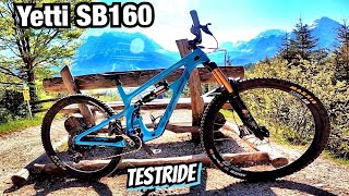
      First Test YETTI SB 160! Black Trail Forest...
      mtb
      8:29 | 397 | Aug 30, 2024 , Lermoos
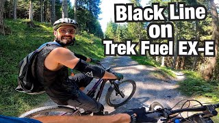
      BLACK LINE ON A TRAIL E-bike! Trek Fuel Ex-e 9.7
      mtb
      7:51 | 287 | Aug 30, 2024 , Lermoos
      youtuber Singletrail Schlägle - Tiroler Zugspitz Arena...
      mtb
      2:26 | 266 | Jul 3, 2024 , Lermoos
      Anspruchsvolle Mountainbike Abfahrt auf dem...
      mtb
      6:05 | 940 | Oct 14, 2020 , Lermoos
      3.9 ★★★★★
      25 Ratings
      5 ★ 36%
      4 ★ 40%
      3 ★ 8%
      2 ★ 4%
      1 ★ 12%

      7 Reviews & Comments

      Guildars
      I really appreciate Lermoos for it's natural character and the old trails are exactly what I am looking for. The new trail ending is not what a customer of that trail is awaiting I think. If that is family segment it should be not at the ending of black trail to secure a safety of the families.
      Radler666 Radler666
      Cooler Trail,wurde wohl viel überarbeitet!Zum Teil flowig, zum Teil Wurzeln und technische Passagen.Der untere Teil wurde zum Family Trail umgebaut.Sehr cool und leicht,trotz schwarzem Schild!
      ThomasniDkPH
      Fanden's ziemlich nett und größtenteils sogar richtig flowig. Das wurzelige Waldstück ist nicht schwerer als die übrigen Sachen hier. Schöne Anliegerröhre unten ... gute Arbeit. Rot/S2

      We hope you've been enjoying Trailforks!

      Create a FREE account to view all trail reviews and much more.

      • By suu & contributors
      • #96113 - 3,263 views

      Frequently Asked Questions

      ▼ Where is Forest Thunder (Forest One) located?
      Forest Thunder (Forest One) is located in Tiroler Zugspitz Arena, Lermoos, Austria. It is part of the Tiroler Zugspitz Arena trail network. The trailhead is located at coordinates 47.39627, 10.86564.
      ▼ How hard is Forest Thunder (Forest One)?
      Forest Thunder (Forest One) is rated as Black difficulty. The average grade is 17.9%.
      ▼ What is the elevation gain for Forest Thunder (Forest One)?
      Forest Thunder (Forest One) has 29 ft of elevation gain. The trail has 1,129 ft of elevation descent. The elevation ranges from 3,260 ft to 4,360 ft.
      ▼ Is Forest Thunder (Forest One) a point to point trail?
      Yes, Forest Thunder (Forest One) is a point to point trail. The direction is Downhill Only. The trail type is singletrack.
      ▼ How long is Forest Thunder (Forest One)?
      Forest Thunder (Forest One) is 1.2 miles long. The trail type is singletrack.
      ▼ Are dogs allowed on Forest Thunder (Forest One)?
      Yes, dogs are allowed on Forest Thunder (Forest One). Please keep dogs on a leash where required and clean up after them.
      ▼ When is the best time of year to ride Forest Thunder (Forest One)?
      Forest Thunder (Forest One) is best visited during: May-Oct.
      ▼ How do I access Forest Thunder (Forest One)? Where is the closest parking trailhead?
      The closest parking and trailhead locations to Forest Thunder (Forest One) are: View all parking locations in the area.
      ▼ How long does it take to ride Forest Thunder (Forest One)?
      Based on recorded activities, it takes an average of 12 minutes to ride Forest Thunder (Forest One). The trail is 1.2 miles long. Actual times will vary based on fitness level, conditions, and pace. View recent activity logs for more details.
      ▼ How busy is Forest Thunder (Forest One)?
      Forest Thunder (Forest One) is a very popular trail. There have been 1,030 recorded activities on this trail. The trail has received 1,436 check-ins. View recent activity on this trail.

      Hit the Trail

      Open in App

      Get this trail on your phone instantly.

      open trail in app

      Download Trail

      Save to wishlist, Garmin & download.
      save the trail

      Find Related Routes

      Find routes and users activities that include this trail.
      find routes for this trail

      You must enter a description before submitting.

