close
-
Layers w
- Weather Layers
- Pro
- Pro
- Pro
- Pro
- Pro
- Pro
- More Layers
- Pro
- Pro
- Pro
- Pro
-
Upgrade to

3D
Trail Conditions
- Unknown
- Snow Groomed
- Snow Packed
- Snow Covered
- Snow Cover Partial
- Freeze/thaw Cycle
- Icy
- Prevalent Mud
- Wet
- Variable
- Ideal
- Dry
- Very Dry
Trail Flow (Ridden Direction)
Trailforks scans users ridelogs to determine the most popular direction each trail is ridden. A good flowing trail network will have most trails flowing in a single direction according to their intension.
The colour categories are based on what percentage of riders are riding a trail in its intended direction.
The colour categories are based on what percentage of riders are riding a trail in its intended direction.
- > 96%
- > 90%
- > 80%
- > 70%
- > 50%
- < 50%
- bi-directional trail
- no data
Trail Last Ridden
Trailforks scans ridelogs to determine the last time a trail was ridden.
- < 2 days
- < 1 week
- < 2 weeks
- < 1 month
- < 6 months
- > 6 months
Trail Ridden Direction
The intended direction a trail should be ridden.
- Downhill Only
- Downhill Primary
- Both Directions
- Uphill Primary
- Uphill Only
- One Direction
Contribute Details
Colors indicate trail is missing specified detail.
- Description
- Photos
- Description & Photos
- Videos
Trail Popularity ?
Trailforks scans ridelogs to determine which trails are ridden the most in the last 9 months.
Trails are compared with nearby trails in the same city region with a possible 25 colour shades.
Think of this as a heatmap, more rides = more kinetic energy = warmer colors.
- most popular
- popular
- less popular
- not popular
ATV/ORV/OHV Filter
Max Vehicle Width
inches
US Cell Coverage
Legend

Radar Time
Activity Recordings
Trailforks uses anonymized public activity data.
?
Activity Recordings
Trailforks uses anonymized public activity data.
?
Personal Heatmap
▶
Activity Types
all
/
none
▶
Options
2
Date range
month
–
Winter Trails
Warning
A routing network for winter maps does not exist. Selecting trails using the winter trails layer has been disabled.
Missing Trails
Most Popular
Least Popular
Trails are colored based on popularity. The more popular a trail is, the more red. Less popular trails trend towards green.
Jump Magnitude Heatmap
Heatmap of where riders jump on trails. Zoom in to see individual jumps, click circles to view jump details.
BC Backroad Status
![map legend]()
Service Road Atlas is a free to use, community-driven service for viewing and creating reports on the numerous back-country service roads around B.C. and Alberta.

Slope Aspect
Direction the slope faces
Trails Deemphasized
Trails are shown in grey.
Only show trails with no bike usage.
Suggested Layers
Based on selected activity type
Save the current map location and zoom level as your default home location whenever this page is loaded.
SaveThe Bezirk Reutte is an administrative district (Bezirk) in Tyrol, Austria. It borders Bavaria (Germany) in the north, the districts Imst and Landeck in the south, and Bregenz and Bludenz (both in Vorarlberg) in the west. The district is also referred to as Außerfern.
This region uses the Uk/Euro style trail grading system.
Activities Click to view
- Mountain Bike
53 trails
- E-Bike
44 trails
- Horse
0 trails
- Hike
122 trails
- Trail Running
122 trails
- Dirtbike/Moto
0 trails
- Observed Trials
0 trails
- ATV/ORV/OHV
0 trails
- Snowmobile
0 trails
- Snowshoe
0 trails
- Downhill Ski
0 trails
- Backcountry Ski
45 trails
- Nordic Ski
0 trails
Region Details
- 19
- 5
- 16
- 6
- 5
Stats
- Avg Trail Rating
- Trails (view details)
- 185
- Trails Mountain Bike
- 53
- Trails E-Bike
- 44
- Trails Gravel Bike
- 3
- Trails Adaptive Bike
- 17
- Trails Winter Fat Bike
- 8
- Trails Hike
- 122
- Trails Trail Running
- 122
- Trails Backcountry Ski
- 45
- Total Distance
- 266 miles
- Total Descent
- 134,529 ft
- Total Vertical
- 5,575 ft
- Highest Trailhead
- 8,276 ft
- Reports
- 554
- Photos
- 263
- Ridden Counter
- 6,607
Sub Regions
- Ehrwald (9)
- Lermoos (24)
- Reutte (7)
- Trailarea Urisee (5)
- Tannheim (8)
- Tannheimer Tal (2)
- Zöblen (3)
- Mühlwaldtrails (3)
- Bike Park Zugspitze (3)
Popular Außerfern Mountain Biking Trails
• 100 ★ 3.2 • 3,143 ft • 0 ft • 690 •
An official trail permitted for riding, but a sorry statement for the Lermoos bike park area. This trail starts out about 100 vertical meters below the gondola station, as a wide, steep, loose gravel and rock road for the first half....
• 95 ★ 3.9 • 1 mile • 29 ft • 498 •
Popular black difficulty singletrack. This mountain bike primary trail can be used downhill only. It features drop, jump, rock garden and wallride. On average it takes 13 minutes to complete this trail.
• 80 ★ 4.1 • 2 miles • 59 ft • 411 •
Start bei der Grubigalm rechts in den 3250 m langen Flowtrail mit vielen Pumptrackelementen und Steilkurven. Im letzten Streckenabschnitt erwarten den Biker technisch anspruchsvolle Spitzkehren - diese können aber über die...
• 95 ★ 4.2 • 2 miles • 16 ft • 277 •
Flow trail with well built berms and rollers and quite a few side hits. Last third comes with a looser surface, but also some tables.
• 65 ★ 4.3 • 5,007 ft • 0 ft • 263 •
Highly rated moderately popular red difficulty alpine singletrack. This mountain bike primary trail can be used downhill primary. On average it takes 13 minutes to complete this trail.
Außerfern Mountain Bike Routes
5 miles • 1,768 ft • 0 •
Zu Beginn des Anstieges zur Tuftalm findet sich ein Hinweisschild zu einer „mittelschweren Mountainbike...
Photos of Außerfern Mountain Bike
Videos of Außerfern Mountain Bike
trail: Blindseetrail
0:24 |
5 |
Jun 28, 2026
trail: Big Down
0:57 |
97 |
Aug 4, 2020
youtuber
![Bare Knuckel - Bike Park Zugspitze | LINES]()
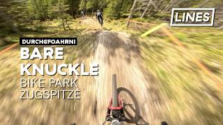
trail: Bare Knuckle
6:18 |
18 |
Jul 17, 2026 , My City
trail: D' Gscheide Line
0:19 |
9 |
Jun 30, 2026 , Reutte
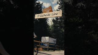
trail: D' Gscheide Line
0:17 |
9 |
Jun 30, 2026 , Reutte
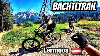
trail: Bachtltrail
10:44 |
274 |
Feb 26, 2025 , Lermoos
trail: D' Oachkätzla Line
7:03 |
109 |
Aug 31, 2024 , Reutte

trail: D' Gmiatliche Line
7:03 |
78 |
Aug 31, 2024 , Reutte
Recent Trail Reports
Activity Feed
| username | action | type | title | date |
|---|---|---|---|---|
| julianstm | add | report | activity #99659737 and 2 more | Jul 21, 2026 @ 12:36am 1 day |
| julianstm | add | report | activity #99659736 | Jul 21, 2026 @ 12:36am 1 day |
| TimmeHeino | vote | trail | activity #99446691 | Jul 18, 2026 @ 7:41am Jul 18, 2026 |
| lines | add | video | activity #99377382 | Jul 17, 2026 @ 8:43am Jul 17, 2026 |
| greencunt | comment | trail | activity #98935517 | Jul 11, 2026 @ 8:19am Jul 11, 2026 |
Recent Comments
| username | type | title | comment | date |
|---|---|---|---|---|
| trail | Just awesome! from top to bottom. Steep,... | Jul 11, 2026 @ 8:19am Jul 11, 2026 | ||
| trail | Really nice and rough natural trail. Would be... | Jul 7, 2026 @ 6:54am Jul 7, 2026 | ||
| trail | Pretty cool trail, very fast and rough flowy... | Jul 5, 2026 @ 4:22am Jul 5, 2026 | ||
| trail | schwarz! | Jun 27, 2026 @ 12:23am Jun 27, 2026 | ||
| trail | Im Zuge der Errichtung der schwarzen Jumpline... | May 30, 2026 @ 1:47am May 30, 2026 |
Local Badges
-

Climbing 10k Badge25 awarded -

Descent 10k Badge43 awarded -

Epic Ride Descent 2k260 awarded -

Climbing 100k Badge0 awarded -

Descent 100k Badge0 awarded -

Epic Ride Climb 2k260 awarded
Bike & Skill Parks
| name | type | city | rating |
|---|---|---|---|
| Pumptrack Lermoos | skill park | Lermoos | |
| Skill Area Lermoos | skill park | Lermoos | |
| Pumptrack Nesselwängle | skill park | Tannheim |
Activity Type Stats
| activitytype | trails | distance | descent | descent distance | total vertical | rating | global rank | state rank | photos | reports | routes | ridelogs |
|---|---|---|---|---|---|---|---|---|---|---|---|---|
| Mountain Bike | 53 | 87 miles | 23,589 ft | 33 miles | 3,904 ft | 261 | 545 | 1 | 4,737 | |||
| E-Bike | 44 | 66 miles | 17,743 ft | 26 miles | 3,904 ft | 8 | 493 | 1,008 | ||||
| Gravel Bike | 3 | 8 miles | 292 ft | 1 mile | 2,680 ft | 2 | 28 | |||||
| Adaptive Bike | 17 | 47 miles | 3,238 ft | 8 miles | 3,904 ft | 106 | ||||||
| Winter Fat Bike | 8 | 7 miles | 2,940 ft | 3 miles | 2,749 ft | 77 | ||||||
| Hike | 122 | 173 miles | 107,402 ft | 100 miles | 4,882 ft | 497 | 1,970 | |||||
| Trail Running | 122 | 173 miles | 107,402 ft | 100 miles | 4,882 ft | 497 | 165 | |||||
| Backcountry Ski | 45 | 80 miles | 18,593 ft | 18 miles | 5,404 ft | 2 | 961 |
Frequently Asked Questions About Außerfern
▼
What are the best places to ride in Außerfern?
Außerfern has 5 areas to explore for mountain biking. The top rated areas are:
▼
What are the highest rated mountain biking trails in Außerfern?
The highest rated mountain biking trails in Außerfern are:
- Blindseetrail (4.5/5)
- Marienberg Trail Part 2 (4.3/5)
- Dr' Sauzeacha Trail (4.2/5)
- Barbarasteig (4.2/5)
- Mühlwaldtrail (4.1/5)
▼
What is the best time of the year to ride in Außerfern?
Based on ride log data, the most popular months to ride in Außerfern are:
- July (53 activities)
- June (42 activities)
- August (34 activities)
▼
What is the longest trail in Außerfern?
The longest trail in Außerfern is Blindseetrail (lower) at 2.7 miles. View all trails sorted by distance.
Activities
Trails
Points of Interest
- Cableway Drop-Off (Grubigsteinbahn) Other
- Gehrenspitze Summit
- Daniel Summit
- Uppspitze Summit
- Grüner Ups Summit
- Chairlift Pick-Up (Sonnalmbahn Berwang) Other
- Chairlift Drop-Off (Sonnalmbahn Berwang) Other
- Cableway Drop-Off (Almkopfbahn Bichlbach) Other
- Cableway Pick-Up (Almkopfbahn Bichlbach) Other
- Aussichtsplattform Tuftlalm Viewpoint
- Hohe Wand / Hochwand (8,816 ft)
- Hohe Wand / Hochwand (Nebengipfel) (8,786 ft)
- Hochplattig (8,720 ft)
- By elyari
 TRAILFORKS TFSPAIN & contributors
 - Admins: ktm-boy-69, mpecsi, lines, larry81541, PatrickMeraner
- #57240 - 1,331 views
- außerfern activity log | embed map of Außerfern mountain bike trails | außerfern mountain biking points of interest
Downloading of trail gps tracks in kml & gpx formats is enabled for Außerfern.
You must login to download files.