


more stats
2.5 miles
Distance
241 ft
Climb
-248 ft
Descent
00:23:12
Avg time
-6 ft
Altitude change
1,024 ft
Altitude min
1,128 ft
Altitude max
1,032 ft
Altitude start
1,027 ft
Altitude end
-0%
Grade
-17.1%
Grade max
25.3%
Grade min
3,953 ft
Distance climb
1 mile
Distance down
3,570 ft
Distance flat
00:23:12
Avg time

Fossil Flats Trail Details

  • Activities
    • Mountain Bike
    • E-Bike
    • Hike
    • Trail Running
  • Riding Area
  • Difficulty Rating
  • Local Popularity
    45 in Mountain Biking [+]
    • 45 in E-Biking
    • 5 in Trail Running
    • 45 in Hiking
  • Global Ranking
    #103115 in Mountain Biking [+]
    • #52693 in E-Biking
    • #213407 in Trail Running
    • #144311 in Hiking
  • State Ranking
    #635 in Mountain Biking · Arkansas [+]
    • #224 in E-Biking
    • #1,042 in Trail Running
    • #684 in Hiking
  • Trail Type
    Singletrack
  • Direction
    Downhill Only[+]
    • Downhill Only for E-Biking
    • Downhill Only for Trail Running
    • Downhill Only for Hiking
  • Season
    Jan-Dec
  • Dogs Allowed
    Yes
  • eBike Allowed
    Yes up to Class 1
  • Year Opened
    1990
  • Land Owner
    Arkansas State Parks

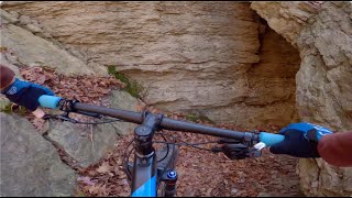
The flat exposed rock in the creek bed lends this trail its name. Many fossils are visible in the exposed creek bed. Along the trail you will see evidence of the CCC and early settlers, creek views, and big rock formations. This trail gives riders a choice of a three, four, or five mile ride and the difficulty increases with each mile added.

Access Info

8 miles south of Fayetteville on I-540 (Exit 53), then 18 miles southwest on Hwy. 170, or 7 miles west of I-540 (Exit 45) at Winslow on Hwy. 74

Tags
BridgesRiver or creek

Trail Supporters

Local Trail Association

Recent Activity on Trail

Past Week
  • 0 rides
  •  
6 Months
  • 27 rides
  • 15 miles avg distance
All
  • 171 rides
  • Last: Oct 25, 2026
c1c2c3c4
January
February
March
April
May
June
July
August
September
October
November
December
update trails status or condition

Fossil Flats Trail Trail Reports

statusdatedescription
Oct 17, 2026 @ 1:07pm (America/Chicago)
Oct 17, 2026
Jun 22, 2026 @ 1:55pm (America/Indiana/Vincennes)
Jun 22, 2026
Aug 26, 2024 @ 4:55am
Aug 26, 2024
reporter trees cleared
May 18, 2024 @ 7:48am
May 18, 2024
Apr 30, 2024 @ 8:13am
Apr 30, 2024
Wet, lots of water crossings. Some of the loops along the creek are underwater. Downed tree across Heartbreak Hill. Should be all passable in 3...
more »
Status:
on Oct 17, 2026
Ideal
Avg: 3.74 (11 votes)
Your vote: 0

view (848)
close
      Directions to fossil-flats-trail trailhead (35.784260, -94.245220)

      Photos

      8 more »
      mtb
      13 |
      Oct 24, 2026 @ 12:56pm
      Oct 24, 2026
      mtb
      46 |
      Apr 23, 2026 @ 10:02am
      Apr 23, 2026
      mtb
      55 |
      Apr 23, 2026 @ 10:02am
      Apr 23, 2026
      mtb
      46 |
      Apr 23, 2026 @ 10:02am
      Apr 23, 2026

      Videos

      5 more »
      Devil's Den State Park, Arkansas
      mtb
      7:52 | 330 | Jul 7, 2025 , Winslow
      Fast XC Trails | Mountain Biking at...
      mtb
      16:21 | 266 | Dec 27, 2024 , Winslow
      Devils Den MTB | Arkansas
      mtb
      4:13 | 547 | Mar 13, 2022 , Winslow
      Fossil Flats - Part 2 '2009'
      mtb
      6:47 | 647 | Feb 9, 2020 , Winslow
      3.6 ★★★★★
      11 Ratings
      5 ★ 27%
      4 ★ 9%
      3 ★ 55%
      2 ★ 9%
      1 ★

      7 Reviews & Comments

      Ajacks333
      Need to rename it outlaw loop and make it green due to new signage and trail difficulty changes.
      Chrisjohn73
      Raced and rode this above section for 20 plus years, never been this narrow.
      Chrisjohn73
      The one narrow section overlooking Lee Creek has nearly completed eroded away, high penalty fall. My son slid off today and could have had a fatal fall but caught a tree about half way down. This desperately needs repair.

      We hope you've been enjoying Trailforks!

      Create a FREE account to view all trail reviews and much more.

      • By Hotrod4989 & contributors
      • #35821 - 4,420 views

      Frequently Asked Questions

      ▼ Where is Fossil Flats Trail located?
      Fossil Flats Trail is located in Devils Den State Park - Monument Trails, Winslow, Arkansas, United States. It is part of the Devils Den State Park - Monument Trails trail network. The trailhead is located at coordinates 35.78426, -94.24522.
      ▼ How hard is Fossil Flats Trail?
      Fossil Flats Trail is rated as Blue difficulty.
      ▼ What is the elevation gain for Fossil Flats Trail?
      Fossil Flats Trail has 241 ft of elevation gain. The trail has 248 ft of elevation descent. The elevation ranges from 1,024 ft to 1,128 ft.
      ▼ Is Fossil Flats Trail a point to point trail?
      Yes, Fossil Flats Trail is a point to point trail. The direction is Downhill Only. The trail type is singletrack.
      ▼ How long is Fossil Flats Trail?
      Fossil Flats Trail is 2.5 miles long. The trail type is singletrack.
      ▼ Are dogs allowed on Fossil Flats Trail?
      Yes, dogs are allowed on Fossil Flats Trail. Please keep dogs on a leash where required and clean up after them.
      ▼ When is the best time of year to ride Fossil Flats Trail?
      Based on activity log data, the most popular months to ride Fossil Flats Trail are:
      • April (22 activities)
      • September (15 activities)
      • June (12 activities)
      Check the reports page for current trail conditions.
      ▼ How do I access Fossil Flats Trail? Where is the closest parking trailhead?
      The closest parking and trailhead locations to Fossil Flats Trail are: View all parking locations in the area.
      ▼ How long does it take to ride Fossil Flats Trail?
      Based on recorded activities, it takes an average of 23 minutes to ride Fossil Flats Trail. The trail is 2.5 miles long. Actual times will vary based on fitness level, conditions, and pace. View recent activity logs for more details.
      ▼ How busy is Fossil Flats Trail?
      Fossil Flats Trail is a moderately popular trail. There have been 836 recorded activities on this trail. The trail has received 848 check-ins. View recent activity on this trail.

      Hit the Trail

      Open in App

      Get this trail on your phone instantly.

      open trail in app

      Download Trail

      Save to wishlist, Garmin & download.
      save the trail

      Find Related Routes

      Find routes and users activities that include this trail.
      find routes for this trail

      You must enter a description before submitting.