more stats
1.3 miles
Distance
58 ft
Climb
-781 ft
Descent
00:27:27
Avg time
-723 ft
Altitude change
632 ft
Altitude min
1,370 ft
Altitude max
1,355 ft
Altitude start
633 ft
Altitude end
-10.3%
Grade
-52%
Grade max
16.8%
Grade min
830 ft
Distance climb
1 mile
Distance down
440 ft
Distance flat
00:27:27
Avg time

Fun-Ja Details

  • Activities
    • Mountain Bike
  • Riding Area
  • Difficulty Rating
  • Voted Difficulty
    Black Diamond (3 votes)
  • Local Popularity
    5 in Mountain Biking
  • Global Ranking
    #15558 in Mountain Biking
  • Trail Type
    Singletrack
  • Bike Type
    DH, AM
  • Direction
    Downhill Only
    Popular Direction Shown
  • Physical Rating
    Easy
  • Trail Visibility
    Always easy to follow
  • Season
    Oman
  • Dogs Allowed
    Yes
  • TTFs on Trail
    Berm, Drop
  • Year Opened
    2021

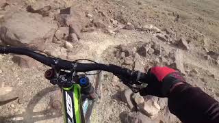
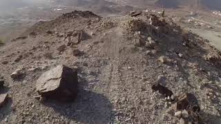
A fun flowing downhill singletrack with great views over Fanja. Has some technical sections and a few corners that require your full commitment, in addition to a few drops that will get your blood pumping

Easy access off the 15, and with a tarmac road half way up for part shuttling.

Trail Supporters
Local Trail Association

Recent Activity on Trail

Past Week
  • 0 rides
  •  
6 Months
  • 0 rides
  •  
All
  • 27 rides
  • Last: May 22, 2025
c1c2c3c4
January
February
March
April
May
June
July
August
September
October
November
December
update trails status or condition

Fun-Ja Trail Reports

no reports have been added for Fun-Ja yet, add a trail report.
Trail reports are used to indicate a trails current condition and inform builders and other riders about any issues on a trail.
Status:
Avg: 4.13 (1 votes)
Your vote: 0

view (288)
close
3D
Trail Conditions
  • Unknown
  • Snow Groomed
  • Snow Packed
  • Snow Covered
  • Snow Cover Partial
  • Freeze/thaw Cycle
  • Icy
  • Prevalent Mud
  • Wet
  • Variable
  • Ideal
  • Dry
  • Very Dry
Trail Flow (Ridden Direction)
Trailforks scans users ridelogs to determine the most popular direction each trail is ridden. A good flowing trail network will have most trails flowing in a single direction according to their intension.
The colour categories are based on what percentage of riders are riding a trail in its intended direction.
  • > 96%
  • > 90%
  • > 80%
  • > 70%
  • > 50%
  • < 50%
  • bi-directional trail
  • no data
Trail Last Ridden
Trailforks scans ridelogs to determine the last time a trail was ridden.
  • < 2 days
  • < 1 week
  • < 2 weeks
  • < 1 month
  • < 6 months
  • > 6 months
Trail Ridden Direction
The intended direction a trail should be ridden.
  • Downhill Only
  • Downhill Primary
  • Both Directions
  • Uphill Primary
  • Uphill Only
  • One Direction
Contribute Details
Colors indicate trail is missing specified detail.
  • Description
  • Photos
  • Description & Photos
  • Videos
Trail Popularity ?
Trailforks scans ridelogs to determine which trails are ridden the most in the last 9 months. Trails are compared with nearby trails in the same city region with a possible 25 colour shades. Think of this as a heatmap, more rides = more kinetic energy = warmer colors.
  • most popular
  • popular
  • less popular
  • not popular
ATV/ORV/OHV Filter
Max Vehicle Width
inches
US Cell Coverage
Legend
cell carrier legend

Radar Time
Activity Recordings
Trailforks uses anonymized public activity data. ?
Activity Recordings
Trailforks uses anonymized public activity data. ?
Personal Heatmap
Activity Types
all / none
Options
2
Date range month
Winter Trails
Warning A routing network for winter maps does not exist. Selecting trails using the winter trails layer has been disabled.
Missing Trails
Most Popular
Least Popular
Trails are colored based on popularity. The more popular a trail is, the more red. Less popular trails trend towards green.
Jump Magnitude Heatmap
Heatmap of where riders jump on trails. Zoom in to see individual jumps, click circles to view jump details.
BC Backroad Status

Service Road Atlas is a free to use, community-driven service for viewing and creating reports on the numerous back-country service roads around B.C. and Alberta.

map legend
Slope Aspect
Direction the slope faces
Flat N NE E SE S SW W NW
Trails Deemphasized
Trails are shown in grey.
disable
Only show trails with no bike usage.
Enable
Suggested Layers
Based on selected activity type

    Save the current map location and zoom level as your default home location whenever this page is loaded.

    Save
        Directions to funja trailhead (23.481540, 58.123500)

        Photos

        10 more »
        98 |
        Jun 1, 2021 @ 9:20pm
        Jun 1, 2021
        70 |
        Jun 1, 2021 @ 9:20pm
        Jun 1, 2021
        81 |
        Jun 1, 2021 @ 9:20pm
        Jun 1, 2021
        91 |
        Jun 1, 2021 @ 9:20pm
        Jun 1, 2021

        Videos

        2 more »
        Fun_Ja DH track -- Back2back Weekend Ride
        7:40 | 253 | Jun 8, 2021 , Muscat
        Fun_Ja Downhill TrackFun_ja DH
        9:03 | 246 | Jun 1, 2021 , Muscat

        Routes with this trail

        4,990 ft 1 Point to Point Race
        The race route for the 2021 Oman National DH Champs - utilising the two new sections and the existing...

        Reviews / Comments

        No reviews yet, be the first to write a review or ask a question.
        Use trail reports to comment on trail conditions.


        We hope you've been enjoying Trailforks!

        Create a FREE account to view trail comments and much more.

        • By joebunnTF Pro OTB BTBG & contributors
        • #426436 - 1,205 views

        Frequently Asked Questions About Fun-Ja

        Where is Fun-Ja located?
        Fun-Ja is located in Muscat, Oman. It is part of the Muscat trail network. The trailhead is located at coordinates 23.48154, 58.1235.
        How hard is Fun-Ja?
        Fun-Ja is rated as Black Diamond difficulty. The physical rating is Easy. The average grade is 10.3%.
        What is the elevation gain for Fun-Ja?
        Fun-Ja has 58 ft of elevation gain. The trail has 781 ft of elevation descent. The elevation ranges from 632 ft to 1,370 ft.
        Is Fun-Ja a point to point trail?
        Yes, Fun-Ja is a point to point trail. The direction is Downhill Only. The trail type is singletrack.

        Hit the Trail

        Open in App

        Get this trail on your phone instantly.
        open trail in app

        Download Trail

        Save to wishlist, Garmin & download.
        save the trail

        Find Related Routes

        Find routes and users activities that include this trail.
        find routes for this trail

        You must enter a description before submitting.