4.7 miles
Distance
805 ft
Climb
-807 ft
Descent
00:29:17
Avg time
Supporters, Builders, Maintainers & Land Managers of G Loop Trail
USFSLand Manager
G Loop Details
-
Activities
- Mountain Bike
- Hike
- Trail Running
-
Riding AreaWard Mountain
Ely, Nevada -
Difficulty Rating
-
Trail TypeSingletrack
-
Bike TypeXC
-
DirectionBoth Directions
-
Climb DifficultyBlue
-
Physical RatingModerate
-
SeasonMar - Nov
-
Dogs AllowedYes
-
Ride in RainYes
-
Global Ranking
-
Local Popularity60 in Mountain Biking [+]
- 85 in Trail Running
- 5 in Hiking
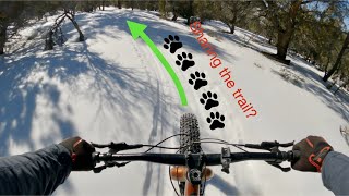
This is a great trail through the high pines and brush. Typically ridden counter-clockwise, there is a steady climb to an old ski hill where you can either take the forestry road up to other trails and roads or loop back down to the campground on a fast and windy singletrack.
Local Trail Association
-
Please consider joining or donating to the local trail association to supportdonate to earn trail karma!
trail development & maintenance.
Traditionally Indigenous Territory
More Stats for G Loop mountain bike trail trail
-
Altitude change-2 ft
-
Altitude min7,296 ft
-
Altitude max7,948 ft
-
Altitude start7,383 ft
-
Altitude end7,381 ft
-
Grade-0.008%
-
Grade max-21.016%
-
Grade min17.523%
-
Distance climb2 miles
-
Distance down2 miles
-
Distance flat1,134 ft
-
Avg time00:29:17
-
Avg reverse time01:25:00
- view trail stats
close
3D
Trail Conditions
- Unknown
- Snow Groomed
- Snow Packed
- Snow Covered
- Snow Cover Partial
- Freeze/thaw Cycle
- Icy
- Prevalent Mud
- Wet
- Variable
- Ideal
- Dry
- Very Dry
Trail Flow (Ridden Direction)
Trailforks scans users ridelogs to determine the most popular direction each trail is ridden. A good flowing trail network will have most trails flowing in a single direction according to their intension.
The colour categories are based on what percentage of riders are riding a trail in its intended direction.
- > 96%
- > 90%
- > 80%
- > 70%
- > 50%
- < 50%
- bi-directional trail
- no data
Trail Last Ridden
Trailforks scans ridelogs to determine the last time a trail was ridden.
- < 2 days
- < 1 week
- < 2 weeks
- < 1 month
- < 6 months
- > 6 months
Trail Ridden Direction
The intended direction a trail should be ridden.
- Downhill Only
- Downhill Primary
- Both Directions
- Uphill Primary
- Uphill Only
- One Direction
Contribute Details
Colors indicate trail is missing specified detail.
- Description
- Photos
- Description & Photos
- Videos
Trail Popularity ?
Trailforks scans ridelogs to determine which trails are ridden the most in the last 9 months.
Trails are compared with nearby trails in the same city region with a possible 25 colour shades.
Think of this as a heatmap, more rides = more kinetic energy = warmer colors.
- most popular
- popular
- less popular
- not popular
ATV/ORV/OHV Filter
Max Vehicle Width
inches
US Cell Coverage
Legend
Radar Time
x
Activity Recordings
Trailforks users anonymized public ridelogs from the past 6 months.
- mountain biking recent
- mountain biking (>6 month)
- hiking (1 year)
- moto (1 year)
Activity Recordings
Trailforks users anonymized public skilogs from the past 12 months.
- Downhill Ski
- Backcountry Ski
- Nordic Ski
- Snowmobile
Winter Trails
Warning
A routing network for winter maps does not exist. Selecting trails using the winter trails layer has been disabled.
x
Missing Trails
Most Popular
Least Popular
Trails are colored based on popularity. The more popular a trail is, the more red. Less popular trails trend towards green.
Jump Magnitude Heatmap
Heatmap of where riders jump on trails. Zoom in to see individual jumps, click circles to view jump details.
Trails Deemphasized
Trails are shown in grey.
Only show trails with NO bikes.
Save the current map location and zoom level as your default home location whenever this page is loaded.
Save
Directions to g-loop trailhead
(39.209520, -114.961700)
update trails status or condition
G Loop Trail Reports
view all reports »
Recent Ridelog Activity on Trail
Past Week
- 0 rides
6 Months
- 6 rides
- 10 miles avg distance
All
- 22 rides
- Last: Oct 26, 2024
Photos
more »
4 Reviews & Comments
We hope you've been enjoying Trailforks!
Create a FREE account to view trail comments and much more.
Videos
more »
Nearby Trails
- Ward Loop H 1,627 ft
- G Loop Connector 1,864 ft
- Ward Loop I 4,101 ft
- G Loop Access 4,498 ft
- Ward Loop K 4,547 ft
- By natenbake & contributors
- #5301 - 2,459 views
- follow/subscribe
- login to download gpx or kml files.
You must enter a description before submitting.