
more stats
2,241 ft
Distance
19 ft
Climb
-92 ft
Descent
00:03:32
Avg time
-73 ft
Altitude change
739 ft
Altitude min
817 ft
Altitude max
812 ft
Altitude start
739 ft
Altitude end
-3.251%
Grade
-19.797%
Grade max
10.861%
Grade min
522 ft
Distance climb
1,291 ft
Distance down
429 ft
Distance flat
00:03:32
Avg time

Gas Cap Details

  • Activities
    • Mountain Bike
    • Hike
    • Trail Running
  • Riding Area
    Jackson Demonstration State Forest
    Mendocino, California
  • Difficulty Rating
  • Local Popularity
    95 in Mountain Biking [+]
    • 80 in Trail Running
    • 90 in Hiking
  • Global Ranking
    #39611 in Mountain Biking [+]
    • #121123 in Trail Running
    • #106290 in Hiking
  • State Ranking
    #1,126 in Mountain Biking · California [+]
    • #5,954 in Trail Running
    • #5,897 in Hiking
  • Trail Type
    Singletrack
  • Bike Type
    XC
  • Direction
    Both Directions
  • Climb Difficulty
    Blue
  • Physical Rating
    Hard
  • Season
    Year round, best in Spring and Fall.
  • Dogs Allowed
    Yes
  • eBike Allowed
  • Ride in Rain
    Yes
  • Land Owner
    Jackson Demonstration State Forest

This is a very popular trail that is used in both directions so use caution. Its not a very long, maybe about 1/4 mile, but it is a bit technical with some tight steep switch backs.

Tags
Local Trail Association
Traditionally Indigenous Territory

Recent Activity on Trail

Past Week
  • 3 rides
  • 15 miles average
6 Months
  • 89 rides
  • 13 miles avg distance
All
  • 600 rides
  • Last: Oct 17, 2026
c1c2c3c4
January
February
March
April
May
June
July
August
September
October
November
December
Status:
on Apr 19, 2026
Ideal
Avg: 4.13 (9 votes)
Your vote: 0

view (2,839)
close
      Directions to gas-cap trailhead (39.316752, -123.725956)

      Photos

      3 more »
      mtb
      134 |
      Apr 14, 2021 @ 3:05pm
      Apr 14, 2021
      mtb
      178 |
      Aug 24, 2020 @ 9:33am
      Aug 24, 2020
      mtb
      145 |
      Aug 24, 2020 @ 9:33am
      Aug 24, 2020

      Videos

      1 more »
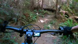
      Gascap Trail - Jackson Demonstration State Forest
      mtb
      3:17 | 244 | Oct 25, 2024 , Mendocino

      Routes with this trail

      ★ 5.0 • 19 miles • 3,127 ft • 13 • Loop •
      This route includes most of our favorite trails in this area and almost completely avoids fire roads. It's...
      ★ 5.0 • 26 miles • 4,331 ft • 26 •
      This is a route loosely based off of a prior enduro.
      ★ 4.0 • 11 miles • 1,823 ft • 8 •
      Mountain Biking Only - Contributed by Chad Swimmer 11 Miles - - - 1,507 Vertical Feet - - - Advanced - - -...
      4.2 ★★★★★
      9 Ratings
      5 ★ 33%
      4 ★ 56%
      3 ★ 11%
      2 ★
      1 ★

      1 Review & Comments

      Chasebeck734 Chasebeck734
      Yes it’s fun. I like it. Try to hit it at least every other ride here, either direction, although it’s more fun south to north due to the elevation

      We hope you've been enjoying Trailforks!

      Create a FREE account to view all trail reviews and much more.

      • By FRguild & contributors
      • #23666 - 2,759 views

      Frequently Asked Questions

      ▼ Where is Gas Cap located?
      Gas Cap is located in Jackson Demonstration State Forest, Mendocino, California, United States. It is part of the Jackson Demonstration State Forest trail network. The trailhead is located at coordinates 39.31675, -123.72596.
      ▼ How hard is Gas Cap?
      Gas Cap is rated as Blue difficulty. The physical rating is Hard. The average grade is 3.251%. The climb difficulty is rated Blue.
      ▼ What is the elevation gain for Gas Cap?
      Gas Cap has 19 ft of elevation gain. The trail has 92 ft of elevation descent. The elevation ranges from 739 ft to 817 ft.
      ▼ Is Gas Cap a point to point trail?
      Gas Cap is not a point to point trail. The direction is Both Directions. The trail type is singletrack.
      ▼ How long is Gas Cap?
      Gas Cap is 2,241 ft long. The trail type is singletrack.
      ▼ Are dogs allowed on Gas Cap?
      Yes, dogs are allowed on Gas Cap. Please keep dogs on a leash where required and clean up after them.
      ▼ When is the best time of year to ride Gas Cap?
      Gas Cap is best visited during: Year round, best in Spring and Fall..
      ▼ How do I access Gas Cap? Where is the closest parking trailhead?
      The closest parking and trailhead locations to Gas Cap are: View all parking locations in the area.
      ▼ How long does it take to ride Gas Cap?
      Based on recorded activities, it takes an average of 4 minutes to ride Gas Cap. The trail is 2,241 ft long. Actual times will vary based on fitness level, conditions, and pace. View recent activity logs for more details.
      ▼ How busy is Gas Cap?
      Gas Cap is a very popular trail. There have been 2,726 recorded activities on this trail. The trail has received 2,839 check-ins. View recent activity on this trail.

      Hit the Trail

      Open in App

      Get this trail on your phone instantly.

      open trail in app

      Download Trail

      Save to wishlist, Garmin & download.
      save the trail

      Find Related Routes

      Find routes and users activities that include this trail.
      find routes for this trail

      You must enter a description before submitting.