
more stats
4,751 ft
Distance
-860 ft
Descent
00:13:13
Avg time
-860 ft
Altitude change
2,354 ft
Altitude min
3,214 ft
Altitude max
3,214 ft
Altitude start
2,356 ft
Altitude end
-18.1%
Grade
-71.7%
Grade max
26 ft
Distance climb
4,616 ft
Distance down
105 ft
Distance flat
00:13:13
Avg time

Gàt Màt Details

  • Activities
    • Mountain Bike
    • E-Bike
  • Riding Area
  • Difficulty Rating
  • Local Popularity
    60 in Mountain Biking heatmap [+]
    • 50 in E-Biking
  • Global Ranking
    #18067 in Mountain Biking [+]
    • #59446 in E-Biking
  • National Ranking
    #1,780 in Mountain Biking · Italy [+]
    • #7,110 in E-Biking
  • Trail Type
    Singletrack
  • Bike Type
    DH, AM
  • Direction
    Downhill Only
    Popular Direction Shown
  • Physical Rating
    Moderate
  • Trail Visibility
    Always easy to follow
  • Dogs Allowed
    Yes
  • eBike Allowed
  • TTFs on Trail
    Jump, Pump Track, Roller Coaster, Other
  • Ride in Rain
    Yes
  • Year Opened
    2022
  • Land Owner
    Cupra Freeride Crew

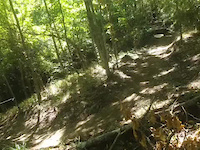
Fun, fast and hopping trail You will find a mixture of Enduro Trail, DH track and freeride combined to perfection. The terrain will make you fall in love in any climatic condition. Between a Vagus Trail and a Gàt Màt, a stop at the Locanda dell'Alpino is recommended, for fantastic local cuisine.

Trail divertente, veloce e saltellante! Troverete un misto tra Enduro Trail, pista da DH e freeride sposati alla perfezione. Il terreno vi farà innamorare in qualsiasi condizione climatica. Tra un Vagus Trail e un Gàt Màt, è consigliata una sosta alla Locanda dell'Alpino, per piatti di cucina locale fantastici.

Access Info

The trail starts just after the town of Vaglie towards Collagna and ends at the Rossendola bridge between Caprile and Ligonchio.

Il trail Parte appena dopo l’abitato di Vaglie direzione Collagna e finisce al ponte della Rossendola tra Caprile e Ligonchio.

Tags
BridgesJumpsPump trackRollers

Recent Activity on Trail

Past Week
  • 0 rides
  •  
6 Months
  • 3 rides
  • 16 miles avg distance
All
  • 19 rides
  • Last: Oct 7, 2026
c1c2c3c4
January
February
March
April
May
June
July
August
September
October
November
December
update trails status or condition

Gàt Màt Trail Reports

statusdatedescription
Jun 20, 2026 @ 2:14pm (Europe/Rome)
Jun 20, 2026
Sporco. Dall’aspetto quasi abbandonato. Sentiero veramente bello ma attualmente non sfruttabile
May 24, 2026 @ 7:30pm (Europe/Rome)
May 24, 2026
attenzione legna accatastata in mezzo al sentiero all inizio poi solita melma a metà intorno al drop
Oct 5, 2025 @ 7:11am (Europe/Rome)
Oct 4, 2025
ottime condizioni, forse un po' d'erba alla fine, attenzione perché non c'è più il ponte finale, qualche buco e qualche ramo
Jun 29, 2025 @ 10:43am
Jun 29, 2025
Pulito dai rami e terreno in ottime condizioni
Jun 1, 2025 @ 10:26am
Jun 1, 2025
Alcuni rami caduti e brevi tratti un po' chiusi dall'erba.
more »
Status:
on Jun 20, 2026
Dry
Avg: 4.13 (1 votes)
Your vote: 0

view (110)
close
      Directions to gat-mat trailhead (44.323120, 10.316050)

      Photos

      4 more »
      mtb
      77 |
      Sep 8, 2023 @ 1:37am
      Sep 8, 2023
      mtb
      76 |
      May 23, 2023 @ 3:27am
      May 23, 2023
      mtb
      108 |
      Nov 4, 2022 @ 5:01am
      Nov 4, 2022
      mtb
      82 |
      Jun 14, 2022 @ 1:19am
      Jun 14, 2022

      Videos

      1 more »
      C-Lito Jump - Valenti
      mtb
      0:05 | 52 | Nov 4, 2022 , Ligonchio

      Routes with this trail

      more »
      15 miles • 3,966 ft • 3 • Point to Point •
      Tappa della Senators Enduro Cup 2022, di Ligonchio (RE), #Round. Ps1 Pradaletto...
      5.0 ★★★★★
      1 Ratings
      5 ★ 100%
      4 ★
      3 ★
      2 ★
      1 ★

      1 Review & Comments

      Bustomail
      Super!! Pensavo si trattasse del solito sentiero-mulattiera spacciato per trail, e invece è un Lunapark dall'inizio alla fine.
      Fondo in terra battuta, da evitare dopo periodi piovosi. Da abbinare al Trail vagus per una discesa perfetta

      We hope you've been enjoying Trailforks!

      Create a FREE account to view all trail reviews and much more.

      • By lelerivi-cupra CFC & contributors
      • #543181 - 1,078 views

      Frequently Asked Questions

      ▼ Where is Gàt Màt located?
      Gàt Màt is located in CuPra Bike Area Ligonchio/Cusna, Ligonchio, Italy. It is part of the CuPra Bike Area Ligonchio/Cusna trail network. The trailhead is located at coordinates 44.32312, 10.31605.
      ▼ How hard is Gàt Màt?
      Gàt Màt is rated as Blue difficulty. The physical rating is Moderate. The average grade is 18.1%.
      ▼ What is the elevation gain for Gàt Màt?
      The trail has 860 ft of elevation descent. The elevation ranges from 2,354 ft to 3,214 ft.
      ▼ Is Gàt Màt a point to point trail?
      Yes, Gàt Màt is a point to point trail. The direction is Downhill Only. The trail type is singletrack.
      ▼ How long is Gàt Màt?
      Gàt Màt is 4,751 ft long. The trail type is singletrack.
      ▼ Are dogs allowed on Gàt Màt?
      Yes, dogs are allowed on Gàt Màt. Please keep dogs on a leash where required and clean up after them.
      ▼ When is the best time of year to ride Gàt Màt?
      Based on activity log data, the most popular months to ride Gàt Màt are:
      • June (3 activities)
      • July (2 activities)
      • October (2 activities)
      Check the reports page for current trail conditions.
      ▼ How do I access Gàt Màt? Where is the closest parking trailhead?
      The closest parking and trailhead locations to Gàt Màt are: View all parking locations in the area.
      ▼ How long does it take to ride Gàt Màt?
      Based on recorded activities, it takes an average of 13 minutes to ride Gàt Màt. The trail is 4,751 ft long. Actual times will vary based on fitness level, conditions, and pace. View recent activity logs for more details.
      ▼ How busy is Gàt Màt?
      Gàt Màt is a moderately popular trail. There have been 99 recorded activities on this trail. The trail has received 110 check-ins. View recent activity on this trail.

      Hit the Trail

      Open in App

      Get this trail on your phone instantly.

      open trail in app

      Download Trail

      Save to wishlist, Garmin & download.
      save the trail

      Find Related Routes

      Find routes and users activities that include this trail.
      find routes for this trail

      You must enter a description before submitting.

