Details
-
Activities
- Mountain Bike
- E-Bike
- Hike
- Trail Running
-
Riding AreaBear’s Best
Las Vegas, Nevada -
Difficulty Rating
-
Trail TypeSingletrack
-
DirectionBoth DirectionsPopular direction shown
-
Climb DifficultyBlue
-
Physical RatingModerate
-
Dogs AllowedYes
-
eBike AllowedYes up to Class 1
-
Global Ranking
-
Local Popularity65 in Mountain Biking [+]
- 65 in E-Biking
- 75 in Trail Running
- 5 in Hiking
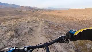
The upper part of Get Schwifty gets more difficult because of the exposure. A few turns gone wrong and the fall could be bad, but the trail itself really isn't too technical. There is a great view right at one of the pointy mesa edges that gives you a great view of Flagpole as it makes its way up from the 5-Way.
The final climbing sections are pretty narrow with some sharp rocks that push you towards the exposure, so be careful.
Local Trail Association
-

-
Please consider joining or donating to the local trail association to supportdonate to earn trail karma!
trail development & maintenance.
Traditionally Indigenous Territory
More Stats for Get Schwifty (Upper) mountain bike trail trail
-
Altitude change0 ft
-
Altitude min3,138 ft
-
Altitude max3,288 ft
-
Altitude start3,240 ft
-
Altitude end3,240 ft
-
Grade0.005%
-
Grade max-26.513%
-
Grade min26.723%
-
Distance climb3,054 ft
-
Distance down2,917 ft
-
Distance flat696 ft
-
Avg time00:16:29
-
Avg reverse time00:15:11
- view trail stats
-
Layers w
- Map Content
- Pro
- Pro
- Pro
- Pro
- Layers
- Pro
- Pro
- Pro
- More Layers
- Pro
- Pro
- Pro
- Pro
- Pro
- Pro
- Pro
- Pro
-
Upgrade to

- Unknown
- Snow Groomed
- Snow Packed
- Snow Covered
- Snow Cover Partial
- Freeze/thaw Cycle
- Icy
- Prevalent Mud
- Wet
- Variable
- Ideal
- Dry
- Very Dry
The colour categories are based on what percentage of riders are riding a trail in its intended direction.
- > 96%
- > 90%
- > 80%
- > 70%
- > 50%
- < 50%
- bi-directional trail
- no data
- < 2 days
- < 1 week
- < 2 weeks
- < 1 month
- < 6 months
- > 6 months
- Downhill Only
- Downhill Primary
- Both Directions
- Uphill Primary
- Uphill Only
- One Direction
- Description
- Photos
- Description & Photos
- Videos
- most popular
- popular
- less popular
- not popular

- mountain biking recent
- mountain biking (>6 month)
- hiking (1 year)
- moto (1 year)
- Downhill Ski
- Backcountry Ski
- Nordic Ski
- Snowmobile
Save the current map location and zoom level as your default home location whenever this page is loaded.
SaveGet Schwifty (Upper) Trail Reports
Recent Ridelog Activity on Trail
- 0 rides
- 62 rides
- 14 miles avg distance
- 650 rides
- Last: Sep 19, 2021

Photos
Routes with this trail
Reviews / Comments
No reviews yet, be the first to write a review or ask a question.
Use trail reports to comment on trail conditions.
We hope you've been enjoying Trailforks!
Create a FREE account to view trail comments and much more.
Videos
Nearby Trails
- Man With A Van 1,453 ft
- Porn Star 1,594 ft
- Gt 1,624 ft
- Perma Grin 1,703 ft
- Nice Curves 1,709 ft
- By todd
 Trailforks & contributors
 - #157395 - 1,107 views
- follow/subscribe
- login to download gpx or kml files.
You must enter a description before submitting.