

more stats
1.3 miles
Distance
-414 ft
Descent
00:12:05
Avg time
-415 ft
Altitude change
1,677 ft
Altitude min
2,093 ft
Altitude max
2,093 ft
Altitude start
1,677 ft
Altitude end
-5.8%
Grade
-18%
Grade max
3%
Grade min
43 ft
Distance climb
1 mile
Distance down
797 ft
Distance flat
00:12:05
Avg time

Upper Giddy-Up! Details

  • Activities
    • Mountain Bike
    • E-Bike
    • Winter Fat Bike
    • Hike
    • Trail Running
  • Riding Area
    Cacapon Resort State Park
    Berkeley Springs, West Virginia
  • Difficulty Rating
  • Voted Difficulty
    Blue (1 vote)
  • Local Popularity
    95 in Mountain Biking [+]
    • 90 in E-Biking
    • 80 in Trail Running
    • 70 in Hiking
    • 5 in Winter Fat Biking
  • Global Ranking
    #71911 in Mountain Biking [+]
    • #89576 in E-Biking
    • #130345 in Trail Running
    • #135574 in Hiking
    • #32025 in Winter Fat Biking
  • State Ranking
    #316 in Mountain Biking · West Virginia [+]
    • #152 in E-Biking
    • #470 in Trail Running
    • #563 in Hiking
    • #67 in Winter Fat Biking
  • Hiking SAC Scale
    T2 Mountain Hiking
  • Trail Type
    Singletrack
  • Bike Type
    DH, AM, XC, Fat
  • Direction
    Downhill Only
    Popular Direction Shown
  • Physical Rating
    Hard
  • Trail Visibility
    Always easy to follow
  • Dogs Allowed
    Yes
  • eBike Allowed
    Yes up to Class 1
  • TTFs on Trail
    Drop, Jump, Gap Jump, Rock Garden
  • Land Owner
    WV State Parks

Giddy-Up is an abandoned horseback riding trail that connects the Batt Picnic area to the South Prospect Rock Trail at the top of the mountain. It currently is in the process of being re-opened. It can be ridden if you're feeling adventurous, but there are over 10 large trees down across the trail.

The trail is unusual for Cacapon in that it is NOT rocky. This trail will be rideable both up and down. The trail is an old road bed that appears to have been well-graded and bench cut into the side of the mountain. There are a few steeper pitches, but nothing too extreme. Until the park blazes the trail, the top can be found by looking at the mileage on the map from the overlook to the trailhead.

The top trailhead is a doubletrack opening in the trees on the right hand side of the Ridge Trail. It is currently marked by a cairn of stones and pink ribbon as well as a white sign on a tree. Easy to find. Once on the trail, it is very easy to follow, even un-blazed, since it is an old road bed. Be aware, this is a FAST trail down There are A line jumps usually on the left hand side of the trail and the turns are somewhat banked already. About 2/3 of the way down, you can turn right onto Get Down to continue the descending fun!

To find the bottom of the trail, go to the Batt Picnic Area and go to the upper loop in the corner furthest from the road entrance. Begin going uphill and to the left till you get to an old fire pit and the trail goes from there.

Tags
DropsJumpsRock gardens
Local Trail Association
Traditionally Indigenous Territory

Recent Activity on Trail

Past Week
  • 6 rides
  • 13 miles average
6 Months
  • 162 rides
  • 16 miles avg distance
All
  • 355 rides
  • Last: Oct 17, 2026
c1c2c3c4
January
February
March
April
May
June
July
August
September
October
November
December
Status:
on Sep 19, 2026
Very Dry
Avg: 4.23 (11 votes)
Your vote: 0

view (1,670)
close
      Directions to upper-giddyup trailhead (39.486810, -78.333650)

      Photos

      1 more »
      ebike
      46 |
      Aug 2, 2026 @ 4:12pm
      Aug 2, 2026

      Videos

      10 more »
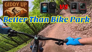
      Revised Giddy-Up @Cacapon is Better Than Local...
      mtb
      19:17 | 266 | May 13, 2025 , Berkeley Springs
      NEW, 2025: UPPER GIDDY UP!
      mtb
      8:32 | 173 | May 2, 2025 , Berkeley Springs
      Giddy Up to Intersection - May 2023
      mtb
      2:53 | 544 | May 8, 2023 , Berkeley Springs
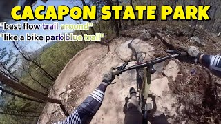
      Cacapon Resort State Park Mountain Biking
      mtb
      36:15 | 327 | Aug 17, 2022 , Berkeley Springs

      Routes with this trail

      23 miles • 3,285 ft • 18 • Point to Point • Race •
      Your 2026 Cacapon Enduro Race Map!! Transfer: Everything starts at the Batt shelter for registration, and...
      29 miles • 4,630 ft • 14 • Race •
      The WV Enduro Series brings you the 2025 Cacapon Enduro "Ziler's Revenge"!! Make sure to come out and...
      4.4 ★★★★★
      11 Ratings
      5 ★ 55%
      4 ★ 27%
      3 ★ 18%
      2 ★
      1 ★

      4 Reviews & Comments

      cuseman03 cuseman03
      I don't know why people keep saying Giddy is steep. It's not steep at all. There is literally nothing steep at all. Trail is a blast, the other commenter is spot on, you can totally open it up, nice big berms (no brakes needed) to control your speed, it's a hoot.
      Bbliss318
      Definitely my favorite section of the Giddy Ups. Another commenter mentioned its steep. I would actually disagree. in fact, it felt very similar grade to the climbing trails but with bigger terms and rollers to get off the ground if you care to. overall super fun. Middle Giddy was fun too but a bit slower and rockier. Upper you can open it up, middle you have to pay attention and pick your line bc of the rocky sections. overall, loads of fun!
      nikovelis nikovelis
      Description definitely needs to updated. This trail is super fun, loose, and steep. A good warm up for the top trails and if you have a need for speed this is the trail to satisfy that desire

      We hope you've been enjoying Trailforks!

      Create a FREE account to view all trail reviews and much more.

      • By mook21 & contributors
      • #297708 - 2,970 views

      Frequently Asked Questions

      ▼ Where is Upper Giddy-Up! located?
      Upper Giddy-Up! is located in Cacapon Resort State Park, Berkeley Springs, West Virginia, United States. It is part of the Cacapon Resort State Park trail network. The trailhead is located at coordinates 39.48681, -78.33365.
      ▼ How hard is Upper Giddy-Up!?
      Upper Giddy-Up! is rated as Blue difficulty. The physical rating is Hard. The average grade is 5.8%.
      ▼ What is the elevation gain for Upper Giddy-Up!?
      The trail has 414 ft of elevation descent. The elevation ranges from 1,677 ft to 2,093 ft.
      ▼ Is Upper Giddy-Up! a point to point trail?
      Yes, Upper Giddy-Up! is a point to point trail. The direction is Downhill Only. The trail type is singletrack.
      ▼ How long is Upper Giddy-Up!?
      Upper Giddy-Up! is 1.3 miles long. The trail type is singletrack.
      ▼ Are dogs allowed on Upper Giddy-Up!?
      Yes, dogs are allowed on Upper Giddy-Up!. Please keep dogs on a leash where required and clean up after them.
      ▼ When is the best time of year to ride Upper Giddy-Up!?
      Based on activity log data, the most popular months to ride Upper Giddy-Up! are:
      • September (64 activities)
      • May (55 activities)
      • October (38 activities)
      Check the reports page for current trail conditions.
      ▼ How do I access Upper Giddy-Up!? Where is the closest parking trailhead?
      The closest parking and trailhead locations to Upper Giddy-Up! are: View all parking locations in the area.
      ▼ How long does it take to ride Upper Giddy-Up!?
      Based on recorded activities, it takes an average of 12 minutes to ride Upper Giddy-Up!. The trail is 1.3 miles long. Actual times will vary based on fitness level, conditions, and pace. View recent activity logs for more details.
      ▼ How busy is Upper Giddy-Up!?
      Upper Giddy-Up! is a very popular trail. There have been 1,452 recorded activities on this trail. The trail has received 1,670 check-ins. View recent activity on this trail.

      Hit the Trail

      Open in App

      Get this trail on your phone instantly.

      open trail in app

      Download Trail

      Save to wishlist, Garmin & download.
      save the trail

      Find Related Routes

      Find routes and users activities that include this trail.
      find routes for this trail

      You must enter a description before submitting.