more stats
2.2 miles
Distance
12 ft
Climb
-1,711 ft
Descent
00:27:02
Avg time
-1,699 ft
Altitude change
2,395 ft
Altitude min
4,096 ft
Altitude max
4,094 ft
Altitude start
2,395 ft
Altitude end
-14.4%
Grade
-55.6%
Grade max
4.1%
Grade min
472 ft
Distance climb
2 miles
Distance down
118 ft
Distance flat
00:27:02
Avg time

Gobbo Details

  • Activities
    • Mountain Bike
    • Hike
    • Trail Running
  • Difficulty Rating
  • Local Popularity
    25 in Mountain Biking [+]
    • 5 in Trail Running
    • 5 in Hiking
  • Global Ranking
    #97937 in Mountain Biking [+]
    • #128207 in Trail Running
    • #121295 in Hiking
  • Trail Type
    Singletrack
  • Bike Type
    DH, AM, XC
  • Direction
    One Direction
    Popular Direction Shown
  • Physical Rating
    Moderate
  • Season
    apr-ott
  • Dogs Allowed
    Yes
  • TTFs on Trail
    Roller Coaster

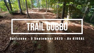
Same start of the old track..but different end. Now on the last part, there are not big compression inside the canyon but new flow line. before enter to the canyon, turn left and you can see a fresh track in to the middle of the beechs forest. this track arrive in a small square of a fire road. follow the track down by a road and you finished on the principal road to Frazione Gaviano, look in front of you a find a small section of the trail near the road.
PAY ATTENTION THE RESIDENTS WHO OFTEN RIDING HORSES ON THE ROAD AT THE END OF THE TRAIL

Access Info

Colle del Melogno --> Barbottina --> Bedò --> Piambello

Recent Activity on Trail

Past Week
  • 0 rides
  •  
6 Months
  • 0 rides
  •  
All
  • 67 rides
  • Last: Sep 9, 2021
c1c2c3c4
January
February
March
April
May
June
July
August
September
October
November
December
update trails status or condition

Gobbo Trail Reports

statusdatedescription
Apr 27, 2026 @ 9:20am (America/Vancouver)
Apr 27, 2026
You cant name it a trail anymore. Do not try to ride, you will curse.
Oct 17, 2025 @ 5:17am (America/Vancouver)
Oct 17, 2025
The trail is not in a good shape and barely visible. There are better options in the area.
Jun 27, 2025 @ 7:53am
Jun 27, 2025
poco manutenzionato nella prima metà per interruzione dovuta a taglio alberi e la seconda metà normalmente percorribile. Peccato perché è un...
Nov 13, 2024 @ 8:13am
Nov 13, 2024
Unrideabble, trail is invisible from all the leaves.
Nov 11, 2024 @ 12:18pm
Nov 11, 2024
more »
Status:
on Apr 27, 2026
Avg: 4.32 (7 votes)
Your vote: 0

view (704)
close
3D
Trail Conditions
  • Unknown
  • Snow Groomed
  • Snow Packed
  • Snow Covered
  • Snow Cover Partial
  • Freeze/thaw Cycle
  • Icy
  • Prevalent Mud
  • Wet
  • Variable
  • Ideal
  • Dry
  • Very Dry
Trail Flow (Ridden Direction)
Trailforks scans users ridelogs to determine the most popular direction each trail is ridden. A good flowing trail network will have most trails flowing in a single direction according to their intension.
The colour categories are based on what percentage of riders are riding a trail in its intended direction.
  • > 96%
  • > 90%
  • > 80%
  • > 70%
  • > 50%
  • < 50%
  • bi-directional trail
  • no data
Trail Last Ridden
Trailforks scans ridelogs to determine the last time a trail was ridden.
  • < 2 days
  • < 1 week
  • < 2 weeks
  • < 1 month
  • < 6 months
  • > 6 months
Trail Ridden Direction
The intended direction a trail should be ridden.
  • Downhill Only
  • Downhill Primary
  • Both Directions
  • Uphill Primary
  • Uphill Only
  • One Direction
Contribute Details
Colors indicate trail is missing specified detail.
  • Description
  • Photos
  • Description & Photos
  • Videos
Trail Popularity ?
Trailforks scans ridelogs to determine which trails are ridden the most in the last 9 months. Trails are compared with nearby trails in the same city region with a possible 25 colour shades. Think of this as a heatmap, more rides = more kinetic energy = warmer colors.
  • most popular
  • popular
  • less popular
  • not popular
ATV/ORV/OHV Filter
Max Vehicle Width
inches
US Cell Coverage
Legend
cell carrier legend

Radar Time
Activity Recordings
Trailforks uses anonymized public activity data. ?
Activity Recordings
Trailforks uses anonymized public activity data. ?
Personal Heatmap
Activity Types
all / none
Options
2
Date range month
Winter Trails
Warning A routing network for winter maps does not exist. Selecting trails using the winter trails layer has been disabled.
Missing Trails
Most Popular
Least Popular
Trails are colored based on popularity. The more popular a trail is, the more red. Less popular trails trend towards green.
Jump Magnitude Heatmap
Heatmap of where riders jump on trails. Zoom in to see individual jumps, click circles to view jump details.
BC Backroad Status

Service Road Atlas is a free to use, community-driven service for viewing and creating reports on the numerous back-country service roads around B.C. and Alberta.

map legend
Slope Aspect
Direction the slope faces
Flat N NE E SE S SW W NW
Trails Deemphasized
Trails are shown in grey.
disable
Only show trails with no bike usage.
Enable
Suggested Layers
Based on selected activity type

    Save the current map location and zoom level as your default home location whenever this page is loaded.

    Save
        Directions to gobbo trailhead (44.214360, 8.155200)

        Photos

        14 more »
        45 |
        May 5, 2024 @ 5:22am
        May 5, 2024
        50 |
        May 5, 2024 @ 5:22am
        May 5, 2024
        43 |
        May 5, 2024 @ 5:22am
        May 5, 2024
        41 |
        May 5, 2024 @ 5:22am
        May 5, 2024

        Videos

        2 more »
        Calizzano eMTBing - Trail Gobbo
        8:50 | 333 | Sep 20, 2023 , Calizzano
        Calizzano Ebike Tour 2022 - Monte Carmo
        17:56 | 299 | Jun 29, 2022 , Calizzano

        Routes with this trail

        41 miles 6,759 ft 11
        Uplift zu Forte, zweiter Uplift zu Base-Nato

        9 Reviews & Comments


        We hope you've been enjoying Trailforks!

        Create a FREE account to view trail comments and much more.

        • By baccTF Pro & contributors
        • #93688 - 3,471 views

        Frequently Asked Questions About Gobbo

        Where is Gobbo located?
        Gobbo is located in Calizzano, Italy. The trailhead is located at coordinates 44.21436, 8.1552.
        How hard is Gobbo?
        Gobbo is rated as Blue difficulty. The physical rating is Moderate. The average grade is 14.4%.
        What is the elevation gain for Gobbo?
        Gobbo has 12 ft of elevation gain. The trail has 1,711 ft of elevation descent. The elevation ranges from 2,395 ft to 4,096 ft.
        Is Gobbo a point to point trail?
        Yes, Gobbo is a point to point trail. The direction is One Direction. The trail type is singletrack.

        Hit the Trail

        Open in App

        Get this trail on your phone instantly.
        open trail in app

        Download Trail

        Save to wishlist, Garmin & download.
        save the trail

        Find Related Routes

        Find routes and users activities that include this trail.
        find routes for this trail

        You must enter a description before submitting.