

more stats
1.4 miles
Distance
-1,333 ft
Descent
00:15:28
Avg time
-1,333 ft
Altitude change
226 ft
Altitude min
1,559 ft
Altitude max
1,559 ft
Altitude start
226 ft
Altitude end
-18.2%
Grade
-103.4%
Grade max
-4.2%
Grade min
23 ft
Distance climb
1 mile
Distance down
26 ft
Distance flat
00:15:28
Avg time

Gozadera Details

  • Activities
    • Mountain Bike
    • E-Bike
    • Hike
    • Trail Running
  • Riding Area
    Adarra
    Donostia/San Sebastian
  • Difficulty Rating
  • Voted Difficulty
    Blue (2 votes)
  • Local Popularity
    80 in Mountain Biking heatmap [+]
    • 90 in E-Biking
    • 5 in Trail Running
    • 5 in Hiking
  • Global Ranking
    #22881 in Mountain Biking [+]
    • #69188 in E-Biking
    • #302709 in Trail Running
    • #298446 in Hiking
  • National Ranking
    #1,083 in Mountain Biking · Spain [+]
    • #9,592 in E-Biking
    • #31,913 in Trail Running
    • #29,576 in Hiking
  • Trail Type
    Singletrack
  • Bike Type
    DH, AM
  • Direction
    Downhill Only
    Popular Direction Shown
  • Climb Difficulty
    Blue
  • Physical Rating
    Moderate
  • Trail Visibility
    Always easy to follow
  • Dogs Allowed
    Yes
  • eBike Allowed
    Yes up to Class 1
  • TTFs on Trail
    Jump

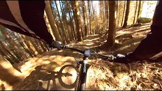
Trail con mucho flow, tramos rapidos, algunos saltos y pocas dificultades técnicas salvo el final que es algo empinado y expuesto.

Tags
Jumps

Recent Activity on Trail

Past Week
  • 2 rides
  • 15 miles average
6 Months
  • 14 rides
  • 17 miles avg distance
All
  • 81 rides
  • Last: Nov 10, 2026
c1c2c3c4
January
February
March
April
May
June
July
August
September
October
November
December
update trails status or condition

Gozadera Trail Reports

statusdatedescription
Nov 11, 2026 @ 5:34pm (Europe/Madrid)
Nov 11, 2026
Ya esta limpia la zona de arboles caidos.
Nov 8, 2026 @ 9:17pm (Europe/Madrid)
Nov 8, 2026
Arbol caído, mucho cuidado. No he podido quitarlo por dejarme la sierra en casa.
Nov 2, 2026 @ 9:01pm (Europe/Madrid)
Nov 2, 2026
Hosto asko dago, bidea tapatzen dute zati handi batean.
Oct 17, 2026 @ 9:14am (Europe/Andorra)
Oct 17, 2026
Sep 26, 2026 @ 8:33am (Europe/Andorra)
Sep 25, 2026
more »
Status:
on Nov 11, 2026
Ideal
Avg: 4.53 (13 votes)
Your vote: 0

view (278)
close
      Directions to gozadera trailhead (43.214970, -1.951660)

      Photos

      15 more »
      mtb
      83 |
      Dec 21, 2024 @ 1:06am
      Dec 21, 2024
      mtb
      176 |
      Jul 25, 2022 @ 8:41am
      Jul 25, 2022
      mtb
      152 |
      Jul 13, 2022 @ 10:36am
      Jul 13, 2022
      report
      mtb
      95 |
      Feb 7, 2026 @ 2:26am
      Feb 7, 2026

      Videos

      1 more »
      GOZADERA Enduro Adarra
      mtb
      5:36 | 393 | May 8, 2025 , Donostia/San Sebastian

      Routes with this trail

      more »
      16 miles • 3,915 ft • 4 • Loop •
      Ruta circular que combina bajadas de Azketa y Gozadera
      16 miles • 3,915 ft • 4 • Loop •
      Ruta que une bajadas de Besabi y Gozadera
      4.9 ★★★★★
      13 Ratings
      5 ★ 85%
      4 ★ 15%
      3 ★
      2 ★
      1 ★

      3 Reviews & Comments

      Lo9ciCDc
      Very good work, I'd definitely say it's a red track
      jasperli
      What a great ride it's quite shaped, some jumps - fast sections. Liked it a lot!
      ipartrails ipartrails
      Sendero muy divertido y variado. Los saltos que están construidos no son del todo lógicos, pero el sendero en su totalidad se hace disfrutón. Zorionak a los/as trailbuilders!

      We hope you've been enjoying Trailforks!

      Create a FREE account to view all trail reviews and much more.

      • By otobikeTF Pro & contributors
      • #416454 - 1,798 views

      Frequently Asked Questions

      ▼ Where is Gozadera located?
      Gozadera is located in Adarra, Donostia/San Sebastian, Spain. It is part of the Adarra trail network. The trailhead is located at coordinates 43.21497, -1.95166.
      ▼ How hard is Gozadera?
      Gozadera is rated as Blue difficulty. The physical rating is Moderate. The average grade is 18.2%. The climb difficulty is rated Blue.
      ▼ What is the elevation gain for Gozadera?
      The trail has 1,333 ft of elevation descent. The elevation ranges from 226 ft to 1,559 ft.
      ▼ Is Gozadera a point to point trail?
      Yes, Gozadera is a point to point trail. The direction is Downhill Only. The trail type is singletrack.
      ▼ How long is Gozadera?
      Gozadera is 1.4 miles long. The trail type is singletrack.
      ▼ Are dogs allowed on Gozadera?
      Yes, dogs are allowed on Gozadera. Please keep dogs on a leash where required and clean up after them.
      ▼ When is the best time of year to ride Gozadera?
      Based on activity log data, the most popular months to ride Gozadera are:
      • September (9 activities)
      • November (9 activities)
      • January (6 activities)
      Check the reports page for current trail conditions.
      ▼ How do I access Gozadera? Where is the closest parking trailhead?
      The closest parking and trailhead locations to Gozadera are: View all parking locations in the area.
      ▼ How long does it take to ride Gozadera?
      Based on recorded activities, it takes an average of 15 minutes to ride Gozadera. The trail is 1.4 miles long. Actual times will vary based on fitness level, conditions, and pace. View recent activity logs for more details.
      ▼ How busy is Gozadera?
      Gozadera is a very popular trail. There have been 269 recorded activities on this trail. The trail has received 278 check-ins. View recent activity on this trail.

      Hit the Trail

      Open in App

      Get this trail on your phone instantly.

      open trail in app

      Download Trail

      Save to wishlist, Garmin & download.
      save the trail

      Find Related Routes

      Find routes and users activities that include this trail.
      find routes for this trail

      You must enter a description before submitting.

