more stats
1,726 ft
Distance
3 ft
Climb
-63 ft
Descent
00:02:52
Avg time
-63 ft
Altitude change
90 ft
Altitude min
152 ft
Altitude max
152 ft
Altitude start
89 ft
Altitude end
-3.6%
Grade
-12.6%
Grade max
5.4%
Grade min
95 ft
Distance climb
902 ft
Distance down
528 ft
Distance flat
00:02:52
Avg time

Gravity Destroyer Details

  • Activities
    • Mountain Bike
    • E-Bike
    • Gravel Bike
    • Winter Fat Bike
  • Riding Area
    Mount Dora MTB Trails
    Mount Dora, Florida
  • Difficulty Rating
  • Local Popularity
    100 in Mountain Biking [+]
    • 100 in E-Biking
  • Global Ranking
    #32020 in Mountain Biking
  • Trail Type
    Singletrack
  • Bike Type
    DH, AM, XC, DJ, Fat, CX, Gravel
  • Direction
    One Direction
  • Physical Rating
    Moderate
  • Trail Visibility
    Always easy to follow
  • Season
    Year round
  • Dogs Allowed
    Yes
  • eBike Allowed
    Yes up to Class 1
  • TTFs on Trail
    A-Frame, Berm, Bridge, Drop, Jump, Ladder Bridge, Wallride
  • Ride in Rain
    Yes
  • Land Owner
    Mount Dora

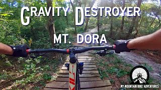
This fast flowy trail enters next to Helter Skelter and after bombing the initial descent, you get ripped around 4 big wooden berms one after another. After navigating a few rooty switchbacks, you'll be greeted by a drop with a go-around option straight into a final wooden berm. If you want another go, simply climb up Mini Destroyer and lap it over and over. For more riding continue onto Florida Flow.

Access Info

Dora Connector Out flows directly into Gravity Destroyer, just watch for cross traffic exiting Helter Skelter. After riding Gravity Destroyer you will end up at the bottom of Mini Destroyer and will have access to Florida Flow as well.

Disclaimer

Trail crosses exit traffic from Helter Skelter.

Traditionally Indigenous Territory

Recent Activity on Trail

Past Week
  • 8 rides
  • 8 miles average
6 Months
  • 281 rides
  • 10 miles avg distance
All
  • 2,340 rides
  • Last: Jun 29, 2026
c1c2c3c4
January
February
March
April
May
June
July
August
September
October
November
December
Status:
on Mar 12, 2026
Dry
Avg: 4.52 (13 votes)
Your vote: 0

view (30,085)
close
3D
Trail Conditions
  • Unknown
  • Snow Groomed
  • Snow Packed
  • Snow Covered
  • Snow Cover Partial
  • Freeze/thaw Cycle
  • Icy
  • Prevalent Mud
  • Wet
  • Variable
  • Ideal
  • Dry
  • Very Dry
Trail Flow (Ridden Direction)
Trailforks scans users ridelogs to determine the most popular direction each trail is ridden. A good flowing trail network will have most trails flowing in a single direction according to their intension.
The colour categories are based on what percentage of riders are riding a trail in its intended direction.
  • > 96%
  • > 90%
  • > 80%
  • > 70%
  • > 50%
  • < 50%
  • bi-directional trail
  • no data
Trail Last Ridden
Trailforks scans ridelogs to determine the last time a trail was ridden.
  • < 2 days
  • < 1 week
  • < 2 weeks
  • < 1 month
  • < 6 months
  • > 6 months
Trail Ridden Direction
The intended direction a trail should be ridden.
  • Downhill Only
  • Downhill Primary
  • Both Directions
  • Uphill Primary
  • Uphill Only
  • One Direction
Contribute Details
Colors indicate trail is missing specified detail.
  • Description
  • Photos
  • Description & Photos
  • Videos
Trail Popularity ?
Trailforks scans ridelogs to determine which trails are ridden the most in the last 9 months. Trails are compared with nearby trails in the same city region with a possible 25 colour shades. Think of this as a heatmap, more rides = more kinetic energy = warmer colors.
  • most popular
  • popular
  • less popular
  • not popular
ATV/ORV/OHV Filter
Max Vehicle Width
inches
US Cell Coverage
Legend
cell carrier legend

Radar Time
Activity Recordings
Trailforks uses anonymized public activity data. ?
Activity Recordings
Trailforks uses anonymized public activity data. ?
Personal Heatmap
Activity Types
all / none
Options
2
Date range month
Winter Trails
Warning A routing network for winter maps does not exist. Selecting trails using the winter trails layer has been disabled.
Missing Trails
Most Popular
Least Popular
Trails are colored based on popularity. The more popular a trail is, the more red. Less popular trails trend towards green.
Jump Magnitude Heatmap
Heatmap of where riders jump on trails. Zoom in to see individual jumps, click circles to view jump details.
BC Backroad Status

Service Road Atlas is a free to use, community-driven service for viewing and creating reports on the numerous back-country service roads around B.C. and Alberta.

map legend
Slope Aspect
Direction the slope faces
Flat N NE E SE S SW W NW
Trails Deemphasized
Trails are shown in grey.
disable
Only show trails with no bike usage.
Enable
Suggested Layers
Based on selected activity type

    Save the current map location and zoom level as your default home location whenever this page is loaded.

    Save
        Directions to gravity-destroyer trailhead (28.805900, -81.627550)

        Photos

        14 more »
        71 |
        Apr 19, 2025 @ 7:05pm
        Apr 19, 2025
        63 |
        Apr 19, 2025 @ 7:05pm
        Apr 19, 2025
        58 |
        Apr 19, 2025 @ 7:05pm
        Apr 19, 2025
        319 |
        Nov 27, 2022 @ 6:39am
        Nov 27, 2022

        Videos

        3 more »
        Gravity Destroyer Full Trail | Mt. Dora...
        2:37 | 3546 | Aug 30, 2020 , Mount Dora
        Flowiest of the Flow, Mount Dora!
        10:12 | 721 | Aug 15, 2019 , Mount Dora
        Gravity Destroyer in Mount Dora FL
        2:44 | 233 | Dec 18, 2018 , Mount Dora

        Routes with this trail

        4.0 3 miles 240 ft 16 Loop
        Simple out and back or loop including all the blue trail options in Mt Dora.

        Reviews / Comments

        No reviews yet, be the first to write a review or ask a question.
        Use trail reports to comment on trail conditions.


        We hope you've been enjoying Trailforks!

        Create a FREE account to view trail comments and much more.

        • By GoinridingTF Pro Pisgah RHD & contributors
        • #77494 - 3,256 views

        Frequently Asked Questions About Gravity Destroyer

        Where is Gravity Destroyer located?
        Gravity Destroyer is located in Mount Dora MTB Trails, Mount Dora, Florida, United States. It is part of the Mount Dora MTB Trails trail network. The trailhead is located at coordinates 28.8059, -81.62755.
        How hard is Gravity Destroyer?
        Gravity Destroyer is rated as Blue difficulty. The physical rating is Moderate. The average grade is 3.6%.
        What is the elevation gain for Gravity Destroyer?
        Gravity Destroyer has 3 ft of elevation gain. The trail has 63 ft of elevation descent. The elevation ranges from 90 ft to 152 ft.
        Is Gravity Destroyer a point to point trail?
        Yes, Gravity Destroyer is a point to point trail. The direction is One Direction. The trail type is singletrack.

        Hit the Trail

        Open in App

        Get this trail on your phone instantly.
        open trail in app

        Download Trail

        Save to wishlist, Garmin & download.
        save the trail

        Find Related Routes

        Find routes and users activities that include this trail.
        find routes for this trail

        You must enter a description before submitting.