

more stats
4,751 ft
Distance
82 ft
Climb
-87 ft
Descent
00:08:20
Avg time
-7 ft
Altitude change
2,716 ft
Altitude min
2,772 ft
Altitude max
2,723 ft
Altitude start
2,717 ft
Altitude end
-0.2%
Grade
-14%
Grade max
15.9%
Grade min
1,578 ft
Distance climb
2,251 ft
Distance down
922 ft
Distance flat
00:08:20
Avg time

Green Granite Details

  • Activities
    • Mountain Bike
    • E-Bike
    • Hike
    • Trail Running
  • Riding Area
  • Difficulty Rating
  • Voted Difficulty
    Blue (1 vote)
  • Local Popularity
    80 in Mountain Biking heatmap [+]
    • 50 in E-Biking
    • 5 in Trail Running
    • 70 in Hiking
  • Global Ranking
    #50582 in Mountain Biking [+]
    • #49925 in E-Biking
    • #216667 in Trail Running
    • #216462 in Hiking
  • National Ranking
    #2,436 in Mountain Biking · Australia [+]
    • #3,540 in E-Biking
    • #7,364 in Trail Running
    • #6,308 in Hiking
  • Trail Type
    Singletrack
  • Bike Type
    AM, XC
  • Direction
    Both Directions
  • Climb Difficulty
    Green
  • Physical Rating
    Easy
  • Dogs Allowed
    Yes
  • eBike Allowed
    Yes up to Class 1
  • TTFs on Trail
    Berm, Rock Garden
  • Ride in Rain
    Yes
  • Year Opened
    2017
  • Land Owner
    Southern Downs Mountain Biking Club Inc

First ever single trail in our beautiful town of Stanthorpe, designed and built by Trailworx and Southern Downs Mountain Biking Club. This was the first trail in our trail network which has shown great potential as a wonderful riding area with our amazing terrain in the Southern Downs.

Access Info

Main Trail Head off Foxton St Stanthorpe

Tags
BermsRock gardens

Trail Supporters

Traditionally Indigenous Territory

Recent Activity on Trail

Past Week
  • 0 rides
  •  
6 Months
  • 7 rides
  • 6 miles avg distance
All
  • 76 rides
  • Last: Oct 29, 2026
c1c2c3c4
January
February
March
April
May
June
July
August
September
October
November
December
update trails status or condition

Green Granite Trail Reports

statusdatedescription
Dec 31, 2023 @ 4:28pm
Dec 31, 2023
Fallen trees,long grass
Dec 9, 2022 @ 11:58am
Dec 9, 2022
It looks like they've bridged the bog with a section of wood slats, really well constructed too.
Dec 8, 2022 @ 12:05pm
Dec 8, 2022
Great
Nov 5, 2022 @ 6:13am
Nov 5, 2022
One wet spot, easy to ride through , just boggy for 3 metres.
Nov 4, 2022 @ 1:27pm
Nov 4, 2022
Up to the top and all the way down yeah!
more »
Status:
on Dec 31, 2023
Variable
Avg: 4.11 (2 votes)
Your vote: 0

view (886)
close
      Directions to green-granite trailhead (-28.657680, 151.944590)

      Photos

      12 more »
      mtb
      200 |
      Dec 19, 2021 @ 8:42pm
      Dec 19, 2021
      mtb
      241 |
      Dec 19, 2021 @ 8:42pm
      Dec 19, 2021
      mtb
      185 |
      Dec 19, 2021 @ 8:42pm
      Dec 19, 2021
      mtb
      212 |
      Apr 20, 2019 @ 7:48pm
      Apr 20, 2019

      Videos

      1 more »
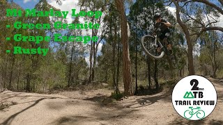
      Loop - Mt Marlay
      mtb
      2:01 | 365 | Feb 6, 2021 , Stanthorpe
      4.5 ★★★★★
      2 Ratings
      5 ★ 50%
      4 ★ 50%
      3 ★
      2 ★
      1 ★

      6 Reviews & Comments

      aknapp47 aknapp47
      This is another example of how Cross Country trails don't need to be dull. As an experienced rider this trail is really fun. While this trail is definitely on the hard side for a green "beginner" rated trail, it is full of small-medium tech features (such as a small but fun rollable slab as well as a short rock garden) as well as some nice flowy sections. I would definitely not recommend this trail for pure beginner's, but is still an amazing trail for most levels of riders.
      Futaba
      This is a well maintained trail and enjoyable as a visitor staying at the Stanthorpe showgrounds for a few nights. Really enjoyed the downhill from the top of number 5 but probably a bit over my level.

      1, 2 and 3 great for spinning laps.

      Thanks to the folks keeping these trails open.
      Afjhd
      Tracks 1, 2 and 3 provide a nice 3km 20 min circuit best ridden anti-clockwise. Green relatively difficult for beginners tracks but blue track 3 an easy intermediate. No real difference. Black track 4 mainly intermediate with some difficult drops. More B lines would be advantageous. Road up new intermediate track 6 but a challenge with constant pedal strikes on protruding rocks - using large flat pedals, clip ons would be better. Got to the top to discover that track still under construction. Will be a nice downhill.

      We hope you've been enjoying Trailforks!

      Create a FREE account to view all trail reviews and much more.

      • By Foresto & contributors
      • #140372 - 1,887 views

      Frequently Asked Questions

      ▼ Where is Green Granite located?
      Green Granite is located in Mt Marlay MTB Trails, Stanthorpe, Australia. It is part of the Mt Marlay MTB Trails trail network. The trailhead is located at coordinates -28.65768, 151.94459.
      ▼ How hard is Green Granite?
      Green Granite is rated as Green difficulty. The physical rating is Easy. The average grade is 0.2%. The climb difficulty is rated Green.
      ▼ What is the elevation gain for Green Granite?
      Green Granite has 82 ft of elevation gain. The trail has 87 ft of elevation descent. The elevation ranges from 2,716 ft to 2,772 ft.
      ▼ Is Green Granite a point to point trail?
      Green Granite is not a point to point trail. The direction is Both Directions. The trail type is singletrack.
      ▼ How long is Green Granite?
      Green Granite is 4,751 ft long. The trail type is singletrack.
      ▼ Are dogs allowed on Green Granite?
      Yes, dogs are allowed on Green Granite. Please keep dogs on a leash where required and clean up after them.
      ▼ How long does it take to ride Green Granite?
      Based on recorded activities, it takes an average of 8 minutes to ride Green Granite. The trail is 4,751 ft long. Actual times will vary based on fitness level, conditions, and pace. View recent activity logs for more details.
      ▼ How busy is Green Granite?
      Green Granite is a very popular trail. There have been 614 recorded activities on this trail. The trail has received 886 check-ins. View recent activity on this trail.

      Hit the Trail

      Open in App

      Get this trail on your phone instantly.

      open trail in app

      Download Trail

      Save to wishlist, Garmin & download.
      save the trail

      Find Related Routes

      Find routes and users activities that include this trail.
      find routes for this trail

      You must enter a description before submitting.

