more stats
4,390 ft
Distance
-235 ft
Descent
00:03:31
Avg time
-235 ft
Altitude change
370 ft
Altitude min
605 ft
Altitude max
605 ft
Altitude start
371 ft
Altitude end
-5.3%
Grade
-25.6%
Grade max
2.5%
Grade min
62 ft
Distance climb
3,891 ft
Distance down
440 ft
Distance flat
00:03:31
Avg time

Grom flow Details

  • Activities
    • Mountain Bike
  • Riding Area
    O'Halloran Hill
    Adelaide
  • Difficulty Rating
  • Local Popularity
    100 in Mountain Biking
  • Global Ranking
    #11534 in Mountain Biking
  • Trail Type
    Singletrack
  • Bike Type
    AM, XC
  • Direction
    Downhill Only
    Popular Direction Shown
  • Climb Difficulty
    Green
  • Physical Rating
    Easy
  • Trail Visibility
    Always easy to follow
  • Family Friendly
    Yes
  • eBike Allowed
    Yes up to Class 1
  • TTFs on Trail
    Berm, Jump
  • Year Opened
    2019
  • Land Owner

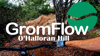
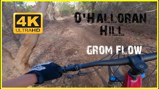
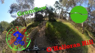
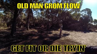
This 1300m descending flow trail was built for the youngsters. Big berms and rollers will make for a grin that stays on long after the dirt has been washed off.

Trail Supporters

Bike Park

Traditionally Indigenous Territory

Recent Activity on Trail

Past Week
  • 1 rides
  • 11.3 km average
6 Months
  • 52 rides
  • 21.0 km avg distance
All
  • 1,014 rides
  • Last: Jul 4, 2026
c1c2c3c4
January
February
March
April
May
June
July
August
September
October
November
December
update trails status or condition

Grom flow Trail Reports

statusdatedescription
Mar 5, 2026 @ 10:14pm (Australia/Adelaide)
Mar 5, 2026
starting to get some chop and ruts around the Rocks and on berms. still rideable but needs some dirt back on the trail.
Sep 29, 2025 @ 3:39pm (Australia/Adelaide)
Sep 28, 2025
Minor erosion (trail braiding, small ruts developing, brake bumps)
Aug 29, 2025 @ 11:15pm
Aug 29, 2025
whole trail is good except for a tree down in the middle of the path about 100m down the trail.
Apr 22, 2025 @ 9:54am
Apr 22, 2025
Mar 30, 2025 @ 11:38am
Mar 30, 2025
exposed rock base rough bumpy and fun
more »
Status:
on Mar 5, 2026
Dry
Avg: 4.36 (16 votes)
Your vote: 0

view (9,545)
close
3D
Trail Conditions
  • Unknown
  • Snow Groomed
  • Snow Packed
  • Snow Covered
  • Snow Cover Partial
  • Freeze/thaw Cycle
  • Icy
  • Prevalent Mud
  • Wet
  • Variable
  • Ideal
  • Dry
  • Very Dry
Trail Flow (Ridden Direction)
Trailforks scans users ridelogs to determine the most popular direction each trail is ridden. A good flowing trail network will have most trails flowing in a single direction according to their intension.
The colour categories are based on what percentage of riders are riding a trail in its intended direction.
  • > 96%
  • > 90%
  • > 80%
  • > 70%
  • > 50%
  • < 50%
  • bi-directional trail
  • no data
Trail Last Ridden
Trailforks scans ridelogs to determine the last time a trail was ridden.
  • < 2 days
  • < 1 week
  • < 2 weeks
  • < 1 month
  • < 6 months
  • > 6 months
Trail Ridden Direction
The intended direction a trail should be ridden.
  • Downhill Only
  • Downhill Primary
  • Both Directions
  • Uphill Primary
  • Uphill Only
  • One Direction
Contribute Details
Colors indicate trail is missing specified detail.
  • Description
  • Photos
  • Description & Photos
  • Videos
Trail Popularity ?
Trailforks scans ridelogs to determine which trails are ridden the most in the last 9 months. Trails are compared with nearby trails in the same city region with a possible 25 colour shades. Think of this as a heatmap, more rides = more kinetic energy = warmer colors.
  • most popular
  • popular
  • less popular
  • not popular
ATV/ORV/OHV Filter
Max Vehicle Width
inches
US Cell Coverage
Legend
cell carrier legend

Radar Time
Activity Recordings
Trailforks uses anonymized public activity data. ?
Activity Recordings
Trailforks uses anonymized public activity data. ?
Personal Heatmap
Activity Types
all / none
Options
2
Date range month
Winter Trails
Warning A routing network for winter maps does not exist. Selecting trails using the winter trails layer has been disabled.
Missing Trails
Most Popular
Least Popular
Trails are colored based on popularity. The more popular a trail is, the more red. Less popular trails trend towards green.
Jump Magnitude Heatmap
Heatmap of where riders jump on trails. Zoom in to see individual jumps, click circles to view jump details.
BC Backroad Status

Service Road Atlas is a free to use, community-driven service for viewing and creating reports on the numerous back-country service roads around B.C. and Alberta.

map legend
Slope Aspect
Direction the slope faces
Flat N NE E SE S SW W NW
Trails Deemphasized
Trails are shown in grey.
disable
Only show trails with no bike usage.
Enable
Suggested Layers
Based on selected activity type

    Save the current map location and zoom level as your default home location whenever this page is loaded.

    Save
        Directions to grom-flow trailhead (-35.048230, 138.542560)

        Photos

        1 more »
        193 |
        Dec 30, 2019 @ 6:52pm
        Dec 30, 2019

        Videos

        5 more »
        O'Halloran Hill - GromFlow
        3:08 | 310 | Aug 19, 2023 , Adelaide
        O'Halloran Hill - Grom Flow
        3:31 | 286 | Apr 15, 2023 , Adelaide
        O'Halloran Hill - Gromflow - Green
        4:15 | 165 | Dec 5, 2022 , Adelaide
        Old Man Grom Flow
        5:08 | 393 | Apr 27, 2021 , Adelaide

        Routes with this trail

        5.0 65 miles 8,785 ft 37 Point to Point
        Some of us like doing Hard Things... Challenge yourself on this antisocial ride on some of Adelaide's most...
        5.0 65 miles 8,768 ft 37
        Start an edit on this and ...
        20 miles 2,430 ft 24 Loop
        The latest version of Big Red's never ending search for the greatest OHH loop possible

        1 Review & Comments


        We hope you've been enjoying Trailforks!

        Create a FREE account to view trail comments and much more.

        Nearby Trails

        • By RadbitTF Pro & contributors
        • #187769 - 4,404 views

        Frequently Asked Questions About Grom flow

        Where is Grom flow located?
        Grom flow is located in O'Halloran Hill, Adelaide, Australia. It is part of the O'Halloran Hill trail network. The trailhead is located at coordinates -35.04823, 138.54256.
        How hard is Grom flow?
        Grom flow is rated as Green difficulty. The physical rating is Easy. The average grade is 5.3%. The climb difficulty is rated Green.
        What is the elevation gain for Grom flow?
        The trail has 235 ft of elevation descent. The elevation ranges from 370 ft to 605 ft.
        Is Grom flow a point to point trail?
        Yes, Grom flow is a point to point trail. The direction is Downhill Only. The trail type is singletrack.

        Hit the Trail

        Open in App

        Get this trail on your phone instantly.
        open trail in app

        Download Trail

        Save to wishlist, Garmin & download.
        save the trail

        Find Related Routes

        Find routes and users activities that include this trail.
        find routes for this trail

        You must enter a description before submitting.