
more stats
2,493 ft
Distance
85 ft
Climb
-440 ft
Descent
00:06:31
Avg time
-355 ft
Altitude change
348 ft
Altitude min
780 ft
Altitude max
780 ft
Altitude start
427 ft
Altitude end
-14.2%
Grade
-59.3%
Grade max
28.1%
Grade min
515 ft
Distance climb
1,860 ft
Distance down
121 ft
Distance flat
00:06:31
Avg time

Grommies Details

  • Activities
    • Mountain Bike
    • Hike
    • Trail Running
  • Riding Area
    Urumau Reserve
    Lyttelton
  • Difficulty Rating
  • Local Popularity
    85 in Mountain Biking heatmap [+]
    • 5 in Trail Running
    • 40 in Hiking
  • Global Ranking
    #60174 in Mountain Biking [+]
    • #157909 in Trail Running
    • #155498 in Hiking
  • National Ranking
    #1,337 in Mountain Biking · New Zealand [+]
    • #2,721 in Trail Running
    • #2,165 in Hiking
  • Trail Type
    Singletrack
  • Bike Type
    AM
  • Direction
    Downhill Primary
    Popular Direction Shown
  • Physical Rating
    Moderate
  • Dogs Allowed
    Yes
  • TTFs on Trail
    Berm, Drop, Jump

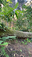
The most popular track in our reserve: flows directly down from the upper half of the backside from Stormer/ following a series of bends and crossing the Traverse track at midway. Grommies then sidles across the hillside over a series of small rollers and down across the rock band into the obvious 180 degree berm. Now the built features ramp up with a series of optional steps, kickers, and drops. Careful of the marked 'Optional Log Drop' as the only feature which is not roll-able, but does have a ride around. Last bit crosses two gulleys with a fairly large G-out, before connecting up to the climbing track.

Tags
BermsDropsJumpsRollers

Local Trail Association

Traditionally Indigenous Territory

Recent Activity on Trail

Past Week
  • 1 rides
  • 24 miles average
6 Months
  • 9 rides
  • 36 miles avg distance
All
  • 187 rides
  • Last: Nov 16, 2026
c1c2c3c4
January
February
March
April
May
June
July
August
September
October
November
December
Status:
on Dec 1, 2025
Ideal
Avg: 4 (11 votes)
Your vote: 0

view (1,667)
close
      Directions to grommies trailhead (-43.602390, 172.730190)

      Photos

      4 more »
      mtb
      487 |
      Dec 14, 2021 @ 5:33pm
      Dec 14, 2021
      mtb
      533 |
      Dec 14, 2021 @ 5:33pm
      Dec 14, 2021
      mtb
      225 |
      Oct 19, 2021 @ 2:09pm
      Oct 19, 2021
      mtb
      293 |
      Oct 19, 2021 @ 2:09pm
      Oct 19, 2021

      Videos

      5 more »
      youtuber LYTTELTON BIKE PARK | STORMER to GROMMIES |...
      mtb
      8:46 | 496 | Sep 27, 2021 , Lyttelton
      youtuber LYTTELTON BIKE PARK | STORMER to GROMMIES |...
      mtb
      8:46 | 270 | Sep 27, 2021 , Lyttelton
      Lyttelton Bike Park | MTB Trail Magic
      mtb
      9:47 | 481 | May 25, 2019 , Lyttelton
      Sarah's crash
      mtb
      0:14 | 117 | Oct 26, 2021 , Lyttelton
      4.0 ★★★★★
      11 Ratings
      5 ★ 36%
      4 ★ 45%
      3 ★ 9%
      2 ★
      1 ★ 9%

      3 Reviews & Comments

      mckay15
      Soo good had to post. Such an amazing spot with the views and forrest unmatched in chch. Trails were all running mint and we'll maintained, blacks will give you a good test too. 100% recommend
      craiglovesdirt
      Exposed areas are drying, however sheltered areas wet and greasy.
      tqm
      Will take a few rides to learn. Some steep rollovers to get the heart racing and the drop-off may stop you in your tracks like it did me (look right for the chicken option).

      We hope you've been enjoying Trailforks!

      Create a FREE account to view all trail reviews and much more.

      • By nakinoahTF Pro & contributors
      • #47806 - 3,116 views

      Frequently Asked Questions

      ▼ Where is Grommies located?
      Grommies is located in Urumau Reserve, Lyttelton, New Zealand. It is part of the Urumau Reserve trail network. The trailhead is located at coordinates -43.60239, 172.73019.
      ▼ How hard is Grommies?
      Grommies is rated as Blue difficulty. The physical rating is Moderate. The average grade is 14.2%.
      ▼ What is the elevation gain for Grommies?
      Grommies has 85 ft of elevation gain. The trail has 440 ft of elevation descent. The elevation ranges from 348 ft to 780 ft.
      ▼ Is Grommies a point to point trail?
      Grommies is not a point to point trail. The direction is Downhill Primary. The trail type is singletrack.
      ▼ How long is Grommies?
      Grommies is 2,493 ft long. The trail type is singletrack.
      ▼ Are dogs allowed on Grommies?
      Yes, dogs are allowed on Grommies. Please keep dogs on a leash where required and clean up after them.
      ▼ When is the best time of year to ride Grommies?
      Based on activity log data, the most popular months to ride Grommies are:
      • April (11 activities)
      • January (9 activities)
      • March (9 activities)
      Check the reports page for current trail conditions.
      ▼ How do I access Grommies? Where is the closest parking trailhead?
      The closest parking and trailhead locations to Grommies are: View all parking locations in the area.
      ▼ How long does it take to ride Grommies?
      Based on recorded activities, it takes an average of 7 minutes to ride Grommies. The trail is 2,493 ft long. Actual times will vary based on fitness level, conditions, and pace. View recent activity logs for more details.
      ▼ How busy is Grommies?
      Grommies is a very popular trail. There have been 1,374 recorded activities on this trail. The trail has received 1,667 check-ins. View recent activity on this trail.

      Hit the Trail

      Open in App

      Get this trail on your phone instantly.

      open trail in app

      Download Trail

      Save to wishlist, Garmin & download.
      save the trail

      Find Related Routes

      Find routes and users activities that include this trail.
      find routes for this trail

      You must enter a description before submitting.

