

more stats
1.5 miles
Distance
38 ft
Climb
-1,207 ft
Descent
00:16:05
Avg time
-1,169 ft
Altitude change
423 ft
Altitude min
1,614 ft
Altitude max
1,598 ft
Altitude start
430 ft
Altitude end
-14.3%
Grade
-59.7%
Grade max
15.5%
Grade min
978 ft
Distance climb
1 mile
Distance down
446 ft
Distance flat
00:16:05
Avg time

Guadaiza Details

  • Activities
    • Mountain Bike
    • E-Bike
    • Hike
    • Trail Running
  • Riding Area
  • Difficulty Rating
  • Local Popularity
    65 in Mountain Biking [+]
    • 80 in E-Biking
    • 5 in Trail Running
    • 5 in Hiking
  • Global Ranking
    #293647 in Mountain Biking [+]
    • #43414 in E-Biking
    • #396370 in Trail Running
    • #394761 in Hiking
  • National Ranking
    #34,485 in Mountain Biking · Spain [+]
    • #3,114 in E-Biking
    • #46,862 in Trail Running
    • #45,622 in Hiking
  • Hiking SAC Scale
    T2 Mountain Hiking
  • Trail Type
    Singletrack
  • Bike Type
    AM
  • Direction
    Downhill Primary
    Popular Direction Shown
  • Trail Visibility
    Always easy to follow
  • Dogs Allowed
    Yes
  • eBike Allowed
  • Ride in Rain
    Yes

Sendero que baja entre árboles hacia el embalse del Guadaiza, no muy vertical pero con tramos más rotos y con algún surco profundo y alguna zona de piedras. Ojo que hace un giro brusco a la izquierda en el primer tercio y es fácil tirar recto (que debe ser más sencillo). En verano muy seco y suelto, no conviene dejar correr mucho la bici.

Tags

Recent Activity on Trail

Past Week
  • 0 rides
  •  
6 Months
  • 5 rides
  • 14 miles avg distance
All
  • 6 rides
  • Last: Oct 18, 2026
c1c2c3c4
January
February
March
April
May
June
July
August
September
October
November
December
update trails status or condition

Guadaiza Trail Reports

statusdatedescription
Oct 18, 2026 @ 10:14am (Europe/Gibraltar)
Oct 18, 2026
Lo han limpiado y quitado toda la maleza. Cuidado que hay un árbol medio caído pero se puede pasar por abajo
Oct 3, 2026 @ 10:02pm (Europe/Madrid)
Oct 3, 2026
Dec 7, 2025 @ 9:28pm (Europe/Madrid)
Dec 7, 2025
2 tree down across trail, blocking trail
more »
Status:
on Oct 18, 2026
Ideal
Avg: 5 (1 votes)
Your vote: 0

view (26)
close
      Directions to guadaiza trailhead (36.551170, -5.013440)

      Photos

      1 more »
      report
      mtb
      76 |
      Dec 7, 2025 @ 12:35pm
      Dec 7, 2025

      Videos

      1 more »
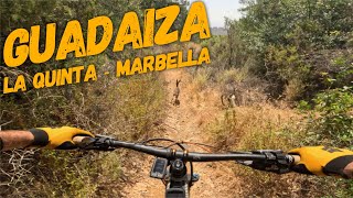
      youtuber ‍♂️ ⛰️ Guadaiza ☀️  | La Quinta...
      mtb
      13:41 | 112 | Nov 22, 2025 , Marbella
      5.0 ★★★★★
      1 Ratings
      5 ★ 100%
      4 ★
      3 ★
      2 ★
      1 ★

      1 Review & Comments

      juanmerchan juanmerchan
      Este es un sendero bastante técnico por algunos tramos pasos delicados por lo demás es puro disfrute largo rápido tiene de todo saltos curvas, cerradas, surcos bastante grandes por los que pasan las motos. Suele ser frecuentado por Motos que suben desde la presa el mejor sendero de la zona, yo le daría dificultad o grado de color rojo de azul no tiene nada si tienes poco nivel y técnica mejor no bajes por aquí

      We hope you've been enjoying Trailforks!

      Create a FREE account to view all trail reviews and much more.

      • By allmountrailmtbTF Pro & contributors
      • #858180 - 326 views

      Frequently Asked Questions

      ▼ Where is Guadaiza located?
      Guadaiza is located in Sierra de Las Nieves, Marbella, Spain. It is part of the Sierra de Las Nieves trail network. The trailhead is located at coordinates 36.55117, -5.01344.
      ▼ How hard is Guadaiza?
      Guadaiza is rated as Blue difficulty. The average grade is 14.3%.
      ▼ What is the elevation gain for Guadaiza?
      Guadaiza has 38 ft of elevation gain. The trail has 1,207 ft of elevation descent. The elevation ranges from 423 ft to 1,614 ft.
      ▼ Is Guadaiza a point to point trail?
      Guadaiza is not a point to point trail. The direction is Downhill Primary. The trail type is singletrack.
      ▼ How long is Guadaiza?
      Guadaiza is 1.5 miles long. The trail type is singletrack.
      ▼ Are dogs allowed on Guadaiza?
      Yes, dogs are allowed on Guadaiza. Please keep dogs on a leash where required and clean up after them.
      ▼ When is the best time of year to ride Guadaiza?
      Based on activity log data, the most popular months to ride Guadaiza are:
      • April (2 activities)
      • October (2 activities)
      • May (1 activities)
      Check the reports page for current trail conditions.
      ▼ How long does it take to ride Guadaiza?
      Based on recorded activities, it takes an average of 16 minutes to ride Guadaiza. The trail is 1.5 miles long. Actual times will vary based on fitness level, conditions, and pace. View recent activity logs for more details.
      ▼ How busy is Guadaiza?
      Guadaiza is a moderately popular trail. There have been 26 recorded activities on this trail. The trail has received 26 check-ins. View recent activity on this trail.

      Hit the Trail

      Open in App

      Get this trail on your phone instantly.

      open trail in app

      Download Trail

      Save to wishlist, Garmin & download.
      save the trail

      Find Related Routes

      Find routes and users activities that include this trail.
      find routes for this trail

      You must enter a description before submitting.

