
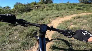

more stats
1,608 ft
Distance
63 ft
Climb
-36 ft
Descent
00:02:45
Avg time
27 ft
Altitude change
1,746 ft
Altitude min
1,809 ft
Altitude max
1,749 ft
Altitude start
1,775 ft
Altitude end
1.7%
Grade
-15.5%
Grade max
13.2%
Grade min
942 ft
Distance climb
554 ft
Distance down
112 ft
Distance flat
00:02:45
Avg time

Guillot Details

  • Activities
    • Mountain Bike
    • E-Bike
    • Hike
    • Trail Running
  • Riding Area
  • Difficulty Rating
  • Local Popularity
    90 in Mountain Biking [+]
    • 90 in E-Biking
    • 75 in Trail Running
    • 85 in Hiking
  • Global Ranking
    #68064 in Mountain Biking [+]
    • #1207 in E-Biking
    • #128487 in Trail Running
    • #118565 in Hiking
  • National Ranking
    #4,658 in Mountain Biking · Spain [+]
    • #382 in E-Biking
    • #11,127 in Trail Running
    • #8,333 in Hiking
  • Trail Type
    Singletrack
  • Bike Type
    AM, XC
  • Direction
    Uphill Primary
  • Climb Difficulty
    Blue
  • Physical Rating
    Moderate
  • Trail Visibility
    Always easy to follow
  • Dogs Allowed
    Yes
  • eBike Allowed
    Yes up to Class 1
  • Land Owner
    Associació Lo Podall

Sender principalment de pujada amb alguns viratges per suavitzar la pujada. Perfecte per enllaçar Escorpins amb la part final de Roques Pelades.
ESP: Sendero de subida con algunos virajes para suavizar la pendiente, Ideal para enlazar Escorpins con Roques Pelades.

Tags

Local Trail Association

Recent Activity on Trail

Past Week
  • 4 rides
  • 19 miles average
6 Months
  • 37 rides
  • 19 miles avg distance
All
  • 272 rides
  • Last: Oct 24, 2026
c1c2c3c4
January
February
March
April
May
June
July
August
September
October
November
December
Status:
on Sep 13, 2026
Dry
Avg: 3.99 (11 votes)
Your vote: 0

view (1,796)
close
      Directions to guillot trailhead (42.187540, 0.917850)

      Photos

      No photos have been added for Guillot yet, add a photo.

      Videos

      1 more »
      Gillot by Territori Lo Podall
      mtb
      2:34 | 288 | Jul 13, 2023 , Tremp

      Routes with this trail

      ★ 5.0 • 16 miles • 2,802 ft • 14 • Loop •
      Ruta que ens porta al Trail dels Escorpins. Passant per la font de Talarn, Baixada pel ZZ Top fins anar a...
      24 miles • 4,561 ft • 22 • Loop •
      Combinació bones baixades de Zona Roques Pelades i Zona Nerets Combinación de buenas bajadas deZona...
      17 miles • 2,858 ft • 14 • Loop •
      Ruta que combina els senders Feixancs i Escorpins pujant per Pilones Up. Terreny rocós típic de la zona...
      4.0 ★★★★★
      11 Ratings
      5 ★ 18%
      4 ★ 64%
      3 ★ 18%
      2 ★
      1 ★

      1 Review & Comments

      PLFamiliesOG91 PLFamiliesOG91
      Aqui cada sendero tiene magia & flow desde cada bajada a los enlaces....

      We hope you've been enjoying Trailforks!

      Create a FREE account to view all trail reviews and much more.

      Frequently Asked Questions

      ▼ Where is Guillot located?
      Guillot is located in Territori Lo Podall Tremp, Tremp, Spain. It is part of the Territori Lo Podall Tremp trail network. The trailhead is located at coordinates 42.18754, 0.91785.
      ▼ How hard is Guillot?
      Guillot is rated as Blue difficulty. The physical rating is Moderate. The average grade is 1.7%. The climb difficulty is rated Blue.
      ▼ What is the elevation gain for Guillot?
      Guillot has 63 ft of elevation gain. The trail has 36 ft of elevation descent. The elevation ranges from 1,746 ft to 1,809 ft.
      ▼ Is Guillot a point to point trail?
      Guillot is not a point to point trail. The direction is Uphill Primary. The trail type is singletrack.
      ▼ How long is Guillot?
      Guillot is 1,608 ft long. The trail type is singletrack.
      ▼ Are dogs allowed on Guillot?
      Yes, dogs are allowed on Guillot. Please keep dogs on a leash where required and clean up after them.
      ▼ When is the best time of year to ride Guillot?
      Based on activity log data, the most popular months to ride Guillot are:
      • April (37 activities)
      • May (32 activities)
      • November (23 activities)
      Check the reports page for current trail conditions.
      ▼ How do I access Guillot? Where is the closest parking trailhead?
      The closest parking and trailhead locations to Guillot are: View all parking locations in the area.
      ▼ How long does it take to ride Guillot?
      Based on recorded activities, it takes an average of 3 minutes to ride Guillot. The trail is 1,608 ft long. Actual times will vary based on fitness level, conditions, and pace. View recent activity logs for more details.
      ▼ How busy is Guillot?
      Guillot is a very popular trail. There have been 1,764 recorded activities on this trail. The trail has received 1,796 check-ins. View recent activity on this trail.

      Hit the Trail

      Open in App

      Get this trail on your phone instantly.

      open trail in app

      Download Trail

      Save to wishlist, Garmin & download.
      save the trail

      Find Related Routes

      Find routes and users activities that include this trail.
      find routes for this trail

      You must enter a description before submitting.

