
more stats
666 ft
Distance
28 ft
Climb
-3 ft
Descent
00:00:42
Avg time
24 ft
Altitude change
404 ft
Altitude min
431 ft
Altitude max
407 ft
Altitude start
433 ft
Altitude end
3.7%
Grade
-2.4%
Grade max
11.5%
Grade min
509 ft
Distance climb
157 ft
Distance down
00:00:42
Avg time

Gun Range Connection Details

  • Activities
    • Mountain Bike
    • E-Bike
    • Hike
    • Trail Running
  • Riding Area
    Lime Ridge
    Concord, California
  • Difficulty Rating
  • Local Popularity
    75 in Mountain Biking [+]
    • 80 in E-Biking
    • 5 in Trail Running
    • 100 in Hiking
  • Global Ranking
    #79514 in Mountain Biking [+]
    • #31430 in E-Biking
    • #342272 in Trail Running
    • #78661 in Hiking
  • State Ranking
    #2,575 in Mountain Biking · California [+]
    • #694 in E-Biking
    • #13,939 in Trail Running
    • #4,460 in Hiking
  • Trail Type
    Singletrack
  • Bike Type
    DH, AM, XC, DJ
  • Direction
    Both Directions
  • Climb Difficulty
    Green
  • Physical Rating
    Easy
  • Trail Visibility
    Always easy to follow
  • Season
    Jan-Dec
  • eBike Allowed
    Yes up to Class 1
  • TTFs on Trail
    Berm, Jump

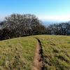
Short, easy, and pretty climb that takes you past the police training gun range. Can sometimes be loud. Fun little descent when done with your ride with a tight drop at the top followed by a moderate switchback into some downhill flow.

Access Info

From the golf course parking lot, head to the north end of the lot. Past the double gate, take the right fork and you'll find the trailhead at the other end of the gravel lot.

Tags
BermsJumps

Traditionally Indigenous Territory

Recent Activity on Trail

Past Week
  • 0 rides
  •  
6 Months
  • 5 rides
  • 9 miles avg distance
All
  • 56 rides
  • Last: Oct 28, 2026
Status:
on Mar 20, 2024
Dry
Avg: 3.98 (1 votes)
Your vote: 0

view (1,688)
close
      Directions to gun-range-connection trailhead (37.926760, -121.995610)

      Photos

      1 more »
      mtb
      133 |
      Apr 10, 2020 @ 11:09am
      Apr 10, 2020

      Videos

      no videos have been added for Gun Range Connection yet, add a video.
      4.0 ★★★★★
      1 Ratings
      5 ★
      4 ★ 100%
      3 ★
      2 ★
      1 ★

      1 Review & Comments

      maximumg maximumg
      What's up with all the closures around the quarry? All the fun has been sucked out of this spot. You can ride past the little signs unless a Karen is around to tattle on you but you can't ride over the massive logs and boulders that are blocking some hella fun little downhills. Won't be back.

      We hope you've been enjoying Trailforks!

      Create a FREE account to view all trail reviews and much more.

      • By MadCat360 & contributors
      • #272344 - 987 views

      Frequently Asked Questions

      ▼ Where is Gun Range Connection located?
      Gun Range Connection is located in Lime Ridge, Concord, California, United States. It is part of the Lime Ridge trail network. The trailhead is located at coordinates 37.92676, -121.99561.
      ▼ How hard is Gun Range Connection?
      Gun Range Connection is rated as Blue difficulty. The physical rating is Easy. The average grade is 3.7%. The climb difficulty is rated Green.
      ▼ What is the elevation gain for Gun Range Connection?
      Gun Range Connection has 28 ft of elevation gain. The trail has 3 ft of elevation descent. The elevation ranges from 404 ft to 431 ft.
      ▼ Is Gun Range Connection a point to point trail?
      Gun Range Connection is not a point to point trail. The direction is Both Directions. The trail type is singletrack.
      ▼ How long is Gun Range Connection?
      Gun Range Connection is 666 ft long. The trail type is singletrack.
      ▼ Are dogs allowed on Gun Range Connection?
      There is no information about dogs being allowed on Gun Range Connection. Check with local trail managers or the trail page for the latest access rules.
      ▼ When is the best time of year to ride Gun Range Connection?
      Gun Range Connection is best visited during: Jan-Dec.
      ▼ How do I access Gun Range Connection? Where is the closest parking trailhead?
      The closest parking and trailhead locations to Gun Range Connection are: View all parking locations in the area.
      ▼ How long does it take to ride Gun Range Connection?
      Based on recorded activities, it takes an average of 1 minute to ride Gun Range Connection. The trail is 666 ft long. Actual times will vary based on fitness level, conditions, and pace. View recent activity logs for more details.
      ▼ How busy is Gun Range Connection?
      Gun Range Connection is a very popular trail. There have been 1,098 recorded activities on this trail. The trail has received 1,688 check-ins. View recent activity on this trail.

      Hit the Trail

      Open in App

      Get this trail on your phone instantly.

      open trail in app

      Download Trail

      Save to wishlist, Garmin & download.
      save the trail

      Find Related Routes

      Find routes and users activities that include this trail.
      find routes for this trail

      You must enter a description before submitting.

