more stats
1.5 miles
Distance
204 ft
Climb
-228 ft
Descent
00:16:40
Avg time
-24 ft
Altitude change
508 ft
Altitude min
640 ft
Altitude max
640 ft
Altitude start
617 ft
Altitude end
-0.3%
Grade
-25.3%
Grade max
20.7%
Grade min
3,074 ft
Distance climb
2,995 ft
Distance down
1,936 ft
Distance flat
00:16:40
Avg time

H2O - Black Loop Details

  • Activities
    • Mountain Bike
    • Hike
    • Trail Running
  • Riding Area
    Westleigh
    Hornsby
  • Difficulty Rating
  • Voted Difficulty
    Blue (5 votes)
  • Local Popularity
    100 in Mountain Biking [+]
    • 5 in Trail Running
    • 5 in Hiking
  • Global Ranking
    #5387 in Mountain Biking [+]
    • #130062 in Trail Running
    • #123050 in Hiking
  • Trail Type
    Singletrack
  • Bike Type
    AM, XC
  • Direction
    Downhill Primary
    Popular Direction Shown
  • Climb Difficulty
    Blue
  • Physical Rating
    Moderate
  • Dogs Allowed
    Yes
  • TTFs on Trail
    Drop, Gap Jump, Ladder Bridge, Rock Face, Roller Coaster

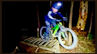
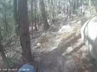
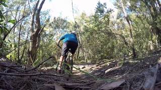
Rocky descents and roll overs down and then up from the creek.

Refer to Westleigh mountain bike Facebook page for trail closures and changes.

Access Info

Park at Ruddock Park, enter via Warigal Drive

Traditionally Indigenous Territory

Recent Activity on Trail

Past Week
  • 1 rides
  • 7 miles average
6 Months
  • 68 rides
  • 9 miles avg distance
All
  • 785 rides
  • Last: Jul 5, 2026
c1c2c3c4
January
February
March
April
May
June
July
August
September
October
November
December
Status:
on Jun 22, 2026
Ideal
Avg: 4.31 (16 votes)
Your vote: 0

view (10,930)
close
3D
Trail Conditions
  • Unknown
  • Snow Groomed
  • Snow Packed
  • Snow Covered
  • Snow Cover Partial
  • Freeze/thaw Cycle
  • Icy
  • Prevalent Mud
  • Wet
  • Variable
  • Ideal
  • Dry
  • Very Dry
Trail Flow (Ridden Direction)
Trailforks scans users ridelogs to determine the most popular direction each trail is ridden. A good flowing trail network will have most trails flowing in a single direction according to their intension.
The colour categories are based on what percentage of riders are riding a trail in its intended direction.
  • > 96%
  • > 90%
  • > 80%
  • > 70%
  • > 50%
  • < 50%
  • bi-directional trail
  • no data
Trail Last Ridden
Trailforks scans ridelogs to determine the last time a trail was ridden.
  • < 2 days
  • < 1 week
  • < 2 weeks
  • < 1 month
  • < 6 months
  • > 6 months
Trail Ridden Direction
The intended direction a trail should be ridden.
  • Downhill Only
  • Downhill Primary
  • Both Directions
  • Uphill Primary
  • Uphill Only
  • One Direction
Contribute Details
Colors indicate trail is missing specified detail.
  • Description
  • Photos
  • Description & Photos
  • Videos
Trail Popularity ?
Trailforks scans ridelogs to determine which trails are ridden the most in the last 9 months. Trails are compared with nearby trails in the same city region with a possible 25 colour shades. Think of this as a heatmap, more rides = more kinetic energy = warmer colors.
  • most popular
  • popular
  • less popular
  • not popular
ATV/ORV/OHV Filter
Max Vehicle Width
inches
US Cell Coverage
Legend
cell carrier legend

Radar Time
Activity Recordings
Trailforks uses anonymized public activity data. ?
Activity Recordings
Trailforks uses anonymized public activity data. ?
Personal Heatmap
Activity Types
all / none
Options
2
Date range month
Winter Trails
Warning A routing network for winter maps does not exist. Selecting trails using the winter trails layer has been disabled.
Missing Trails
Most Popular
Least Popular
Trails are colored based on popularity. The more popular a trail is, the more red. Less popular trails trend towards green.
Jump Magnitude Heatmap
Heatmap of where riders jump on trails. Zoom in to see individual jumps, click circles to view jump details.
BC Backroad Status

Service Road Atlas is a free to use, community-driven service for viewing and creating reports on the numerous back-country service roads around B.C. and Alberta.

map legend
Slope Aspect
Direction the slope faces
Flat N NE E SE S SW W NW
Trails Deemphasized
Trails are shown in grey.
disable
Only show trails with no bike usage.
Enable
Suggested Layers
Based on selected activity type

    Save the current map location and zoom level as your default home location whenever this page is loaded.

    Save
        Directions to h2o-black-loop trailhead (-33.712530, 151.076810)

        Photos

        29 more »
        84 |
        Nov 24, 2025 @ 11:04am
        Nov 24, 2025
        45 |
        Nov 24, 2025 @ 11:04am
        Nov 24, 2025
        63 |
        Nov 24, 2025 @ 11:04am
        Nov 24, 2025
        53 |
        Nov 24, 2025 @ 11:04am
        Nov 24, 2025

        Videos

        4 more »
        H2O Westleigh - Mountain bike park
        3:22 | 727 | Feb 25, 2021 , Hornsby
        2020 H20 Westleigh Mountain Bike Night Ride MTB
        3:37 | 793 | May 23, 2020 , Hornsby
        Westleigh Ride Highlights
        2:22 | 1252 | Apr 30, 2019 , Hornsby
        A Not So Secret Trail in Sydney
        0:03 | 1806 | Jan 20, 2018 , Hornsby

        Routes with this trail

        3.0 4 miles 385 ft 17 Loop
        Joining the existing routes into one continuous loop
        2.0 4 miles 389 ft 5 Loop
        H2o continuous loop no black section as it was reversed on map

        2 Reviews & Comments


        We hope you've been enjoying Trailforks!

        Create a FREE account to view trail comments and much more.

        • By nandayoTF Pro & contributors
        • #66212 - 5,008 views

        Frequently Asked Questions About H2O - Black Loop

        Where is H2O - Black Loop located?
        H2O - Black Loop is located in Westleigh, Hornsby, Australia. It is part of the Westleigh trail network. The trailhead is located at coordinates -33.71253, 151.07681.
        How hard is H2O - Black Loop?
        H2O - Black Loop is rated as Black Diamond difficulty. The physical rating is Moderate. The average grade is 0.3%. The climb difficulty is rated Blue.
        What is the elevation gain for H2O - Black Loop?
        H2O - Black Loop has 204 ft of elevation gain. The trail has 228 ft of elevation descent. The elevation ranges from 508 ft to 640 ft.
        Is H2O - Black Loop a point to point trail?
        H2O - Black Loop is not a point to point trail. The direction is Downhill Primary. The trail type is singletrack.

        Hit the Trail

        Open in App

        Get this trail on your phone instantly.
        open trail in app

        Download Trail

        Save to wishlist, Garmin & download.
        save the trail

        Find Related Routes

        Find routes and users activities that include this trail.
        find routes for this trail

        You must enter a description before submitting.