more stats
3.3 miles
Distance
195 ft
Climb
-173 ft
Descent
00:24:44
Avg time
20 ft
Altitude change
2,982 ft
Altitude min
3,016 ft
Altitude max
2,989 ft
Altitude start
3,009 ft
Altitude end
0.1%
Grade
-17.2%
Grade max
11.9%
Grade min
1 mile
Distance climb
1 mile
Distance down
4,295 ft
Distance flat
00:24:44
Avg time

Hatchery Bay Details

  • Activities
    • Mountain Bike
    • Hike
    • Trail Running
  • Riding Area
  • AKA
    Hatchery Bay Trail
  • Difficulty Rating
  • Voted Difficulty
    Green (2 votes)
  • Local Popularity
    90 in Mountain Biking heatmap [+]
    • 90 in Trail Running
    • 5 in Hiking
  • Global Ranking
    #33966 in Mountain Biking [+]
    • #82018 in Trail Running
    • #206831 in Hiking
  • National Ranking
    #1,634 in Mountain Biking · Australia [+]
    • #2,925 in Trail Running
    • #6,218 in Hiking
  • Trail Type
    Singletrack
  • Direction
    Both Directions[+]
    • Both Directions for Trail Running
    • Both Directions for Hiking
  • Dogs Allowed
    Yes
  • Year Opened
    2016

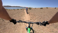
A great trail for all skill levels, winding it's way around the lake to Hatchery Bay. Passes through cattle grazing paddocks, so keep an eye out for the odd cow, and make sure you close the gates

Intermediate and advanced riders should look for the more technical a-lines that branch off from the main trail.

Access Info

The trail head closest to the township of Jindabyne starts at the boat ramp, however you can ride from town along the Jindabyne Community Trail (concrete path), through the caravan park to the trail head.

Tags
Lake

Trail Supporters

Local Trail Association

Traditionally Indigenous Territory

Recent Activity on Trail

Past Week
  • 3 rides
  • 35.0 km average
6 Months
  • 16 rides
  • 22.8 km avg distance
All
  • 257 rides
  • Last: Nov 16, 2026
c1c2c3c4
January
February
March
April
May
June
July
August
September
October
November
December
update trails status or condition

Hatchery Bay Trail Reports

Status:
on Oct 24, 2025
Ideal
Avg: 4.3 (7 votes)
Your vote: 0

view (2,433)
close
      Directions to hatchery-bay trailhead (-36.387540, 148.606720)

      Photos

      31 more »
      mtb
      63 |
      Mar 4, 2026 @ 12:22am
      Mar 4, 2026
      mtb
      196 |
      Dec 28, 2019 @ 5:39pm
      Dec 28, 2019
      mtb
      177 |
      Dec 28, 2019 @ 5:38pm
      Dec 28, 2019
      mtb
      173 |
      Feb 17, 2019 @ 12:22pm
      Feb 17, 2019

      Videos

      1 more »
      Near Miss
      mtb
      0:18 | 518 | Feb 15, 2019 , Jindabyne

      Routes with this trail

      more »
      28 miles • 1,624 ft • 5 •
      Thredbo to Jindabyne.;dfj;ms;dgjf;sjfjs;gj;sgs;
      26 miles • 1,646 ft • 6 •
      Ngarigo Campground to Jindabyne.
      4.6 ★★★★★
      7 Ratings
      5 ★ 71%
      4 ★ 14%
      3 ★ 14%
      2 ★
      1 ★

      3 Reviews & Comments

      BenH79 BenH79
      Excellent XC trail put together by the local MTB club by my understanding, good mix of terrain, fast flowing in sections. Excellent scenery and location through cattle grazing paddocks and lake Jindabyne is never far from view. Great trail for beginners to experts. An excellent example of doing a trail right, glad I took the time to ride it and would be great if there were more purpose built public trail like this around the country!

      We hope you've been enjoying Trailforks!

      Create a FREE account to view all trail reviews and much more.

      • By sgc7of7TF Pro JTS & contributors
      • #83661 - 16,648 views

      Frequently Asked Questions

      ▼ Where is Hatchery Bay located?
      Hatchery Bay is located in Jindabyne, Australia. It is part of the Jindabyne trail network. The trailhead is located at coordinates -36.38754, 148.60672.
      ▼ How hard is Hatchery Bay?
      Hatchery Bay is rated as Green difficulty. The average grade is 0.1%.
      ▼ What is the elevation gain for Hatchery Bay?
      Hatchery Bay has 195 ft of elevation gain. The trail has 173 ft of elevation descent. The elevation ranges from 2,982 ft to 3,016 ft.
      ▼ Is Hatchery Bay a point to point trail?
      Hatchery Bay is not a point to point trail. The direction is Both Directions. The trail type is singletrack.
      ▼ How long is Hatchery Bay?
      Hatchery Bay is 3.3 miles long. The trail type is singletrack.
      ▼ Are dogs allowed on Hatchery Bay?
      Yes, dogs are allowed on Hatchery Bay. Please keep dogs on a leash where required and clean up after them.
      ▼ When is the best time of year to ride Hatchery Bay?
      Based on activity log data, the most popular months to ride Hatchery Bay are:
      • January (25 activities)
      • April (19 activities)
      • November (16 activities)
      Check the reports page for current trail conditions.
      ▼ How do I access Hatchery Bay? Where is the closest parking trailhead?
      The closest parking and trailhead locations to Hatchery Bay are: View all parking locations in the area.
      ▼ How long does it take to ride Hatchery Bay?
      Based on recorded activities, it takes an average of 25 minutes to ride Hatchery Bay. The trail is 3.3 miles long. Actual times will vary based on fitness level, conditions, and pace. View recent activity logs for more details.
      ▼ How busy is Hatchery Bay?
      Hatchery Bay is a very popular trail. There have been 1,924 recorded activities on this trail. The trail has received 2,433 check-ins. View recent activity on this trail.

      Hit the Trail

      Open in App

      Get this trail on your phone instantly.

      open trail in app

      Download Trail

      Save to wishlist, Garmin & download.
      save the trail

      Find Related Routes

      Find routes and users activities that include this trail.
      find routes for this trail

      You must enter a description before submitting.