more stats
3.4 miles
Distance
391 ft
Climb
-398 ft
Descent
00:26:09
Avg time
-8 ft
Altitude change
6,711 ft
Altitude min
6,960 ft
Altitude max
6,719 ft
Altitude start
6,713 ft
Altitude end
-42.2%
Grade max
24.8%
Grade min
1 mile
Distance climb
1 mile
Distance down
3,143 ft
Distance flat
00:26:09
Avg time

Trail Details

  • Activities
    • Mountain Bike
    • Hike
    • Trail Running
  • Riding Area
    East Eagle
    Eagle, Colorado
  • Difficulty Rating
  • Voted Difficulty
    Green (2 votes)
  • Local Popularity
    90 in Mountain Biking [+]
    • 95 in Trail Running
    • 75 in Hiking
  • Global Ranking
    #48247 in Mountain Biking [+]
    • #19518 in Trail Running
    • #61717 in Hiking
  • Trail Type
    Singletrack
  • Direction
    Both Directions
  • Climb Difficulty
    Green
  • Physical Rating
    Moderate
  • Dogs Allowed
    Yes
  • eBike Allowed
  • Land Owner
    Bureau of Land Management

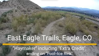
Haymaker starts at the base of some chalky hills near the local bmx race track and pool & ice rink. The trail heads east to the back side of the hills, then gradually climbs upwards. Once you reach the top, the trail descends quickly through some fun berms and rollers.

Trail is not directional but heavily used in counter clockwise direction.

Trail Supporters
Local Trail Association
Traditionally Indigenous Territory

Recent Activity on Trail

Past Week
  • 4 rides
  • 13 miles average
6 Months
  • 40 rides
  • 6 miles avg distance
All
  • 286 rides
  • Last: Jun 25, 2026
c1c2c3c4
January
February
March
April
May
June
July
August
September
October
November
December
update trails status or condition

Haymaker (1st &... Trail Reports

Status:
on Mar 14, 2026
Dry
Avg: 3.99 (7 votes)
Your vote: 0

view (3,124)
close
3D
Trail Conditions
  • Unknown
  • Snow Groomed
  • Snow Packed
  • Snow Covered
  • Snow Cover Partial
  • Freeze/thaw Cycle
  • Icy
  • Prevalent Mud
  • Wet
  • Variable
  • Ideal
  • Dry
  • Very Dry
Trail Flow (Ridden Direction)
Trailforks scans users ridelogs to determine the most popular direction each trail is ridden. A good flowing trail network will have most trails flowing in a single direction according to their intension.
The colour categories are based on what percentage of riders are riding a trail in its intended direction.
  • > 96%
  • > 90%
  • > 80%
  • > 70%
  • > 50%
  • < 50%
  • bi-directional trail
  • no data
Trail Last Ridden
Trailforks scans ridelogs to determine the last time a trail was ridden.
  • < 2 days
  • < 1 week
  • < 2 weeks
  • < 1 month
  • < 6 months
  • > 6 months
Trail Ridden Direction
The intended direction a trail should be ridden.
  • Downhill Only
  • Downhill Primary
  • Both Directions
  • Uphill Primary
  • Uphill Only
  • One Direction
Contribute Details
Colors indicate trail is missing specified detail.
  • Description
  • Photos
  • Description & Photos
  • Videos
Trail Popularity ?
Trailforks scans ridelogs to determine which trails are ridden the most in the last 9 months. Trails are compared with nearby trails in the same city region with a possible 25 colour shades. Think of this as a heatmap, more rides = more kinetic energy = warmer colors.
  • most popular
  • popular
  • less popular
  • not popular
ATV/ORV/OHV Filter
Max Vehicle Width
inches
US Cell Coverage
Legend
cell carrier legend

Radar Time
Activity Recordings
Trailforks uses anonymized public activity data. ?
Activity Recordings
Trailforks uses anonymized public activity data. ?
Personal Heatmap
Activity Types
all / none
Options
2
Date range month
Winter Trails
Warning A routing network for winter maps does not exist. Selecting trails using the winter trails layer has been disabled.
Missing Trails
Most Popular
Least Popular
Trails are colored based on popularity. The more popular a trail is, the more red. Less popular trails trend towards green.
Jump Magnitude Heatmap
Heatmap of where riders jump on trails. Zoom in to see individual jumps, click circles to view jump details.
BC Backroad Status

Service Road Atlas is a free to use, community-driven service for viewing and creating reports on the numerous back-country service roads around B.C. and Alberta.

map legend
Slope Aspect
Direction the slope faces
Flat N NE E SE S SW W NW
Trails Deemphasized
Trails are shown in grey.
disable
Only show trails with no bike usage.
Enable
Suggested Layers
Based on selected activity type

    Save the current map location and zoom level as your default home location whenever this page is loaded.

    Save
        Directions to haymaker-1st--2nd-loops trailhead (39.643050, -106.813710)

        Photos

        61 more »
        25 |
        Aug 11, 2025 @ 10:00am
        Aug 11, 2025
        29 |
        Aug 11, 2025 @ 10:00am
        Aug 11, 2025
        21 |
        Aug 11, 2025 @ 10:00am
        Aug 11, 2025
        24 |
        Aug 11, 2025 @ 9:59am
        Aug 11, 2025

        Videos

        4 more »
        East Eagle MTB trails - 'Haymaker', including...
        35:57 | 61 | Aug 11, 2025 , Eagle
        youtuber Pool Ice Rink and Haymaker
        9:38 | 190 | Sep 11, 2022 , Eagle
        Haymaker Lights
        0:17 | 101 | Oct 15, 2017 , Eagle
        Haymaker
        0:05 | 173 | Oct 15, 2017 , Eagle

        Routes with this trail

        12 miles 1,531 ft 5 Loop
        This moderate loop is a great way to explore three recent, new trails in the East Eagle Area. They are...
        4.0 8 miles 1,298 ft 4 Point to Point
        Up to the steep and challenging and back out Haymaker. Great Ride, variety of terrain.
        15 miles 2,368 ft 12 Loop Race
        FunDuro (definition): To partake in a fun, friendly, and competitive community bike race all while raising...

        2 Reviews & Comments


        We hope you've been enjoying Trailforks!

        Create a FREE account to view trail comments and much more.

        • By toddTF Pro Trailforks & contributors
        • #19677 - 6,973 views

        Frequently Asked Questions About Haymaker (1st & 2nd Loops)

        Where is Haymaker (1st & 2nd Loops) located?
        Haymaker (1st & 2nd Loops) is located in East Eagle, Eagle, Colorado, United States. It is part of the East Eagle trail network. The trailhead is located at coordinates 39.64305, -106.81371.
        How hard is Haymaker (1st & 2nd Loops)?
        Haymaker (1st & 2nd Loops) is rated as Blue difficulty. The physical rating is Moderate. The climb difficulty is rated Green.
        What is the elevation gain for Haymaker (1st & 2nd Loops)?
        Haymaker (1st & 2nd Loops) has 391 ft of elevation gain. The trail has 398 ft of elevation descent. The elevation ranges from 6,711 ft to 6,960 ft.
        Is Haymaker (1st & 2nd Loops) a point to point trail?
        Haymaker (1st & 2nd Loops) is not a point to point trail. The direction is Both Directions. The trail type is singletrack.

        Hit the Trail

        Open in App

        Get this trail on your phone instantly.
        open trail in app

        Download Trail

        Save to wishlist, Garmin & download.
        save the trail

        Find Related Routes

        Find routes and users activities that include this trail.
        find routes for this trail

        You must enter a description before submitting.