more stats
1,312 ft
Distance
-217 ft
Descent
00:02:41
Avg time
-217 ft
Altitude change
733 ft
Altitude min
949 ft
Altitude max
949 ft
Altitude start
732 ft
Altitude end
-16.5%
Grade
-64.6%
Grade max
3.5%
Grade min
72 ft
Distance climb
1,145 ft
Distance down
95 ft
Distance flat
00:02:41
Avg time

Hobo mid Details

  • Activities
    • Mountain Bike
    • E-Bike
    • Winter Fat Bike
  • Riding Area
    Balquhidder
    Strathyre
  • Difficulty Rating
  • Local Popularity
    70 in Mountain Biking [+]
    • 85 in E-Biking
    • 5 in Winter Fat Biking
  • Global Ranking
    #46113 in Mountain Biking [+]
    • #17910 in E-Biking
    • #4117 in Winter Fat Biking
  • National Ranking
    #1,307 in Mountain Biking · United Kingdom [+]
    • #941 in E-Biking
    • #105 in Winter Fat Biking
  • Trail Type
    Singletrack
  • Bike Type
    AM, XC, Fat
  • Climb Difficulty
    Blue
  • Physical Rating
    Moderate
  • Trail Visibility
    Always easy to follow
  • Season
    Jan-Dec
  • Dogs Allowed
    Yes
  • eBike Allowed
    Yes up to Class 1
  • TTFs on Trail
    Berm, Bridge, Drop, Jump
  • Ride in Rain
    Yes
  • Year Opened
    2015
  • Land Owner
    Forestry And Land Scotland

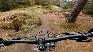
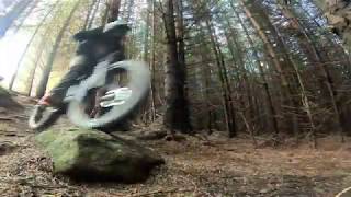
The "Hobo - Mid" is a natural flowy trail that is loamy and rooty underwheel with a few rock drops. It starts with a drop into the "tunnel" (just a dark section through some dense conifers), and after a short rocky section then offers a host of berms and drops through the woods. A fun easy red, the trail then finishes at a forestry road where you have three options:- LEFT to climb back into Kirkton Glen. RIGHT to exit to the road back to the village or STRAIGHT ON down a single track (with a fence to cross) that also takes you back to the village. Fast and flowy, this works well in dry or wet.

Access Info

Park at Balquhidder Hall or Balquhidder Kirk and access via forestry roads and the "Lost Trail" (which is no longer a single track since the forestry built a rod on its line)

Tags

Trail Supporters

Local Trail Association

Recent Activity on Trail

Past Week
  • 0 rides
  •  
6 Months
  • 7 rides
  • 10 miles avg distance
All
  • 43 rides
  • Last: Oct 7, 2026
c1c2c3c4
January
February
March
April
May
June
July
August
September
October
November
December
update trails status or condition

Hobo mid Trail Reports

statusdatedescription
Feb 15, 2025 @ 4:51am
Feb 15, 2025
all clear after storm
Jan 19, 2025 @ 6:07am
Jan 19, 2025
2 fallen trees overhanging trail. The second you ride under. The first you’d need to duck / dismount / be a tiny child.
Dec 27, 2024 @ 10:16am
Dec 27, 2024
Running well. There is a new fallen and low hanging tree accross the trail. You can ride under it no problem at present.
Dec 11, 2024 @ 1:56pm
Dec 11, 2024
Frozen solid dirt.
Nov 3, 2024 @ 8:07am
Nov 3, 2024
Running really well.
more »
Status:
on Feb 15, 2025
Variable
Avg: 4.53 (7 votes)
Your vote: 0

view (655)
close
      Directions to hobo-mid-101201 trailhead (56.361840, -4.382070)

      Photos

      3 more »
      mtb
      61 |
      Feb 5, 2021 @ 5:45am
      Feb 5, 2021
      mtb
      68 |
      Feb 5, 2021 @ 5:45am
      Feb 5, 2021
      mtb
      58 |
      Feb 5, 2021 @ 5:45am
      Feb 5, 2021

      Videos

      4 more »
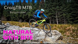
      youtuber Balquhidder mtb, quality trails!
      mtb
      7:11 | 417 | Oct 24, 2021 , Strathyre
      NATURAL MTB TRAILS - Balquhidder
      mtb
      6:55 | 148 | Oct 18, 2020 , Strathyre
      Balquhidder MTB Trails - The HOBO Singletrack
      mtb
      0:12 | 360 | Sep 11, 2020 , Strathyre
      Balquhidder MTB Trails - The HOBO Singletrack
      mtb
      330 | May 17, 2020 , Strathyre
      5.0 ★★★★★
      7 Ratings
      5 ★ 100%
      4 ★
      3 ★
      2 ★
      1 ★

      1 Review & Comments

      aag87 aag87
      Cleared fallen tree at the bottom 25/08

      We hope you've been enjoying Trailforks!

      Create a FREE account to view all trail reviews and much more.

      • By gav-sTF Pro & contributors
      • #101201 - 1,760 views

      Frequently Asked Questions

      ▼ Where is Hobo mid located?
      Hobo mid is located in Balquhidder, Strathyre, United Kingdom. It is part of the Balquhidder trail network. The trailhead is located at coordinates 56.36184, -4.38207.
      ▼ How hard is Hobo mid?
      Hobo mid is rated as Red difficulty. The physical rating is Moderate. The average grade is 16.5%. The climb difficulty is rated Blue.
      ▼ What is the elevation gain for Hobo mid?
      The trail has 217 ft of elevation descent. The elevation ranges from 733 ft to 949 ft.
      ▼ How long is Hobo mid?
      Hobo mid is 1,312 ft long. The trail type is singletrack.
      ▼ Are dogs allowed on Hobo mid?
      Yes, dogs are allowed on Hobo mid. Please keep dogs on a leash where required and clean up after them.
      ▼ When is the best time of year to ride Hobo mid?
      Hobo mid is best visited during: Jan-Dec.
      ▼ How do I access Hobo mid? Where is the closest parking trailhead?
      The closest parking and trailhead locations to Hobo mid are: View all parking locations in the area.
      ▼ How long does it take to ride Hobo mid?
      Based on recorded activities, it takes an average of 3 minutes to ride Hobo mid. The trail is 1,312 ft long. Actual times will vary based on fitness level, conditions, and pace. View recent activity logs for more details.
      ▼ How busy is Hobo mid?
      Hobo mid is a very popular trail. There have been 473 recorded activities on this trail. The trail has received 655 check-ins. View recent activity on this trail.

      Hit the Trail

      Open in App

      Get this trail on your phone instantly.

      open trail in app

      Download Trail

      Save to wishlist, Garmin & download.
      save the trail

      Find Related Routes

      Find routes and users activities that include this trail.
      find routes for this trail

      You must enter a description before submitting.