more stats
2,693 ft
Distance
82 ft
Climb
-240 ft
Descent
00:11:01
Avg time
-157 ft
Altitude change
527 ft
Altitude min
714 ft
Altitude max
684 ft
Altitude start
527 ft
Altitude end
-5.843%
Grade
-28.061%
Grade max
20.059%
Grade min
1,109 ft
Distance climb
1,516 ft
Distance down
68 ft
Distance flat
00:11:01
Avg time

Horse Drop Details

  • Activities
    • Mountain Bike
    • E-Bike
    • Hike
    • Trail Running
  • Riding Area
    Will Rogers State Park
    Santa Monica, California
  • AKA
    Old Ranch Road Shortcut
  • Difficulty Rating
  • Voted Difficulty
    Blue (1 vote)
  • Local Popularity
    5 in Mountain Biking heatmap [+]
    • 5 in E-Biking
    • 5 in Trail Running
    • 5 in Hiking
  • Global Ranking
    #138290 in Mountain Biking [+]
    • #128795 in E-Biking
    • #216871 in Trail Running
    • #207733 in Hiking
  • State Ranking
    #5,249 in Mountain Biking · California [+]
    • #2,842 in E-Biking
    • #11,380 in Trail Running
    • #11,658 in Hiking
  • Trail Type
    Singletrack
  • Bike Type
    AM, XC
  • Direction
    Both Directions
    Popular Direction Shown
  • eBike Allowed
  • TTFs on Trail
    Berm

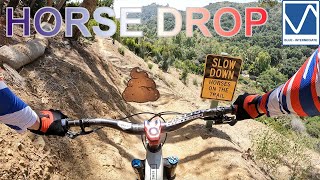
Super fun connector trail, but has been damaged by the rain in the winter of 16/17, leading to a lot of rain gullies, both skinny and wide, shallow and deep. The trail begs for you to ride it fast, but be cautious if it's your first time and always beware there could be hikers and horses coming up.

Disclaimer

Multi use trail including horses. Ride cautiously on weekends.

Tags
BermsSkinnies

Local Trail Association

Traditionally Indigenous Territory

Recent Activity on Trail

Past Week
  • 0 rides
  •  
6 Months
  • 0 rides
  •  
All
  • 167 rides
  • Last: May 31, 2025
update trails status or condition

Horse Drop Trail Reports

statusdatedescription
Feb 1, 2023 @ 6:14pm
Feb 1, 2023
The community on high horses have erected a gate that is locked. This blocks all traffic to Horse Drop unless you have a key to the gate.
Dec 20, 2022 @ 9:07pm
Dec 20, 2022
No issues
Nov 27, 2022 @ 6:09am
Nov 27, 2022
Second half is very fun right now
Jul 6, 2022 @ 5:01am
Jul 6, 2022
No issues, fun trail
Apr 6, 2022 @ 4:55am
Apr 6, 2022
No issues, exit toward street has been updated and improved
more »
Status:
on Feb 1, 2023
Avg: 3.88 (3 votes)
Your vote: 0

view (1,920)
close
      Directions to horse-drop trailhead (34.073830, -118.507220)

      Photos

      4 more »
      mtb
      120 |
      Aug 6, 2017 @ 7:51pm
      Aug 6, 2017
      mtb
      126 |
      Aug 6, 2017 @ 7:51pm
      Aug 6, 2017
      report
      mtb
      110 |
      Feb 1, 2023 @ 6:18pm
      Feb 1, 2023
      report
      mtb
      128 |
      Jun 25, 2019 @ 5:52pm
      Jun 25, 2019

      Videos

      5 more »
      Horse Drop - Santa Monica Mountains
      mtb
      2:38 | 415 | May 24, 2022 , Santa Monica
      youtuber Horse Trail (almost) Wet
      mtb
      2:56 | 769 | May 11, 2018 , Santa Monica
      youtuber Old Ranch Road Shortcut
      mtb
      630 | Jan 6, 2017 , Santa Monica
      mtb
      0:54 | 147 | Dec 15, 2019 , Santa Monica

      Routes with this trail

      more »
      27 miles • 5,423 ft • 13 •
      Good route hitting some of the lesser known good enduro trails in the area
      8 miles • 1,007 ft • 7 • Shuttled •
      Fun Downhill, good for a sunday ride
      3.7 ★★★★★
      3 Ratings
      5 ★
      4 ★ 67%
      3 ★ 33%
      2 ★
      1 ★

      8 Reviews & Comments

      thomasjkenney1024 thomasjkenney1024
      Thirty years ago, this trail was NOT open to bikes, never has been. Folks started to ignore the no bikes signs everywhere at that time, and here we are. The poachers have royally pissed off the land owners. If you wanna know why, ask the person who led you to this trail in the first place.
      sircrashalot29
      Does anyone know if that gate is legally established? Rich a*sholes in LA have a long standing tradition of illegitimately erecting gates simply because they have the money to do so.

      “We” should look into this. Completely ruins the area as a destination.
      Danielmarsh117
      New giant gate blocks all access, say goodbye to a once great trail

      We hope you've been enjoying Trailforks!

      Create a FREE account to view all trail reviews and much more.

      • By ersz & contributors
      • #77276 - 2,448 views

      Frequently Asked Questions

      ▼ Where is Horse Drop located?
      Horse Drop is located in Will Rogers State Park, Santa Monica, California, United States. It is part of the Will Rogers State Park trail network. The trailhead is located at coordinates 34.07383, -118.50722.
      ▼ How hard is Horse Drop?
      Horse Drop is rated as Blue difficulty. The average grade is 5.843%.
      ▼ What is the elevation gain for Horse Drop?
      Horse Drop has 82 ft of elevation gain. The trail has 240 ft of elevation descent. The elevation ranges from 527 ft to 714 ft.
      ▼ Is Horse Drop a point to point trail?
      Horse Drop is not a point to point trail. The direction is Both Directions. The trail type is singletrack.
      ▼ How long is Horse Drop?
      Horse Drop is 2,693 ft long. The trail type is singletrack.
      ▼ Are dogs allowed on Horse Drop?
      There is no information about dogs being allowed on Horse Drop. Check with local trail managers or the trail page for the latest access rules.
      ▼ How do I access Horse Drop? Where is the closest parking trailhead?
      The closest parking and trailhead locations to Horse Drop are: View all parking locations in the area.
      ▼ How long does it take to ride Horse Drop?
      Based on recorded activities, it takes an average of 4 minutes to ride Horse Drop. The trail is 2,693 ft long. Actual times will vary based on fitness level, conditions, and pace. View recent activity logs for more details.
      ▼ How busy is Horse Drop?
      Horse Drop is a less popular trail with lighter traffic. There have been 1,869 recorded activities on this trail. The trail has received 1,920 check-ins. View recent activity on this trail.

      Hit the Trail

      Open in App

      Get this trail on your phone instantly.

      open trail in app

      Download Trail

      Save to wishlist, Garmin & download.
      save the trail

      Find Related Routes

      Find routes and users activities that include this trail.
      find routes for this trail

      You must enter a description before submitting.