more stats
2.8 miles
Distance
796 ft
Climb
-378 ft
Descent
00:17:42
Avg time
419 ft
Altitude change
2,217 ft
Altitude min
2,921 ft
Altitude max
2,502 ft
Altitude start
2,920 ft
Altitude end
2.8%
Grade
-51.8%
Grade max
33%
Grade min
2 miles
Distance climb
4,429 ft
Distance down
1,070 ft
Distance flat
00:17:42
Avg time

Howards Bypass Details

  • Activities
    • Dirtbike/Moto
    • Mountain Bike
    • E-Bike
    • Hike
    • Trail Running
  • Riding Area
    Pozo
    San Luis Obispo, California
  • Ref Number
    #15E05
  • Difficulty Rating
  • Local Popularity
    5 in Mountain Biking [+]
    • 5 in E-Biking
    • 5 in Trail Running
    • 5 in Hiking
    • 5 in Dirtbiking
  • Global Ranking
    #369887 in Mountain Biking [+]
    • #220738 in E-Biking
    • #408729 in Trail Running
    • #409960 in Hiking
    • #7849 in Dirtbiking
  • State Ranking
    #11,522 in Mountain Biking · California [+]
    • #3,892 in E-Biking
    • #15,297 in Trail Running
    • #15,383 in Hiking
    • #465 in Dirtbiking
  • Hiking SAC Scale
    T2 Mountain Hiking
  • Trail Type
    Singletrack
  • Direction
    Both Directions
  • Dogs Allowed
    Yes
  • eBike Allowed
    Yes up to Class 1

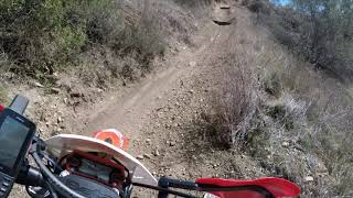
Rocky and steep in sections with a good amount of exposure. Lots of plastic water bars in the trail to keep the erosion at a minimum. Up and down with steep sections, and a lot of rutted out spots

Tags
Exposure

Local Trail Association

Traditionally Indigenous Territory

Recent Activity on Trail

Past Week
  • 0 rides
  •  
6 Months
  • 0 rides
  •  
All
  • 1 rides
  • Last: Dec 26, 2023
update trails status or condition

Howards Bypass Trail Reports

statusdatedescription
Jan 29, 2022 @ 9:24pm
Jan 29, 2022
Some ruts, but overall trail is in pretty good shape. It looks like it is being worked on currently. Concrete turf block is by the trail and...
more »
Status:
on Jan 29, 2022
no votes yet
Your vote: 0

view (13)
close
      Directions to howards-bypass trailhead (35.369430, -120.356360)

      Photos

      No photos have been added for Howards Bypass yet, add a photo.

      Videos

      1 more »
      Beta Xtrainer: Howard's Bypass Trail (Pozo)
      moto
      9:38 | 433 | Mar 15, 2021 , San Luis Obispo

      2 Reviews & Comments

      Hjeanor
      Took my dr650 and my buddies gs800 on this beast. Would not recommend unless you’re runnin a 450 or smaller. Highly technical. Glad i did it but never again with our barges lol
      BenKe3PY
      Fun technical terrain best ridden with an ebike. Still needed to hike about 5%

      Watch out as you transition to loose sand at the bottom of the OHV trail. After confidentiality navigating miles of rugged black trail I face planted the second I hit the loose sand

      We hope you've been enjoying Trailforks!

      Create a FREE account to view all trail reviews and much more.

      • By toddTF Pro Trailforks & contributors
      • #417079 - 762 views

      Frequently Asked Questions

      ▼ Where is Howards Bypass located?
      Howards Bypass is located in Pozo, San Luis Obispo, California, United States. It is part of the Pozo trail network. The trailhead is located at coordinates 35.36943, -120.35636.
      ▼ How hard is Howards Bypass?
      Howards Bypass is rated as Black Diamond difficulty. The average grade is 2.8%.
      ▼ What is the elevation gain for Howards Bypass?
      Howards Bypass has 796 ft of elevation gain. The trail has 378 ft of elevation descent. The elevation ranges from 2,217 ft to 2,921 ft.
      ▼ Is Howards Bypass a point to point trail?
      Howards Bypass is not a point to point trail. The direction is Both Directions. The trail type is singletrack.
      ▼ How long is Howards Bypass?
      Howards Bypass is 2.8 miles long. The trail type is singletrack.
      ▼ Are dogs allowed on Howards Bypass?
      Yes, dogs are allowed on Howards Bypass. Please keep dogs on a leash where required and clean up after them.
      ▼ How do I access Howards Bypass? Where is the closest parking trailhead?
      The closest parking and trailhead locations to Howards Bypass are: View all parking locations in the area.
      ▼ How long does it take to ride Howards Bypass?
      The estimated time to ride Howards Bypass is approximately 18 minutes. The trail is 2.8 miles long. Actual times will vary based on fitness level, conditions, and pace.
      ▼ How busy is Howards Bypass?
      Howards Bypass is a less popular trail with lighter traffic. There have been 12 recorded activities on this trail. The trail has received 13 check-ins. View recent activity on this trail.

      Hit the Trail

      Open in App

      Get this trail on your phone instantly.

      open trail in app

      Download Trail

      Save to wishlist, Garmin & download.
      save the trail

      Find Related Routes

      Find routes and users activities that include this trail.
      find routes for this trail

      You must enter a description before submitting.