
more stats
3.8 miles
Distance
5 ft
Climb
-1,311 ft
Descent
00:22:27
Avg time
-1,307 ft
Altitude change
6,844 ft
Altitude min
8,152 ft
Altitude max
8,151 ft
Altitude start
6,844 ft
Altitude end
-6.6%
Grade
-29%
Grade max
4.7%
Grade min
308 ft
Distance climb
3 miles
Distance down
1,703 ft
Distance flat
00:22:27
Avg time

Tokie Dokie Details

  • Activities
    • Mountain Bike
    • E-Bike
    • Winter Fat Bike
    • Hike
    • Trail Running
    • Snowshoe
    • Nordic Ski
  • Riding Area
    Ward Mountain
    Ely, Nevada
  • Difficulty Rating
  • Local Popularity
    85 in Mountain Biking heatmap [+]
    • 85 in E-Biking
    • 5 in Trail Running
    • 5 in Hiking
    • 5 in Snowshoeing
    • 5 in Nordic Skiing
    • 5 in Winter Fat Biking
  • Global Ranking
    #47550 in Mountain Biking [+]
    • #12018 in E-Biking
    • #215286 in Trail Running
    • #206489 in Hiking
    • #3927 in Snowshoeing
    • #16940 in Nordic Skiing
    • #2992 in Winter Fat Biking
  • State Ranking
    #230 in Mountain Biking · Nevada [+]
    • #68 in E-Biking
    • #1,178 in Trail Running
    • #1,087 in Hiking
    • #1 in Snowshoeing
    • #17 in Nordic Skiing
    • #5 in Winter Fat Biking
  • Trail Type
    Singletrack
  • Bike Type
    DH, AM, XC, DJ, Fat
  • Climb Difficulty
    Blue
  • Physical Rating
    Moderate
  • Trail Visibility
    Always easy to follow
  • Season
    Mar - Nov
  • Family Friendly
    Yes
  • Dogs Allowed
    Yes
  • eBike Allowed
    Yes up to Class 1
  • TTFs on Trail
    Bridge, Drop, Jump, Gap Jump, Skinny
  • Ride in Rain
    Yes

This is the main trail above Ice Plant Canyon. There are various options and side trails for riding this, including a shuttle from the top. The trail is mostly smooth downhill with some rocky areas, a few features, and optional jumps at the bottom end. The upper half is steeper than the lower. Traffic moves both directions, so be mindful of others.

Trail Supporters

Local Trail Association

Traditionally Indigenous Territory

Recent Activity on Trail

Past Week
  • 0 rides
  •  
6 Months
  • 12 rides
  • 24 miles avg distance
All
  • 104 rides
  • Last: Sep 7, 2026
c1c2c3c4
January
February
March
April
May
June
July
August
September
October
November
December
update trails status or condition

Tokie Dokie Trail Reports

statusdatedescription
Aug 10, 2024 @ 7:12pm
Aug 10, 2024
Apr 11, 2024 @ 6:15pm
Apr 11, 2024
Snow Covered Still
Apr 11, 2024 @ 6:13pm
Apr 11, 2024
Nov 15, 2023 @ 7:17pm
Nov 15, 2023
Good to ride but conditions could change fast.
Oct 17, 2023 @ 9:45pm
Oct 17, 2023
Great Conditions
more »
Status:
on Aug 10, 2024
Dry
Avg: 3.94 (13 votes)
Your vote: 0

view (850)
close
      Directions to tokie-dokie trailhead (39.189000, -114.923600)

      Photos

      11 more »
      mtb
      211 |
      Oct 15, 2023 @ 8:39pm
      Oct 15, 2023
      mtb
      135 |
      Jul 22, 2023 @ 12:43pm
      Jul 22, 2023
      mtb
      202 |
      May 5, 2022 @ 4:11pm
      May 5, 2022
      mtb
      247 |
      May 5, 2022 @ 4:11pm
      May 5, 2022

      Videos

      6 more »
      Tokee Dokee with Candice Campeau
      mtb
      12:55 | 217 | Oct 5, 2023 , Ely
      Pivot Switchblade vs. Tokee Dokee
      mtb
      18:39 | 244 | Oct 11, 2022 , Ely
      Fears, Tears and Beers 2022 all 6 stages uncut
      mtb
      43:56 | 368 | Jun 16, 2022 , Ely
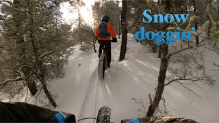
      Trail ride on fresh snow with Kent Robertson |...
      mtb
      19:24 | 179 | Mar 18, 2022 , Ely

      Routes with this trail

      more »
      480 miles • 31,281 ft • 8 • Point to Point •
      Nevada is a state of extremes. It has the least rainfall of any state, one of the smallest populations,...
      5 miles • 935 ft • 3 •
      The intersection at the beginning of Lower Total BS has been confusing for some riders.
      4 miles • 588 ft • 7 •
      A great variety of trails to showcase what the Ice Plant area has to offer. Takes 1 to 1 1/2 hours total...
      3.9 ★★★★★
      13 Ratings
      5 ★ 31%
      4 ★ 46%
      3 ★ 15%
      2 ★
      1 ★ 8%

      10 Reviews & Comments

      Etinlv
      Rode this trail for the first time today and...I love it. From the top i'd call it a solid blue - nothing crazy but definitely kept me on my toes. Its fast and fun. Nice and chunky up top to get the suspension bumping, some fun flowy turns in the middle, and then a speedway of a straight at the bottom (and some "jumps" but they were way above my pay grade and looked pretty sketchy to me...but I'm people send them).

      Great work to the builders, it was worth the drive from Vegas and I'll be back as soon as I can.

      Note on the shuttle road - my friends crossover made it to the parking symbol about 3/4th of the way, then there is a steep rocky hill. We stopped there, and glad we did. You definitely need high clearance after that, but it wasn't a horrible ride/push to the top. 20-30 mins and I was headed down with a smile pinned to my face.
      DirtbagMusubi DirtbagMusubi
      This is a pretty fun trail. Definitely the current gem of the system. Super loose up at the top. Worth stopping to ride if you need to break up the monotonous drive on hwy 50.
      zijlstra zijlstra
      Really fun trail as a downhill. I would ride one of the parallel trails for the uphill, since the have more switchbacks. Or shuttle via the road. Beginning section has a deep center groove from water running down it, but that disappears after 5 minutes. Definitely recommend riding this one!

      We hope you've been enjoying Trailforks!

      Create a FREE account to view all trail reviews and much more.

      • By natenbake & contributors
      • #4354 - 5,507 views

      Frequently Asked Questions

      ▼ Where is Tokie Dokie located?
      Tokie Dokie is located in Ward Mountain, Ely, Nevada, United States. It is part of the Ward Mountain trail network. The trailhead is located at coordinates 39.189, -114.9236.
      ▼ How hard is Tokie Dokie?
      Tokie Dokie is rated as Blue difficulty. The physical rating is Moderate. The average grade is 6.6%. The climb difficulty is rated Blue.
      ▼ What is the elevation gain for Tokie Dokie?
      Tokie Dokie has 5 ft of elevation gain. The trail has 1,311 ft of elevation descent. The elevation ranges from 6,844 ft to 8,152 ft.
      ▼ How long is Tokie Dokie?
      Tokie Dokie is 3.8 miles long. The trail type is singletrack.
      ▼ Are dogs allowed on Tokie Dokie?
      Yes, dogs are allowed on Tokie Dokie. Please keep dogs on a leash where required and clean up after them.
      ▼ When is the best time of year to ride Tokie Dokie?
      Tokie Dokie is best visited during: Mar - Nov.
      ▼ How do I access Tokie Dokie? Where is the closest parking trailhead?
      The closest parking and trailhead locations to Tokie Dokie are: View all parking locations in the area.
      ▼ How long does it take to ride Tokie Dokie?
      Based on recorded activities, it takes an average of 22 minutes to ride Tokie Dokie. The trail is 3.8 miles long. Actual times will vary based on fitness level, conditions, and pace. View recent activity logs for more details.
      ▼ How busy is Tokie Dokie?
      Tokie Dokie is a very popular trail. There have been 839 recorded activities on this trail. The trail has received 850 check-ins. View recent activity on this trail.

      Hit the Trail

      Open in App

      Get this trail on your phone instantly.

      open trail in app

      Download Trail

      Save to wishlist, Garmin & download.
      save the trail

      Find Related Routes

      Find routes and users activities that include this trail.
      find routes for this trail

      You must enter a description before submitting.