more stats
1,148 ft
Distance
-248 ft
Descent
00:01:48
Avg time
-248 ft
Altitude change
2,591 ft
Altitude min
2,838 ft
Altitude max
2,838 ft
Altitude start
2,592 ft
Altitude end
-21.6%
Grade
-58.3%
Grade max
0.4%
Grade min
978 ft
Distance down
171 ft
Distance flat
00:01:48
Avg time

Inducer Details

  • Activities
    • Mountain Bike
    • Hike
    • Trail Running
  • Riding Area
    Salmo Ski Hill Trails
    Salmo, British Columbia
  • Difficulty Rating
  • Local Popularity
    70 in Mountain Biking [+]
    • 5 in Trail Running
    • 5 in Hiking
  • Global Ranking
    #85327 in Mountain Biking [+]
    • #353382 in Trail Running
    • #338489 in Hiking
  • Provincial Ranking
    #4,239 in Mountain Biking · British Columbia [+]
    • #14,015 in Trail Running
    • #13,810 in Hiking
  • Trail Type
    Singletrack
  • Bike Type
    AM
  • Direction
    Downhill Primary
    Popular Direction Shown
  • Physical Rating
    Moderate
  • Season
    Apr-Nov
  • Dogs Allowed
    Yes
  • TTFs on Trail
    Bridge, Drop
  • Ride in Rain
    Yes

Middle Inducer is fast with great pump and flow and one tricky 's' near the end. The easiest section of Inducer. Can be linked to lower Inducer or High Water and ridden from the top or accessed midway along Sunrise.

Access Info

Access from upper Inducer or by riding up the main ski hill access road from the junction of Sunset and Sunrise or drop down an old access road on the far side of where Sunrise crosses the ski run midway.

Tags
BridgesDrops
Local Trail Association

Recent Activity on Trail

Past Week
  • 0 rides
  •  
6 Months
  • 43 rides
  • 9 miles avg distance
All
  • 153 rides
  • Last: Oct 4, 2026
c1c2c3c4
January
February
March
April
May
June
July
August
September
October
November
December
update trails status or condition

Inducer Trail Reports

statusdatedescription
May 31, 2026 @ 12:45pm (America/Vancouver)
May 31, 2026
All clear from the May 29 windstorm
Apr 26, 2026 @ 8:12pm (America/Vancouver)
Apr 26, 2026
reporter Open and good to go! New line at the bottom so heads up :)
Mar 22, 2026 @ 11:10am (America/Vancouver)
Mar 22, 2026
reporter Inducer was hit hard by December and January storms. We are working g to get cleared and safe and rideable but not open yet.
Mar 10, 2026 @ 12:59pm (America/Vancouver)
Mar 10, 2026
marked danger tree
Mar 10, 2026 @ 12:57pm (America/Vancouver)
Mar 10, 2026
tree
more »
Status:
on May 31, 2026
Avg: 3.99 (3 votes)
Your vote: 0

view (849)
close
      Directions to inducer trailhead (49.181970, -117.308640)

      Photos

      25 more »
      mtb
      74 |
      Sep 9, 2018 @ 12:52pm
      Sep 9, 2018
      mtb
      72 |
      Sep 9, 2018 @ 12:51pm
      Sep 9, 2018
      report
      mtb
      55 |
      Mar 10, 2026 @ 12:59pm
      Mar 10, 2026
      report
      mtb
      64 |
      Mar 10, 2026 @ 12:57pm
      Mar 10, 2026

      Videos

      2 more »
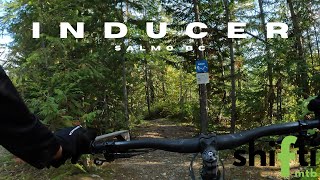
      Inducer.. Salmo BC..
      mtb
      8:09 | 259 | Sep 30, 2024 , Salmo
      youtuber Salmo's Best Kept Secret? // Salmo Ski Hill -...
      mtb
      8:55 | 411 | Mar 2, 2021 , Salmo

      Routes with this trail

      ★ 1.0 • 10 miles • 3,225 ft • 14 • Loop • Race •
      SALMO ENDURO COURSE STAGE 1 FULL INDUCER STAGE 2 DRIFTER STAGE 3 FULL TRUE BLUE TO SUNSET FINISH
      16 miles • 4,185 ft • 12 • Race •
      4.0 ★★★★★
      3 Ratings
      5 ★
      4 ★ 100%
      3 ★
      2 ★
      1 ★

      2 Reviews & Comments


      We hope you've been enjoying Trailforks!

      Create a FREE account to view all trail reviews and much more.

      • By elletabascoTF Pro SVTS WKRDAS & contributors
      • #61624 - 2,739 views

      Frequently Asked Questions

      ▼ Where is Inducer located?
      Inducer is located in Salmo Ski Hill Trails, Salmo, British Columbia, Canada. It is part of the Salmo Ski Hill Trails trail network. The trailhead is located at coordinates 49.18197, -117.30864.
      ▼ How hard is Inducer?
      Inducer is rated as Blue difficulty. The physical rating is Moderate. The average grade is 21.6%.
      ▼ What is the elevation gain for Inducer?
      The trail has 248 ft of elevation descent. The elevation ranges from 2,591 ft to 2,838 ft.
      ▼ Is Inducer a point to point trail?
      Inducer is not a point to point trail. The direction is Downhill Primary. The trail type is singletrack.
      ▼ How long is Inducer?
      Inducer is 1,148 ft long. The trail type is singletrack.
      ▼ Are dogs allowed on Inducer?
      Yes, dogs are allowed on Inducer. Please keep dogs on a leash where required and clean up after them.
      ▼ When is the best time of year to ride Inducer?
      Inducer is best visited during: Apr-Nov.
      ▼ How do I access Inducer? Where is the closest parking trailhead?
      The closest parking and trailhead locations to Inducer are: View all parking locations in the area.
      ▼ How long does it take to ride Inducer?
      Based on recorded activities, it takes an average of 2 minutes to ride Inducer. The trail is 1,148 ft long. Actual times will vary based on fitness level, conditions, and pace. View recent activity logs for more details.
      ▼ How busy is Inducer?
      Inducer is a very popular trail. There have been 827 recorded activities on this trail. The trail has received 849 check-ins. View recent activity on this trail.

      Hit the Trail

      Open in App

      Get this trail on your phone instantly.

      open trail in app

      Download Trail

      Save to wishlist, Garmin & download.
      save the trail

      Find Related Routes

      Find routes and users activities that include this trail.
      find routes for this trail

      You must enter a description before submitting.