


more stats
6.4 miles
Distance
25 ft
Climb
-1,179 ft
Descent
00:30:58
Avg time
-1,154 ft
Altitude change
1,702 ft
Altitude min
2,865 ft
Altitude max
2,865 ft
Altitude start
1,713 ft
Altitude end
-3.4%
Grade
-31.8%
Grade max
6.4%
Grade min
1,745 ft
Distance climb
6 miles
Distance down
341 ft
Distance flat
00:30:58
Avg time

Ingar Firetrail Details

  • Activities
    • Mountain Bike
    • E-Bike
    • Gravel Bike
    • Horse
    • Hike
    • Trail Running
  • Riding Area
  • Difficulty Rating
  • Local Popularity
    50 in Mountain Biking [+]
    • 60 in E-Biking
    • 5 in Trail Running
    • 5 in Hiking
    • 5 in Horseback
    • 5 in Gravel Biking
  • Hiking SAC Scale
    T1 Hiking
  • Trail Type
    Dirt/Gravel Road
  • Bike Type
    XC, Gravel
  • Climb Difficulty
    Blue
  • Physical Rating
    Moderate
  • Trail Visibility
    Always easy to follow
  • Season
    all year, except after heavy rains
  • Family Friendly
    Yes
  • eBike Allowed
    Yes up to Class 1
  • Ride in Rain
    Yes
  • Year Opened
    2023
  • Land Owner

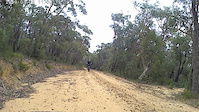
This is 10km of mainly downhill, easy to follow firetrail. The trail ends at a firefighting dam with picnic area and swimming hole. You can return the same way, or take the fork before the picnic area to continue on to Woodford (note this contains steep uphill), and then take the Oaks firetrail to Glenbrook if you are up for a full day. Or return to Wentworth Falls on the Andersons firetrail.

This area can get hot in summer. You need to be self sufficient - always carry appropriate water, first aid, spares etc. Don't ride in fire weather. The road can be corrugated, and watch out for sandy corners. Generally drains well after rain.

Access Info

You can reach this trail by train from Wentworth Falls train station, and then ride 5kms to the trail head at the end of Queen Elizabeth Drive. The start of the fire trail passes through private land and is now closed by a gate, however you can ride straight ahead from the road onto single track for a few hundred meters then peel left to rejoin the firetrail.

Tags
Family friendlySandySwimming spot
Local Trail Association
Traditionally Indigenous Territory

Recent Activity on Trail

Past Week
  • 0 rides
  •  
6 Months
  • 2 rides
  • 29 miles avg distance
All
  • 22 rides
  • Last: Oct 3, 2026
c1c2c3c4
January
February
March
April
May
June
July
August
September
October
November
December
update trails status or condition

Ingar Firetrail Trail Reports

statusdatedescription
Sep 5, 2026 @ 10:47am (Australia/Sydney)
Sep 4, 2026
Oct 7, 2024 @ 10:26am
Oct 7, 2024
All good.
Mar 24, 2024 @ 1:08pm
Mar 24, 2024
Nov 26, 2022 @ 5:01pm
Nov 26, 2022
Apr 8, 2021 @ 10:58pm
Apr 8, 2021
A couple of large trees down, just before bottom of the hill near the creek crossing. Otherwise trail was in great shape. Wide easy fire trail....
more »
Status:
on Sep 5, 2026
Very Dry
Avg: 3.76 (3 votes)
Your vote: 0

view (119)
close
      Directions to ingar-firetrail trailhead (-33.740110, 150.383510)

      Photos

      9 more »
      mtb
      47 |
      Dec 3, 2023 @ 11:17am
      Dec 3, 2023
      mtb
      170 |
      May 27, 2020 @ 11:22pm
      May 27, 2020
      mtb
      150 |
      May 27, 2020 @ 11:21pm
      May 27, 2020
      mtb
      145 |
      Oct 28, 2019 @ 4:22am
      Oct 28, 2019

      Videos

      1 more »
      Narrow Neck
      mtb
      0:20 | 39 | Aug 4, 2023 , Katoomba
      3.4 ★★★★★
      3 Ratings
      5 ★ 33%
      4 ★
      3 ★ 33%
      2 ★ 33%
      1 ★

      2 Reviews & Comments

      RomanMark RomanMark
      hidden treasure - trail leading to a secluded lake

      We hope you've been enjoying Trailforks!

      Create a FREE account to view all trail reviews and much more.

      • By chopstirTF Pro & contributors
      • #74636 - 5,224 views

      Frequently Asked Questions

      ▼ Where is Ingar Firetrail located?
      Ingar Firetrail is located in Blue Mountains National Park, Katoomba, Australia. It is part of the Blue Mountains National Park trail network. The trailhead is located at coordinates -33.74011, 150.38351.
      ▼ What is the elevation gain for Ingar Firetrail?
      Ingar Firetrail has 25 ft of elevation gain. The trail has 1,179 ft of elevation descent. The elevation ranges from 1,702 ft to 2,865 ft.
      ▼ How long is Ingar Firetrail?
      Ingar Firetrail is 6.4 miles long. The trail type is dirt/gravel road.
      ▼ Are dogs allowed on Ingar Firetrail?
      There is no information about dogs being allowed on Ingar Firetrail. Check with local trail managers or the trail page for the latest access rules.
      ▼ When is the best time of year to ride Ingar Firetrail?
      Ingar Firetrail is best visited during: all year, except after heavy rains.
      ▼ How do I access Ingar Firetrail? Where is the closest parking trailhead?
      The closest parking and trailhead locations to Ingar Firetrail are: View all parking locations in the area.
      ▼ How long does it take to ride Ingar Firetrail?
      Based on recorded activities, it takes an average of 31 minutes to ride Ingar Firetrail. The trail is 6.4 miles long. Actual times will vary based on fitness level, conditions, and pace. View recent activity logs for more details.
      ▼ How busy is Ingar Firetrail?
      Ingar Firetrail is a moderately popular trail. There have been 114 recorded activities on this trail. The trail has received 119 check-ins. View recent activity on this trail.

      Hit the Trail

      Open in App

      Get this trail on your phone instantly.

      open trail in app

      Download Trail

      Save to wishlist, Garmin & download.
      save the trail

      Find Related Routes

      Find routes and users activities that include this trail.
      find routes for this trail

      You must enter a description before submitting.


