more stats
3,442 ft
Distance
-707 ft
Descent
00:08:31
Avg time
-708 ft
Altitude change
2,148 ft
Altitude min
2,857 ft
Altitude max
2,857 ft
Altitude start
2,149 ft
Altitude end
-20.6%
Grade
-68.6%
Grade max
-1.1%
Grade min
3,442 ft
Distance down
00:08:31
Avg time

Invictus Details

  • Activities
    • Mountain Bike
  • Riding Area
    Raging River State Forest
    Snoqualmie, Washington
  • Difficulty Rating
  • Voted Difficulty
    Double Black Diamond (1 vote)
  • Local Popularity
    55 in Mountain Biking
  • Global Ranking
    #61435 in Mountain Biking
  • Trail Type
    Singletrack
  • Bike Type
    DH, AM, XC
  • Direction
    Downhill Only
    Popular Direction Shown
  • Physical Rating
    Moderate
  • Dogs Allowed
    Yes
  • eBike Allowed
  • Year Opened
    2017
  • Land Owner
    Department of Natural Resources

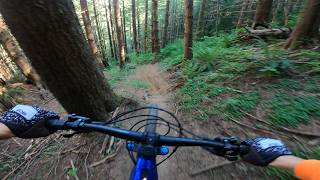
Fun, steep, rough. Remind yourself that you are waaaaay out in the sticks before descending. No fall zone This is an expert only trail.

Disclaimer

Take Caution. You are far out in a no-cell phone coverage area!

Local Trail Association
Traditionally Indigenous Territory

Recent Activity on Trail

Past Week
  • 0 rides
  •  
6 Months
  • 25 rides
  • 21 miles avg distance
All
  • 198 rides
  • Last: Sep 12, 2026
update trails status or condition

Invictus Trail Reports

statusdatedescription
Aug 26, 2026 @ 10:11pm (America/Los_Angeles)
Aug 26, 2026
Some overgrowth on the lower half blocking sight lines but it’s passable.
Apr 27, 2026 @ 10:30am (America/Los_Angeles)
Apr 27, 2026
Large tree near bottom still there. Definitely some debris on trail and not in quite as good shape as the more trafficked (ccdh, pt, etc) trails...
Apr 5, 2026 @ 5:47pm (America/Los_Angeles)
Apr 5, 2026
Large tree across bottom of trail, big hand saw would do. best accessed hiking up from bottom. trail good to go other than general debris
Feb 7, 2026 @ 6:45pm (America/Los_Angeles)
Feb 7, 2026
Large tree down across trail, blocking trail. Near the bottom in the last couple steep sections.
May 25, 2025 @ 8:08am
May 25, 2025
Upper part runs well. Lower part is raw and washed out with loose rocks. Couldn’t ride several sections which I was able to ride before.
more »
Status:
on Aug 26, 2026
Dry
Avg: 4.24 (23 votes)
Your vote: 0

view (1,364)
close
      Directions to invictus trailhead (47.445850, -121.811520)

      Photos

      29 more »
      mtb
      1,207 |
      Jun 7, 2018 @ 2:30pm
      Jun 7, 2018
      mtb
      2,031 |
      Jun 7, 2018 @ 2:31pm
      Jun 7, 2018
      mtb
      1,105 |
      May 10, 2020 @ 9:43pm
      May 10, 2020
      mtb
      919 |
      Jun 22, 2018 @ 7:29pm
      Jun 22, 2018

      Videos

      8 more »
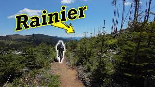
      youtuber My first run on the hardest (legal) trail in...
      mtb
      2:55 | 4119 | Jun 12, 2018 , Snoqualmie
      youtuber Raging River Guide || A Destination Trail System!
      mtb
      32:19 | 99 | Nov 11, 2024 , Snoqualmie
      Double Black Diamond Trail “Invictus” //...
      mtb
      3:13 | 399 | Aug 5, 2024 , Snoqualmie
      Invictus at Raging River
      mtb
      10:18 | 558 | Nov 19, 2023 , Snoqualmie

      Routes with this trail

      42 miles 9,538 ft 18
      I just want to ride all of raging on the map. Want to share with my friends and couldn't figure it out...
      20 miles 4,356 ft 54
      Hit all of the hardest sections of Raging River in one ride.
      18 miles 2,425 ft 10
      A way to see Invictus/no service with minimal climbing but still distance. This is a stupid route if you...
      4.3
      23 Ratings
      5 70%
      4 4%
      3 17%
      2 4%
      1 4%

      7 Reviews & Comments

      pinspanner pinspanner
      There are more awkward moves on Invictus than Predator and the trail is more technically challenging but it’s shorter, slower, and less physical.
      Rode it in the rain this weekend and really enjoyed it. Classic BC-style tech - less smashy and more panache-y. Great work Evergreen.
      kastanridesbikes
      My last comment should have had emojis not question marks haha lmao
      kastanridesbikes
      Please don't skid ???? It's a very steep trail, with steep rock drops on rowdy roots. So come prepared and ride hard ????

      We hope you've been enjoying Trailforks!

      Create a FREE account to view all trail reviews and much more.

      • By jalm111TF Pro & contributors
      • #102422 - 12,081 views

      Frequently Asked Questions

      Where is Invictus located?
      Invictus is located in Raging River State Forest, Snoqualmie, Washington, United States. It is part of the Raging River State Forest trail network. The trailhead is located at coordinates 47.44585, -121.81152.
      How hard is Invictus?
      Invictus is rated as Double Black Diamond difficulty. The physical rating is Moderate. The average grade is 20.6%.
      What is the elevation gain for Invictus?
      The trail has 707 ft of elevation descent. The elevation ranges from 2,148 ft to 2,857 ft.
      Is Invictus a point to point trail?
      Yes, Invictus is a point to point trail. The direction is Downhill Only. The trail type is singletrack.
      How long is Invictus?
      Invictus is 3,442 ft long. The trail type is singletrack.
      Are dogs allowed on Invictus?
      Yes, dogs are allowed on Invictus. Please keep dogs on a leash where required and clean up after them.
      How do I access Invictus? Where is the closest parking trailhead?
      The closest parking and trailhead locations to Invictus are: View all parking locations in the area.
      How long does it take to ride Invictus?
      Based on recorded activities, it takes an average of 8 minutes to ride Invictus. The trail is 3,442 ft long. Actual times will vary based on fitness level, conditions, and pace. View recent activity logs for more details.
      How busy is Invictus?
      Invictus is a moderately popular trail. There have been 1,413 recorded activities on this trail. The trail has received 1,364 check-ins. View recent activity on this trail.

      Hit the Trail

      Open in App

      Get this trail on your phone instantly.

      open trail in app

      Download Trail

      Save to wishlist, Garmin & download.
      save the trail

      Find Related Routes

      Find routes and users activities that include this trail.
      find routes for this trail

      You must enter a description before submitting.