more stats
2,657 ft
Distance
-467 ft
Descent
00:13:52
Avg time
-467 ft
Altitude change
521 ft
Altitude min
988 ft
Altitude max
988 ft
Altitude start
522 ft
Altitude end
-17.5%
Grade
-40.7%
Grade max
2,592 ft
Distance down
66 ft
Distance flat
00:13:52
Avg time

Jalec Details

  • Activities
    • Mountain Bike
    • E-Bike
  • Riding Area
  • Difficulty Rating
  • Local Popularity
    15 in Mountain Biking [+]
    • 25 in E-Biking
  • Global Ranking
    #61174 in Mountain Biking [+]
    • #99804 in E-Biking
  • Trail Type
    Singletrack
  • Bike Type
    DH, AM, XC
  • Direction
    Downhill Only
    Popular Direction Shown
  • Dogs Allowed
    Yes
  • eBike Allowed
  • TTFs on Trail
    Drop, Rock Garden, Skinny
  • Year Opened
    2021

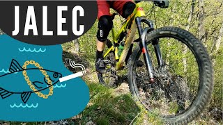
Natural enduro trail. V hornej časti zopár technicky náročnejších skalných zrázov a dropov. Niektoré majú aj obchádzku. Dolná polovica je v pohode - členitý lesný terén, iba po hline.

Access Info

Prístup je asfaltkou z Jalšového na Jalšovské chaty a odtiaľ k trailu asi 650 m žltou turistickou značkou smerom k Ovčej skale. Končí blízko Rybárskej chaty, 60 m od asfaltky Koplotovce -Jalšové.

Recent Activity on Trail

Past Week
  • 0 rides
  •  
6 Months
  • 0 rides
  •  
All
  • 2 rides
  • Last: Nov 7, 2025
c1c2c3c4
January
February
March
April
May
June
July
August
September
October
November
December
update trails status or condition

Jalec Trail Reports

statusdatedescription
Sep 5, 2025 @ 7:39pm
Sep 5, 2025
May 2, 2024 @ 10:26am
May 2, 2024
Dlho nebol report. Všetko čisté, prejazdné, ale miestami trochu zarastené/úzke :)
Oct 27, 2022 @ 7:01am
Oct 27, 2022
Trail je vyhrabaný, vyčistený od padnutých stromov. Povrch nemože byť už ani lepší. Bež to tam skontrolovať!
Oct 23, 2022 @ 10:03pm
Oct 23, 2022
v strede trate padnuty strom, treba preskakovat. Celkom vela listov.
Sep 24, 2022 @ 5:50am
Sep 24, 2022
Trail vyčisteny, povrch trocha suchy ale celkom v tope. Treba si dat na prechode v strede trate medzi "traverzom" a "flowtrailom" pozor, bolo to...
more »
Status:
on Sep 5, 2025
Ideal
Avg: 3.99 (2 votes)
Your vote: 0

view (75)
close
3D
Trail Conditions
  • Unknown
  • Snow Groomed
  • Snow Packed
  • Snow Covered
  • Snow Cover Partial
  • Freeze/thaw Cycle
  • Icy
  • Prevalent Mud
  • Wet
  • Variable
  • Ideal
  • Dry
  • Very Dry
Trail Flow (Ridden Direction)
Trailforks scans users ridelogs to determine the most popular direction each trail is ridden. A good flowing trail network will have most trails flowing in a single direction according to their intension.
The colour categories are based on what percentage of riders are riding a trail in its intended direction.
  • > 96%
  • > 90%
  • > 80%
  • > 70%
  • > 50%
  • < 50%
  • bi-directional trail
  • no data
Trail Last Ridden
Trailforks scans ridelogs to determine the last time a trail was ridden.
  • < 2 days
  • < 1 week
  • < 2 weeks
  • < 1 month
  • < 6 months
  • > 6 months
Trail Ridden Direction
The intended direction a trail should be ridden.
  • Downhill Only
  • Downhill Primary
  • Both Directions
  • Uphill Primary
  • Uphill Only
  • One Direction
Contribute Details
Colors indicate trail is missing specified detail.
  • Description
  • Photos
  • Description & Photos
  • Videos
Trail Popularity ?
Trailforks scans ridelogs to determine which trails are ridden the most in the last 9 months. Trails are compared with nearby trails in the same city region with a possible 25 colour shades. Think of this as a heatmap, more rides = more kinetic energy = warmer colors.
  • most popular
  • popular
  • less popular
  • not popular
ATV/ORV/OHV Filter
Max Vehicle Width
inches
US Cell Coverage
Legend
cell carrier legend

Radar Time
Activity Recordings
Trailforks uses anonymized public activity data. ?
Activity Recordings
Trailforks uses anonymized public activity data. ?
Personal Heatmap
Activity Types
all / none
Options
2
Date range month
Winter Trails
Warning A routing network for winter maps does not exist. Selecting trails using the winter trails layer has been disabled.
Missing Trails
Most Popular
Least Popular
Trails are colored based on popularity. The more popular a trail is, the more red. Less popular trails trend towards green.
Jump Magnitude Heatmap
Heatmap of where riders jump on trails. Zoom in to see individual jumps, click circles to view jump details.
BC Backroad Status

Service Road Atlas is a free to use, community-driven service for viewing and creating reports on the numerous back-country service roads around B.C. and Alberta.

map legend
Slope Aspect
Direction the slope faces
Flat N NE E SE S SW W NW
Trails Deemphasized
Trails are shown in grey.
disable
Only show trails with no bike usage.
Enable
Suggested Layers
Based on selected activity type

    Save the current map location and zoom level as your default home location whenever this page is loaded.

    Save
        Directions to jalec trailhead (48.497580, 17.827720)

        Photos

        5 more »
        71 |
        May 2, 2024 @ 10:23am
        May 2, 2024
        107 |
        Feb 6, 2022 @ 12:53pm
        Feb 6, 2022
        121 |
        Feb 6, 2022 @ 12:46pm
        Feb 6, 2022
        115 |
        Jul 18, 2021 @ 11:24am
        Jul 18, 2021

        Videos

        2 more »
        Trail Jalec
        2:17 | 206 | May 8, 2022 , Hlohovec
        Jalšové - nový trail (RAW)
        2:11 | 323 | Oct 28, 2021 , Hlohovec

        3 Reviews & Comments


        We hope you've been enjoying Trailforks!

        Create a FREE account to view trail comments and much more.

        Nearby Trails

        • By IgorHC & contributors
        • #428475 - 992 views

        Frequently Asked Questions About Jalec

        Where is Jalec located?
        Jalec is located in Hlohovec, Slovakia. It is part of the Hlohovec trail network. The trailhead is located at coordinates 48.49758, 17.82772.
        How hard is Jalec?
        Jalec is rated as Black Diamond difficulty. The average grade is 17.5%.
        What is the elevation gain for Jalec?
        The trail has 467 ft of elevation descent. The elevation ranges from 521 ft to 988 ft.
        Is Jalec a point to point trail?
        Yes, Jalec is a point to point trail. The direction is Downhill Only. The trail type is singletrack.

        Hit the Trail

        Open in App

        Get this trail on your phone instantly.
        open trail in app

        Download Trail

        Save to wishlist, Garmin & download.
        save the trail

        Find Related Routes

        Find routes and users activities that include this trail.
        find routes for this trail

        You must enter a description before submitting.