
more stats
2,149 ft
Distance
171 ft
Climb
-2 ft
Descent
00:05:03
Avg time
169 ft
Altitude change
5,392 ft
Altitude min
5,561 ft
Altitude max
5,392 ft
Altitude start
5,561 ft
Altitude end
7.9%
Grade
-8.4%
Grade max
22.8%
Grade min
1,791 ft
Distance climb
39 ft
Distance down
200 ft
Distance flat
00:05:03
Avg time

JMC Details

  • Activities
    • Mountain Bike
    • E-Bike
    • Winter Fat Bike
    • Hike
    • Trail Running
    • Snowshoe
  • Riding Area
    Forebay
    Payson, Utah
  • Difficulty Rating
  • Voted Difficulty
    Blue (1 vote)
  • Local Popularity
    85 in Mountain Biking [+]
    • 65 in E-Biking
    • 60 in Trail Running
    • 95 in Hiking
    • 5 in Snowshoeing
    • 5 in Winter Fat Biking
  • Global Ranking
    #73418 in Mountain Biking [+]
    • #50448 in E-Biking
    • #141003 in Trail Running
    • #107408 in Hiking
    • #23264 in Snowshoeing
    • #8556 in Winter Fat Biking
  • State Ranking
    #1,236 in Mountain Biking · Utah [+]
    • #604 in E-Biking
    • #3,173 in Trail Running
    • #2,379 in Hiking
    • #184 in Snowshoeing
    • #100 in Winter Fat Biking
  • Hiking SAC Scale
    T1 Hiking
  • Trail Exposure
    Normal
  • Trail Type
    Singletrack
  • Snow Grooming
    Backcountry
  • Bike Type
    AM, XC, Fat
  • Direction
    Both Directions[+]
    Popular In Reverse
    • Both Directions for E-Biking
    • Both Directions for Trail Running
    • Both Directions for Hiking
    • Both Directions for Snowshoeing
    • Both Directions for Winter Fat Biking
  • Climb Difficulty
    Black Diamond
  • Physical Rating
    Moderate
  • Trail Visibility
    Always easy to follow
  • eBike Allowed
    Yes up to Class 1
  • Lighting
    No
  • Land Owner
    Payson City

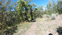
Narrow and steep with some tight turns and small rock features. Nice climb to the Orange Gate, top of Noah's and Favorite trails. Often used as a fast downhill section.

Tags
Picnic spotTight and twisty

Local Trail Association

Traditionally Indigenous Territory

Recent Activity on Trail

Past Week
  • 1 rides
  • 26 miles average
6 Months
  • 33 rides
  • 11 miles avg distance
All
  • 228 rides
  • Last: Oct 17, 2026
c1c2c3c4
January
February
March
April
May
June
July
August
September
October
November
December
update trails status or condition

JMC Trail Reports

statusdatedescription
Oct 17, 2026 @ 8:02pm (America/Denver)
Oct 17, 2026
reporter
Oct 16, 2026 @ 2:03pm (America/Los_Angeles)
Oct 16, 2026
Not approved
Oct 11, 2026 @ 7:38am (America/Denver)
Oct 11, 2026
reporter Prevalent Mud. Please respect the trail closure.
Oct 1, 2026 @ 1:53pm (America/Denver)
Oct 1, 2026
reporter
Sep 28, 2026 @ 2:03pm (America/Denver)
Sep 28, 2026
reporter You guessed it, muddy. Please respect the closure while we get the much needed moisture.
more »
Status:
on Oct 17, 2026
Ideal
Avg: 3.82 (6 votes)
Your vote: 0

view (1,202)
close
      Directions to jmc trailhead (39.986100, -111.695760)

      Photos

      4 more »
      mtb
      JMC
      65 |
      May 20, 2021 @ 9:37pm
      May 20, 2021
      mtb
      JMC
      86 |
      May 14, 2020 @ 9:09pm
      May 14, 2020
      mtb
      JMC
      201 |
      Nov 7, 2014 @ 8:08am
      Nov 7, 2014
      mtb
      JMC
      257 |
      Nov 7, 2014 @ 8:08am
      Nov 7, 2014

      Videos

      1 more »
      JMC Downhill
      mtb
      3:28 | 319 | Sep 19, 2014 , Payson

      Routes with this trail

      6 miles • 804 ft • 10 • Loop •
      Nebo goats 4 hour of Forebay main route
      3 miles • 414 ft • 14 •
      Short loop (45 minutes) in four bay
      3.7 ★★★★★
      6 Ratings
      5 ★ 33%
      4 ★ 17%
      3 ★ 33%
      2 ★ 17%
      1 ★

      3 Reviews & Comments

      jerheck
      I don't know why this is rated as a black. Maybe a blue, or steeper green. There were only a few small rocks on the way down. Pretty steep, at parts, if you wanted to climb it. Decent, but short, descent.
      MattMan33
      Really fun trail ridden DH with decent flow.

      We hope you've been enjoying Trailforks!

      Create a FREE account to view all trail reviews and much more.

      • By toddTF Pro Trailforks & contributors
      • #9607 - 2,483 views

      Frequently Asked Questions

      ▼ Where is JMC located?
      JMC is located in Forebay, Payson, Utah, United States. It is part of the Forebay trail network. The trailhead is located at coordinates 39.9861, -111.69576.
      ▼ How hard is JMC?
      JMC is rated as Black Diamond difficulty. The physical rating is Moderate. The average grade is 7.9%. The climb difficulty is rated Black Diamond.
      ▼ What is the elevation gain for JMC?
      JMC has 171 ft of elevation gain. The trail has 2 ft of elevation descent. The elevation ranges from 5,392 ft to 5,561 ft.
      ▼ Is JMC a point to point trail?
      JMC is not a point to point trail. The direction is Both Directions. The trail type is singletrack.
      ▼ How long is JMC?
      JMC is 2,149 ft long. The trail type is singletrack.
      ▼ Are dogs allowed on JMC?
      There is no information about dogs being allowed on JMC. Check with local trail managers or the trail page for the latest access rules.
      ▼ When is the best time of year to ride JMC?
      Based on activity log data, the most popular months to ride JMC are:
      • September (20 activities)
      • August (12 activities)
      • July (8 activities)
      Check the reports page for current trail conditions.
      ▼ How do I access JMC? Where is the closest parking trailhead?
      The closest parking and trailhead locations to JMC are: View all parking locations in the area.
      ▼ How long does it take to ride JMC?
      Based on recorded activities, it takes an average of 5 minutes to ride JMC. The trail is 2,149 ft long. Actual times will vary based on fitness level, conditions, and pace. View recent activity logs for more details.
      ▼ How busy is JMC?
      JMC is a very popular trail. There have been 1,083 recorded activities on this trail. The trail has received 1,202 check-ins. View recent activity on this trail.

      Hit the Trail

      Open in App

      Get this trail on your phone instantly.

      open trail in app

      Download Trail

      Save to wishlist, Garmin & download.
      save the trail

      Find Related Routes

      Find routes and users activities that include this trail.
      find routes for this trail

      You must enter a description before submitting.

