


more stats
3.8 miles
Distance
359 ft
Climb
-367 ft
Descent
01:00:08
Avg time
-8 ft
Altitude change
8,825 ft
Altitude min
9,030 ft
Altitude max
8,848 ft
Altitude start
8,841 ft
Altitude end
-0.039%
Grade
-16.943%
Grade max
19.55%
Grade min
2 miles
Distance climb
2 miles
Distance down
2,448 ft
Distance flat
01:00:08
Avg time

Johnsons Loop Details

  • Activities
    • Hike
    • Mountain Bike
    • Winter Fat Bike
    • Trail Running
  • Riding Area
    Fish Lake
    Beaver, Utah
  • Difficulty Rating
  • Local Popularity
    5 in Mountain Biking [+]
    • 5 in Trail Running
    • 5 in Hiking
    • 5 in Winter Fat Biking
  • Global Ranking
    #161726 in Mountain Biking [+]
    • #155948 in Trail Running
    • #155663 in Hiking
    • #29762 in Winter Fat Biking
  • State Ranking
    #3,093 in Mountain Biking · Utah [+]
    • #3,662 in Trail Running
    • #3,831 in Hiking
    • #319 in Winter Fat Biking
  • Hiking SAC Scale
    T1 Hiking
  • Trail Type
    Singletrack
  • Bike Type
    AM, XC, Fat
  • Direction
    Both Directions
  • Dogs Allowed
    Yes
  • eBike Allowed

Mostly pretty mellow riding through meadows. Some gorgeous shoreline riding along Johnson's Reservoir.

Washed out a not very ride-able in several areas.

Tags
Meadow

Recent Activity on Trail

Past Week
  • 0 rides
  •  
6 Months
  • 0 rides
  •  
All
  • 0 rides
  • Last: Aug 15, 2020
update trails status or condition

Johnsons Loop Trail Reports

statusdatedescription
Sep 23, 2022 @ 1:39pm
Sep 23, 2022
Jun 23, 2019 @ 3:33pm
Jun 23, 2019
The middle of the trail is completely non-rideable. You have to walk your bike while getting West Nile virus.
more »
Status:
on Sep 23, 2022
Dry
Avg: 3.21 (3 votes)
Your vote: 0

view (6)
close
      Directions to johnsons-loop trailhead (38.588750, -111.673696)

      Photos

      10 more »
      mtb
      48 |
      Aug 16, 2025 @ 1:28pm
      Aug 16, 2025
      mtb
      32 |
      Aug 16, 2025 @ 1:28pm
      Aug 16, 2025
      mtb
      37 |
      Aug 16, 2025 @ 1:28pm
      Aug 16, 2025
      mtb
      38 |
      Aug 16, 2025 @ 1:28pm
      Aug 16, 2025

      Videos

      1 more »
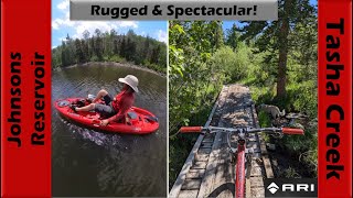
      youtuber Rugged & Spectacular Riding + Pedal...
      mtb
      45:06 | 118 | Jun 28, 2024 , Beaver
      1.7 ★★★★★
      3 Ratings
      5 ★
      4 ★
      3 ★
      2 ★ 67%
      1 ★ 33%

      6 Reviews & Comments

      Trailmaven
      Could be good with several reroutes and a lot of work. As it is a good bit of bike carry through overgrown and Rocky section. Downhill broken up by several down trees and miles of loose sandy rock beach where the trail goes away
      blaskojf blaskojf
      This trail is best ridden as an out and back on either one of the legs. The connector between both swells is not that difficult and for experienced high intermediate writers is rideable otherwise a very short hiker bike. I have uploaded pictures so that you can see how nice the trail is.
      TheReds11
      Totally duped into this trail. Had to hike-a-bike for what should be the fun section through the trees.

      We hope you've been enjoying Trailforks!

      Create a FREE account to view all trail reviews and much more.

      • By minerbikerTF Pro & contributors
      • #146949 - 995 views

      Frequently Asked Questions

      ▼ Where is Johnsons Loop located?
      Johnsons Loop is located in Fish Lake, Beaver, Utah, United States. It is part of the Fish Lake trail network. The trailhead is located at coordinates 38.58875, -111.6737.
      ▼ How hard is Johnsons Loop?
      Johnsons Loop is rated as Blue difficulty. The average grade is 0.039%.
      ▼ What is the elevation gain for Johnsons Loop?
      Johnsons Loop has 359 ft of elevation gain. The trail has 367 ft of elevation descent. The elevation ranges from 8,825 ft to 9,030 ft.
      ▼ Is Johnsons Loop a point to point trail?
      Johnsons Loop is not a point to point trail. The direction is Both Directions. The trail type is singletrack.
      ▼ How long is Johnsons Loop?
      Johnsons Loop is 3.8 miles long. The trail type is singletrack.
      ▼ Are dogs allowed on Johnsons Loop?
      Yes, dogs are allowed on Johnsons Loop. Please keep dogs on a leash where required and clean up after them.
      ▼ How do I access Johnsons Loop? Where is the closest parking trailhead?
      The closest parking and trailhead locations to Johnsons Loop are: View all parking locations in the area.
      ▼ How long does it take to ride Johnsons Loop?
      The estimated time to ride Johnsons Loop is approximately 1 hour. The trail is 3.8 miles long. Actual times will vary based on fitness level, conditions, and pace.
      ▼ How busy is Johnsons Loop?
      Johnsons Loop is a less popular trail with lighter traffic. There have been 5 recorded activities on this trail. The trail has received 6 check-ins. View recent activity on this trail.

      Hit the Trail

      Open in App

      Get this trail on your phone instantly.

      open trail in app

      Download Trail

      Save to wishlist, Garmin & download.
      save the trail

      Find Related Routes

      Find routes and users activities that include this trail.
      find routes for this trail

      You must enter a description before submitting.


