This trail is permanently closed/decommissioned
more stats
2,014 ft
Distance
9 ft
Climb
-196 ft
Descent
00:01:38
Avg time
-189 ft
Altitude change
2,269 ft
Altitude min
2,458 ft
Altitude max
2,458 ft
Altitude start
2,270 ft
Altitude end
-9.4%
Grade
-38.6%
Grade max
5.3%
Grade min
197 ft
Distance climb
1,654 ft
Distance down
164 ft
Distance flat
00:01:38
Avg time

Joy Cross Details

  • Activities
    • Mountain Bike
    • E-Bike
    • Adaptive Bike
  • Riding Area
    Whistler Mountain Bike Park
    Whistler, British Columbia
  • Difficulty Rating
  • Voted Difficulty
    Green (1 vote)
  • Local Popularity
    15 in Mountain Biking [+]
    • 10 in E-Biking
    • 5 in Adaptive Biking
  • Trail Type
    Machine Groomed
  • Bike Type
    DH, AM, Adaptive MTB
  • Direction
    Downhill Only[+]
    Popular Direction Shown
    • Downhill Only for E-Biking
  • eBike Allowed
  • TTFs on Trail
    Berm, Jump, Pump Track
  • Land Owner

A fun intermediate flow option down through the Boneyard - built fresh every summer.

Tags
BermsJumpsPump track

Bike Park

Recent Activity on Trail

Past Week
  • 0 rides
  •  
6 Months
  • 17 rides
  • 26 miles avg distance
All
  • 2,889 rides
  • Last: Oct 11, 2026
c1c2c3c4
January
February
March
April
May
June
July
August
September
October
November
December
update trails status or condition

Joy Cross Trail Reports

Status:
on May 23, 2025
Avg: 3.79 (66 votes)
Your vote: 0

view (30,107)
close
      Directions to joy-cross trailhead (50.109710, -122.954210)

      Photos

      92 more »
      mtb
      221 |
      Apr 24, 2016 @ 1:19am
      Apr 24, 2016
      mtb
      311 |
      Apr 4, 2016 @ 10:42pm
      Apr 4, 2016
      mtb
      125 |
      Aug 13, 2022 @ 2:03pm
      Aug 13, 2022
      mtb
      96 |
      Jul 21, 2021 @ 3:52pm
      Jul 21, 2021

      Videos

      30 more »
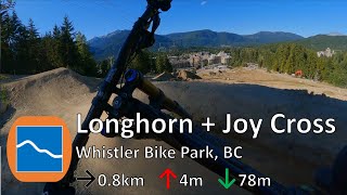
      Longhorn & Joy Cross - Whistler Bike Park...
      mtb
      0:49 | 327 | Sep 19, 2022 , Whistler
      This Trail Is A Dangerous Balance Act With...
      mtb
      2:16 | 243 | Jul 30, 2022 , Whistler
      youtuber Family Joy - Whistler Bike Park
      mtb
      0:29 | 626 | Mar 14, 2022 , Whistler
      Whistler Mountain Bike Park: Sept 2020 Ride, I...
      mtb
      1:2:29 | 229 | Jan 11, 2022 , Whistler

      Routes with this trail

      ★ 3.5 • 5 miles • 1,113 ft • 24 • Point to Point •
      Start your Whistler Bike Park day off by warming up on some mellower trails before dropping into the more...
      5 miles • 970 ft • 20 • Point to Point • Race •
      Whistler Blackcomb Funduro Friday #3 - 12 June 2015 Enduro mountain bike racing includes uphill, downhill...
      ★ 5.0 • 2 miles • 15 • Point to Point • Race •
      A three stage "Couples" Race where teams of two compete in XC, DH and Enduro to crown the best riding...
      3.8 ★★★★★
      65 Ratings
      5 ★ 29%
      4 ★ 29%
      3 ★ 31%
      2 ★ 11%
      1 ★

      Reviews / Comments

      No reviews yet, be the first to write a review or ask a question.
      Use trail reports to comment on trail conditions.


      We hope you've been enjoying Trailforks!

      Create a FREE account to view all trail reviews and much more.

      Frequently Asked Questions

      ▼ Where is Joy Cross located?
      Joy Cross is located in Whistler Mountain Bike Park, Whistler, British Columbia, Canada. It is part of the Whistler Mountain Bike Park trail network. The trailhead is located at coordinates 50.10971, -122.95421.
      ▼ How hard is Joy Cross?
      Joy Cross is rated as Blue difficulty. The average grade is 9.4%.
      ▼ What is the elevation gain for Joy Cross?
      Joy Cross has 9 ft of elevation gain. The trail has 196 ft of elevation descent. The elevation ranges from 2,269 ft to 2,458 ft.
      ▼ Is Joy Cross a point to point trail?
      Yes, Joy Cross is a point to point trail. The direction is Downhill Only. The trail type is machine groomed.
      ▼ How long is Joy Cross?
      Joy Cross is 2,014 ft long. The trail type is machine groomed.
      ▼ Are dogs allowed on Joy Cross?
      There is no information about dogs being allowed on Joy Cross. Check with local trail managers or the trail page for the latest access rules.
      ▼ When is the best time of year to ride Joy Cross?
      Based on activity log data, the most popular months to ride Joy Cross are:
      • August (14 activities)
      • September (12 activities)
      • January (10 activities)
      Check the reports page for current trail conditions.
      ▼ How do I access Joy Cross? Where is the closest parking trailhead?
      The closest parking and trailhead locations to Joy Cross are: View all parking locations in the area.
      ▼ How long does it take to ride Joy Cross?
      Based on recorded activities, it takes an average of 2 minutes to ride Joy Cross. The trail is 2,014 ft long. Actual times will vary based on fitness level, conditions, and pace. View recent activity logs for more details.
      ▼ How busy is Joy Cross?
      Joy Cross is a less popular trail with lighter traffic. There have been 19,301 recorded activities on this trail. The trail has received 30,107 check-ins. View recent activity on this trail.

      Hit the Trail

      Open in App

      Get this trail on your phone instantly.

      open trail in app

      Download Trail

      Save to wishlist, Garmin & download.
      save the trail

      Find Related Routes

      Find routes and users activities that include this trail.
      find routes for this trail

      You must enter a description before submitting.