more stats
3,497 ft
Distance
124 ft
Climb
00:08:34
Avg time
124 ft
Altitude change
3,490 ft
Altitude min
3,614 ft
Altitude max
3,490 ft
Altitude start
3,615 ft
Altitude end
3.5%
Grade
-1.1%
Grade max
13.3%
Grade min
2,815 ft
Distance climb
59 ft
Distance down
627 ft
Distance flat
00:08:34
Avg time

Just Get There Details

  • Activities
    • Mountain Bike
    • Winter Fat Bike
    • Hike
    • Trail Running
  • Riding Area
    Happy Creek
    Hinton, Alberta
  • Difficulty Rating
  • Local Popularity
    100 in Mountain Biking heatmap [+]
    • 100 in Trail Running
    • 95 in Hiking
    • 5 in Winter Fat Biking
  • Global Ranking
    #32447 in Mountain Biking [+]
    • #72028 in Trail Running
    • #93806 in Hiking
    • #12116 in Winter Fat Biking
  • Provincial Ranking
    #533 in Mountain Biking · Alberta [+]
    • #1,286 in Trail Running
    • #1,545 in Hiking
    • #334 in Winter Fat Biking
  • Trail Type
    Mixed
  • Bike Type
    AM, XC, Fat
  • Direction
    Both Directions
  • Climb Difficulty
    Blue
  • Physical Rating
    Moderate
  • Season
    May - Oct
  • Dogs Allowed
    Yes
  • eBike Allowed
  • Land Owner
    Town of Hinton

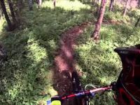
A mix of double track and single track with a couple of climbs. Follow this to the J and the EZ viewpoint. Leads to Ranger, the Halloween connector and Just Giver. A really fun decent back from the J to the town trails.

Access Info

Access from West end of Maxwell lake on town trails

Tags
Views

Local Trail Association

Recent Activity on Trail

Past Week
  • 1 rides
  • 13.6 km average
6 Months
  • 64 rides
  • 14.2 km avg distance
All
  • 459 rides
  • Last: Nov 17, 2026
c1c2c3c4
January
February
March
April
May
June
July
August
September
October
November
December
update trails status or condition

Just Get There Trail Reports

statusdatedescription
Oct 15, 2023 @ 3:17am
Oct 15, 2023
May 3, 2023 @ 12:54pm
May 3, 2023
reporter
Feb 20, 2023 @ 1:54am
Feb 20, 2023
3” of loose snow over hard pack. Couple of areas of ice below the snow but was a nice ride. Just me and the chipmunks.
May 2, 2022 @ 12:43pm
May 2, 2022
reporter Mostly dry with a couple of soft spots especially right after you turn off the town trails
May 6, 2021 @ 7:48am
May 6, 2021
reporter Mostly good with some mushy sections nearest the town trail. The firesmart re-route is a mess with spongy mud. The mid-way cutline is also still...
more »
Status:
on Oct 15, 2023
Ideal
Avg: 4.08 (6 votes)
Your vote: 0

view (3,901)
close
      Directions to just-get-there trailhead (53.384330, -117.594060)

      Photos

      5 more »
      mtb
      127 |
      Dec 1, 2020 @ 8:18am
      Dec 1, 2020
      mtb
      324 |
      Dec 17, 2015 @ 7:21am
      Dec 17, 2015
      report
      mtb
      99 |
      Oct 2, 2020 @ 6:35pm
      Oct 2, 2020
      report
      mtb
      137 |
      Dec 29, 2017 @ 1:07pm
      Dec 29, 2017

      Videos

      1 more »
      GoPro Hinton Mountain Biking ALain and Rodel...
      mtb
      781 | Jul 15, 2015 , Hinton

      Routes with this trail

      more »
      41 miles • 5,148 ft • 20 • Loop •
      This covers all of the xc trails in the Hinton Bike Park.
      ★ 1.0 • 6 miles • 709 ft • 8 • Loop •
      A rewarding and fun loop to do, linking some great trails together.
      7 miles • 859 ft • 10 • Loop • Race •
      The HMBA V-duro is a series of virtual activities throughout the year, staged in an Enduro format open to...
      4.2 ★★★★★
      6 Ratings
      5 ★ 50%
      4 ★ 17%
      3 ★ 33%
      2 ★
      1 ★

      1 Review & Comments

      traviswbrown82
      Accending JGT and THE J from maxwell without stopping will leave you knowing how your put together by the end of it. A tough trek up if your up for it. Most enjoy he way down from ranger

      We hope you've been enjoying Trailforks!

      Create a FREE account to view all trail reviews and much more.

      • By jayhore HMBA & contributors
      • #5060 - 1,781 views

      Frequently Asked Questions

      ▼ Where is Just Get There located?
      Just Get There is located in Happy Creek, Hinton, Alberta, Canada. It is part of the Happy Creek trail network. The trailhead is located at coordinates 53.38433, -117.59406.
      ▼ How hard is Just Get There?
      Just Get There is rated as Blue difficulty. The physical rating is Moderate. The average grade is 3.5%. The climb difficulty is rated Blue.
      ▼ What is the elevation gain for Just Get There?
      Just Get There has 124 ft of elevation gain. The elevation ranges from 3,490 ft to 3,614 ft.
      ▼ Is Just Get There a point to point trail?
      Just Get There is not a point to point trail. The direction is Both Directions. The trail type is mixed.
      ▼ How long is Just Get There?
      Just Get There is 3,497 ft long. The trail type is mixed.
      ▼ Are dogs allowed on Just Get There?
      Yes, dogs are allowed on Just Get There. Please keep dogs on a leash where required and clean up after them.
      ▼ When is the best time of year to ride Just Get There?
      Based on activity log data, the most popular months to ride Just Get There are:
      • May (57 activities)
      • July (39 activities)
      • June (30 activities)
      Check the reports page for current trail conditions.
      ▼ How do I access Just Get There? Where is the closest parking trailhead?
      The closest parking and trailhead locations to Just Get There are: View all parking locations in the area.
      ▼ How long does it take to ride Just Get There?
      Based on recorded activities, it takes an average of 9 minutes to ride Just Get There. The trail is 3,497 ft long. Actual times will vary based on fitness level, conditions, and pace. View recent activity logs for more details.
      ▼ How busy is Just Get There?
      Just Get There is a very popular trail. There have been 3,315 recorded activities on this trail. The trail has received 3,901 check-ins. View recent activity on this trail.

      Hit the Trail

      Open in App

      Get this trail on your phone instantly.

      open trail in app

      Download Trail

      Save to wishlist, Garmin & download.
      save the trail

      Find Related Routes

      Find routes and users activities that include this trail.
      find routes for this trail

      You must enter a description before submitting.