




Open in App
Get this trail on your phone instantly.

en realidad podrían ser 3 trialeras.
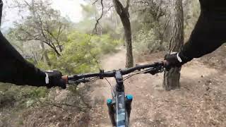
Tiene una parte muy corta al principio de la dificultad marcada (roja/negra); en el resto, la dificultad baja mucho:
-se inicia con un drop a trazar bien (rojo +). luego los primeros 90 m (hasta la curva) son algo más difíciles (rojo).
-en los siguientes 700 m (hasta el cruce con la pista forestal) es un trail verde, de enlace
-en los últimos 200 m (desde la pista forestal hasta el final) es un trail revirado, estrecho y técnico. con una rampa final que impresiona por su verticalidad. al final hay un escalón de salida potente (validar pues según las lluvias se puede poner feo). azul el inicio pero rojo el final (y negro el escalón final)
This trail is unsanctioned.
| c1 | c2 | c3 | c4 |
|---|---|---|---|
January | February | March | April |
May | June | July | August |
September | October | November | December |

Service Road Atlas is a free to use, community-driven service for viewing and creating reports on the numerous back-country service roads around B.C. and Alberta.
Save the current map location and zoom level as your default home location whenever this page is loaded.
SaveWe hope you've been enjoying Trailforks!
Create a FREE account to view all trail reviews and much more.
You must enter a description before submitting.

