
more stats
1.2 miles
Distance
-913 ft
Descent
00:10:39
Avg time
-914 ft
Altitude change
1,145 ft
Altitude min
2,059 ft
Altitude max
2,059 ft
Altitude start
1,145 ft
Altitude end
-14.9%
Grade
-46.2%
Grade max
-2.4%
Grade min
1 mile
Distance down
16 ft
Distance flat
00:10:39
Avg time

Kiental-Trail Details

  • Activities
    • Mountain Bike
    • E-Bike
  • Riding Area
  • AKA
    Canadian
  • Difficulty Rating
  • Voted Difficulty
    Red (4 votes)
  • Local Popularity
    75 in Mountain Biking [+]
    • 80 in E-Biking
  • Global Ranking
    #55948 in Mountain Biking [+]
    • #30218 in E-Biking
  • National Ranking
    #446 in Mountain Biking · Austria [+]
    • #212 in E-Biking
  • Trail Type
    Singletrack
  • Bike Type
    AM, XC
  • Direction
    Both Directions
    Popular Direction Shown
  • Season
    Mar - Oct
  • Dogs Allowed
    Yes
  • eBike Allowed
  • TTFs on Trail
    Berm, Drop, Jump, Rock Face

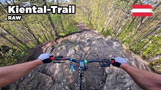
Fairly steep and straitght forward trail with fast sections and some tight corners. Some jumps in between. Rock face with different line choices near the end.

Tags

Local Trail Association

Recent Activity on Trail

Past Week
  • 1 rides
  • 14 miles average
6 Months
  • 27 rides
  • 16 miles avg distance
All
  • 130 rides
  • Last: Oct 26, 2026
c1c2c3c4
January
February
March
April
May
June
July
August
September
October
November
December
update trails status or condition

Kiental-Trail Trail Reports

statusdatedescription
Apr 27, 2026 @ 9:48am (Europe/Vienna)
Apr 27, 2026
reporter
Mar 10, 2026 @ 9:40am (Europe/Vienna)
Mar 10, 2026
reporter
Feb 28, 2026 @ 11:03pm (America/Los_Angeles)
Feb 28, 2026
Not approved
Nov 17, 2025 @ 11:21am (Europe/Vienna)
Nov 17, 2025
reporter Wintersperre von 1.11.2025 bis 28.2.2026, ab 1. März geht die Saison wieder los
Mar 2, 2025 @ 8:44am
Mar 2, 2025
reporter Achtung: Anschließend an den Kiental-Trail muss derzeit der Uphill Richtung Anninger über die Kiental-Route (Part 2) gewählt werden. Die...
more »
Status:
on Apr 27, 2026
Dry
Avg: 4.49 (10 votes)
Your vote: 0

view (701)
close
      Directions to kientaltrail trailhead (48.055510, 16.246080)

      Photos

      5 more »
      mtb
      294 |
      May 9, 2021 @ 9:39am
      May 9, 2021
      mtb
      439 |
      Aug 31, 2020 @ 1:12pm
      Aug 31, 2020
      mtb
      229 |
      Aug 31, 2020 @ 1:12pm
      Aug 31, 2020
      mtb
      203 |
      Aug 31, 2020 @ 1:12pm
      Aug 31, 2020

      Videos

      7 more »
      youtuber Kiental Trail (RAW) - MTB Area Anninger
      mtb
      6:00 | 499 | Apr 30, 2023 , Mödling
      youtuber Kiental-Trail 2026 - Full Run (RAW) - MTB Area...
      mtb
      6:20 | 127 | Apr 19, 2026 , Mödling
      Kiental Trail // Anninger Downhill
      mtb
      6:24 | 345 | May 10, 2022 , Mödling
      youtuber Kiental Trail 2021 RAW (durchgfoan) - MTB Area...
      mtb
      5:37 | 403 | Mar 20, 2022 , Mödling
      4.9 ★★★★★
      10 Ratings
      5 ★ 90%
      4 ★ 10%
      3 ★
      2 ★
      1 ★

      4 Reviews & Comments

      crisotop crisotop
      kudos to the landowners and foremost the builders for shaping a fairly natural but super fun legal line. Can be quite slippery in the dry, and has 1,5 hard uphills in the lower half
      ianhuang ianhuang
      Probably one of the best non-bikepark trails around Vienna. Very fun and natural, because the terrain is so steep, most of the turns are off camber and there are not too many berms, which I truly enjoy. There are a number of blind drops that can be dangerous or misleading to the first time/amateur rider.
      go-bike-yourself go-bike-yourself
      A must ride, when near Vienna. And it's a shared trail, so it's official and legal to ride.

      It offers anything from fast and flowy sections to steep and loamy turns to jumps to a rocky step-down at the end. The trail has an easier alternative in the middle (it goes to the left of the little peal called "Steinwand") if you want to avoid the short but steep uphill. You will leave out some nice jumps and turns but are rewarded with a nice view.

      Take your time for the rock section towards the end. Having a look at the line first helps a lot.

      We hope you've been enjoying Trailforks!

      Create a FREE account to view all trail reviews and much more.

      • By linesTF Pro TRAILFORKS & contributors
      • #296915 - 3,004 views

      Frequently Asked Questions

      ▼ Where is Kiental-Trail located?
      Kiental-Trail is located in MTB-Area Anninger, Mödling, Austria. It is part of the MTB-Area Anninger trail network. The trailhead is located at coordinates 48.05551, 16.24608.
      ▼ How hard is Kiental-Trail?
      Kiental-Trail is rated as Red difficulty. The average grade is 14.9%.
      ▼ What is the elevation gain for Kiental-Trail?
      The trail has 913 ft of elevation descent. The elevation ranges from 1,145 ft to 2,059 ft.
      ▼ Is Kiental-Trail a point to point trail?
      Kiental-Trail is not a point to point trail. The direction is Both Directions. The trail type is singletrack.
      ▼ How long is Kiental-Trail?
      Kiental-Trail is 1.2 miles long. The trail type is singletrack.
      ▼ Are dogs allowed on Kiental-Trail?
      Yes, dogs are allowed on Kiental-Trail. Please keep dogs on a leash where required and clean up after them.
      ▼ When is the best time of year to ride Kiental-Trail?
      Based on activity log data, the most popular months to ride Kiental-Trail are:
      • April (13 activities)
      • May (11 activities)
      • August (10 activities)
      Check the reports page for current trail conditions.
      ▼ How do I access Kiental-Trail? Where is the closest parking trailhead?
      The closest parking and trailhead locations to Kiental-Trail are: View all parking locations in the area.
      ▼ How long does it take to ride Kiental-Trail?
      Based on recorded activities, it takes an average of 11 minutes to ride Kiental-Trail. The trail is 1.2 miles long. Actual times will vary based on fitness level, conditions, and pace. View recent activity logs for more details.
      ▼ How busy is Kiental-Trail?
      Kiental-Trail is a very popular trail. There have been 693 recorded activities on this trail. The trail has received 701 check-ins. View recent activity on this trail.

      Hit the Trail

      Open in App

      Get this trail on your phone instantly.

      open trail in app

      Download Trail

      Save to wishlist, Garmin & download.
      save the trail

      Find Related Routes

      Find routes and users activities that include this trail.
      find routes for this trail

      You must enter a description before submitting.