more stats
3,704 ft
Distance
4 ft
Climb
-566 ft
Descent
00:13:34
Avg time
-562 ft
Altitude change
2,489 ft
Altitude min
3,054 ft
Altitude max
3,050 ft
Altitude start
2,490 ft
Altitude end
-15.2%
Grade
-55.6%
Grade max
5%
Grade min
154 ft
Distance climb
3,425 ft
Distance down
121 ft
Distance flat
00:13:34
Avg time

La cisterna Details

  • Activities
    • Mountain Bike
    • E-Bike
  • Riding Area
  • Difficulty Rating
  • Local Popularity
    35 in Mountain Biking [+]
    • 20 in E-Biking
  • Global Ranking
    #132423 in Mountain Biking [+]
    • #128767 in E-Biking
  • National Ranking
    #10,060 in Mountain Biking · Italy [+]
    • #12,546 in E-Biking
  • Trail Type
    Singletrack
  • Bike Type
    DH, AM
  • Direction
    Downhill Only
    Popular Direction Shown
  • Physical Rating
    Moderate
  • Dogs Allowed
    Yes
  • eBike Allowed
    Yes up to Class 1

Per raggiungere questo sentiero dovrete percorrere la pista tagliafuoco della galleria proseguendo in salita per un chilometro circa. Ad un certo punto troverete una vecchia cisterna arrugginita usata in passato per la raccolta dell' acqua, questo è il punto di partenza della traccia. Noterete due tracce, imboccate quella a destra, la prima salendo. Il sentiero totalmente in discesa soddisfa tutti i palati, sezioni veloci e scorrevoli, alternati da pietraie e contropendenze, fanno di questa traccia uno dei sentieri preferiti da chi fa enduro. Non sono presenti incroci, guidando verso valle vi ricongiungerete alla strada SP56. Vi troverete a 500 metri dal prato di San Romolo.

Tags

Bike Park

Recent Activity on Trail

Past Week
  • 1 rides
  • 22 miles average
6 Months
  • 2 rides
  • 18 miles avg distance
All
  • 12 rides
  • Last: Oct 27, 2026
c1c2c3c4
January
February
March
April
May
June
July
August
September
October
November
December
update trails status or condition

La cisterna Trail Reports

statusdatedescription
Jun 15, 2026 @ 9:30pm (Europe/Rome)
Jun 15, 2026
Apr 23, 2026 @ 11:34am (Europe/Rome)
Apr 23, 2026
Loose rocks and lots of leaves
Jul 12, 2025 @ 9:39am
Jul 12, 2025
Presenza di un bel lungo rockgarden impegnativo da fare ma non pendente. Esiste il trail nuova cisterna: si prende andando dritto, lasciando il...
Oct 6, 2024 @ 5:00am
Oct 6, 2024
Oct 5, 2024 @ 2:47pm
Oct 5, 2024
Ci sono molti massi impegnativi da superare a metà del primo tratto. Nella variante una trentina di metri sono scavati, si procede a piedi; molti...
more »
Status:
on Jun 15, 2026
Dry
Avg: 3.3 (7 votes)
Your vote: 0

view (88)
close
      Directions to la-cisterna trailhead (43.866543, 7.732884)

      Photos

      10 more »
      mtb
      81 |
      Jul 28, 2022 @ 8:08am
      Jul 28, 2022
      report
      mtb
      41 |
      Oct 7, 2024 @ 5:14am
      Oct 7, 2024
      report
      mtb
      36 |
      Oct 7, 2024 @ 5:14am
      Oct 7, 2024
      report
      mtb
      35 |
      Oct 7, 2024 @ 5:13am
      Oct 7, 2024

      Videos

      1 more »
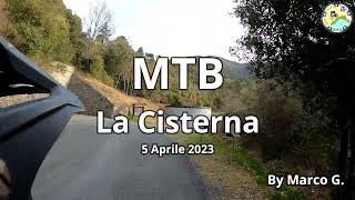
      MTB  La Cisterna nuova modifica
      mtb
      6:11 | 120 | Apr 6, 2023 , Sanremo
      2.7 ★★★★★
      7 Ratings
      5 ★
      4 ★ 43%
      3 ★ 14%
      2 ★ 14%
      1 ★ 29%

      1 Review & Comments

      Sgaus Sgaus
      Ora e' stata modificata in meglio la traccia seguite il video
      Buon Divertimento

      We hope you've been enjoying Trailforks!

      Create a FREE account to view all trail reviews and much more.

      Nearby Trails

      Frequently Asked Questions

      ▼ Where is La cisterna located?
      La cisterna is located in Sanremo Bike Resort, Sanremo, Italy. It is part of the Sanremo Bike Resort trail network. The trailhead is located at coordinates 43.86654, 7.73288.
      ▼ How hard is La cisterna?
      La cisterna is rated as Blue difficulty. The physical rating is Moderate. The average grade is 15.2%.
      ▼ What is the elevation gain for La cisterna?
      La cisterna has 4 ft of elevation gain. The trail has 566 ft of elevation descent. The elevation ranges from 2,489 ft to 3,054 ft.
      ▼ Is La cisterna a point to point trail?
      Yes, La cisterna is a point to point trail. The direction is Downhill Only. The trail type is singletrack.
      ▼ How long is La cisterna?
      La cisterna is 3,704 ft long. The trail type is singletrack.
      ▼ Are dogs allowed on La cisterna?
      Yes, dogs are allowed on La cisterna. Please keep dogs on a leash where required and clean up after them.
      ▼ When is the best time of year to ride La cisterna?
      Based on activity log data, the most popular months to ride La cisterna are:
      • October (3 activities)
      • January (1 activities)
      • March (1 activities)
      Check the reports page for current trail conditions.
      ▼ How do I access La cisterna? Where is the closest parking trailhead?
      The closest parking and trailhead locations to La cisterna are: View all parking locations in the area.
      ▼ How long does it take to ride La cisterna?
      Based on recorded activities, it takes an average of 14 minutes to ride La cisterna. The trail is 3,704 ft long. Actual times will vary based on fitness level, conditions, and pace. View recent activity logs for more details.
      ▼ How busy is La cisterna?
      La cisterna is a less popular trail with lighter traffic. There have been 102 recorded activities on this trail. The trail has received 88 check-ins. View recent activity on this trail.

      Hit the Trail

      Open in App

      Get this trail on your phone instantly.

      open trail in app

      Download Trail

      Save to wishlist, Garmin & download.
      save the trail

      Find Related Routes

      Find routes and users activities that include this trail.
      find routes for this trail

      You must enter a description before submitting.