

more stats
1.1 miles
Distance
193 ft
Climb
-35 ft
Descent
00:10:57
Avg time
157 ft
Altitude change
3,484 ft
Altitude min
3,649 ft
Altitude max
3,484 ft
Altitude start
3,642 ft
Altitude end
2.6%
Grade
-15.4%
Grade max
20%
Grade min
3,812 ft
Distance climb
1,608 ft
Distance down
643 ft
Distance flat
00:10:57
Avg time

La Renault Details

  • Activities
    • Mountain Bike
    • E-Bike
    • Hike
    • Trail Running
  • Riding Area
    Cerro del Telégrafo
    Moralzarzal
  • AKA
    Sendero de la Renault
  • Difficulty Rating
  • Voted Difficulty
    Green (2 votes)
  • Local Popularity
    100 in Mountain Biking [+]
    • 90 in E-Biking
    • 75 in Trail Running
    • 5 in Hiking
  • Global Ranking
    #97471 in Mountain Biking [+]
    • #17979 in E-Biking
    • #142553 in Trail Running
    • #337140 in Hiking
  • National Ranking
    #7,086 in Mountain Biking · Spain [+]
    • #1,815 in E-Biking
    • #11,748 in Trail Running
    • #33,794 in Hiking
  • Hiking SAC Scale
    T1 Hiking
  • Trail Type
    Singletrack
  • Bike Type
    AM, XC
  • Direction
    Both Directions
  • Climb Difficulty
    Green
  • Physical Rating
    Easy
  • Trail Visibility
    Always easy to follow
  • Dogs Allowed
    Yes
  • eBike Allowed
    Yes up to Class 1
  • TTFs on Trail
    Berm, Jump
  • Land Owner
    Comunidad de Madrid

Easy playful and quite flat trail with natural berms and jumps. You will find many different lines during the descent.

Tags
BermsJumps

Recent Activity on Trail

Past Week
  • 2 rides
  • 29 miles average
6 Months
  • 39 rides
  • 27 miles avg distance
All
  • 237 rides
  • Last: Oct 25, 2026
update trails status or condition

La Renault Trail Reports

Status:
on Apr 5, 2026
Dry
Avg: 3.99 (3 votes)
Your vote: 0

view (1,569)
close
      Directions to la-renault trailhead (40.687100, -4.012530)

      Photos

      No photos have been added for La Renault yet, add a photo.

      Videos

      2 more »
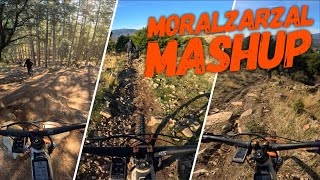
      youtuber ⛰ Moralzarzal Mashup ◾️ | Cerro del...
      mtb
      32:06 | 42 | Dec 21, 2025 , Moralzarzal
      youtuber Rutón por Alpedrete - Copa de España XCO -...
      mtb
      8:23 | 118 | Apr 17, 2023 , Moralzarzal

      Routes with this trail

      33 miles • 3,904 ft • 23 • Loop •
      Bonita ruta de más de 50 km que recorre algunas de las sendas más atractivas de la Sierra de Guadarrama....
      4.0 ★★★★★
      3 Ratings
      5 ★ 33%
      4 ★ 33%
      3 ★ 33%
      2 ★
      1 ★

      1 Review & Comments

      LZ1975
      Bonita senda con sube-bajas para llegar desde las proximidades de Becerril hasta la entrada de Collado Mediano. Fácil de realizar salvo un par de zonas con algunas rocas

      We hope you've been enjoying Trailforks!

      Create a FREE account to view all trail reviews and much more.

      • By pablo-gloTF Pro & contributors
      • #296719 - 682 views

      Frequently Asked Questions

      ▼ Where is La Renault located?
      La Renault is located in Cerro del Telégrafo, Moralzarzal, Spain. It is part of the Cerro del Telégrafo trail network. The trailhead is located at coordinates 40.6871, -4.01253.
      ▼ How hard is La Renault?
      La Renault is rated as Green difficulty. The physical rating is Easy. The average grade is 2.6%. The climb difficulty is rated Green.
      ▼ What is the elevation gain for La Renault?
      La Renault has 193 ft of elevation gain. The trail has 35 ft of elevation descent. The elevation ranges from 3,484 ft to 3,649 ft.
      ▼ Is La Renault a point to point trail?
      La Renault is not a point to point trail. The direction is Both Directions. The trail type is singletrack.
      ▼ How long is La Renault?
      La Renault is 1.1 miles long. The trail type is singletrack.
      ▼ Are dogs allowed on La Renault?
      Yes, dogs are allowed on La Renault. Please keep dogs on a leash where required and clean up after them.
      ▼ How do I access La Renault? Where is the closest parking trailhead?
      The closest parking and trailhead locations to La Renault are: View all parking locations in the area.
      ▼ How long does it take to ride La Renault?
      Based on recorded activities, it takes an average of 11 minutes to ride La Renault. The trail is 1.1 miles long. Actual times will vary based on fitness level, conditions, and pace. View recent activity logs for more details.
      ▼ How busy is La Renault?
      La Renault is a very popular trail. There have been 1,542 recorded activities on this trail. The trail has received 1,569 check-ins. View recent activity on this trail.

      Hit the Trail

      Open in App

      Get this trail on your phone instantly.

      open trail in app

      Download Trail

      Save to wishlist, Garmin & download.
      save the trail

      Find Related Routes

      Find routes and users activities that include this trail.
      find routes for this trail

      You must enter a description before submitting.

