more stats
2,060 ft
Distance
25 ft
Climb
-243 ft
Descent
00:02:15
Avg time
-218 ft
Altitude change
679 ft
Altitude min
907 ft
Altitude max
907 ft
Altitude start
689 ft
Altitude end
-10.593%
Grade
-54.987%
Grade max
24.713%
Grade min
311 ft
Distance climb
1,749 ft
Distance down
00:02:15
Avg time

La Tablerone Details

  • Activities
    • Mountain Bike
    • E-Bike
  • Riding Area
    VBN Secteur Saint-Raymond
    Saint-Raymond, Quebec
  • Difficulty Rating
  • Local Popularity
    55 in Mountain Biking [+]
    • 50 in E-Biking
  • Global Ranking
    #74385 in Mountain Biking [+]
    • #68629 in E-Biking
  • Provincial Ranking
    #1,183 in Mountain Biking · Quebec [+]
    • #1,249 in E-Biking
  • Trail Type
    Machine Groomed
  • Bike Type
    DH, AM, DJ
  • Direction
    Downhill Only
    Popular Direction Shown
  • Physical Rating
    Moderate
  • eBike Allowed
    Yes up to Class 1
  • TTFs on Trail
    Berm, Bridge, Jump
  • Year Opened
    2017
  • Land Owner
    Vallée Bras-du-Nord

Piste très roulante avec plusieurs virage inclinés ainsi que plusieurs sauts. Les sauts de la Toblerone sont les plus gros du secteur.

Tags
BermsBridgesJumps

Trail Supporters

Local Trail Association

Traditionally Indigenous Territory

Recent Activity on Trail

Past Week
  • 0 rides
  •  
6 Months
  • 66 rides
  • 26.7 km avg distance
All
  • 814 rides
  • Last: Oct 22, 2026
c1c2c3c4
January
February
March
April
May
June
July
August
September
October
November
December
Status:
on Aug 21, 2026
Ideal
Avg: 4.48 (23 votes)
Your vote: 0

view (4,394)
close
      Directions to la-tablerone trailhead (46.927422, -71.803932)

      Photos

      28 more »
      mtb
      107 |
      Jul 22, 2022 @ 12:31pm
      Jul 22, 2022
      mtb
      93 |
      Jul 22, 2022 @ 12:31pm
      Jul 22, 2022
      mtb
      138 |
      Sep 26, 2021 @ 6:32pm
      Sep 26, 2021
      mtb
      129 |
      Jun 14, 2020 @ 4:41am
      Jun 14, 2020

      Videos

      11 more »
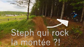
      youtuber Leçon #1: Toujours garder les yeux sur la piste
      mtb
      0:44 | 356 | Feb 8, 2021 , Saint-Raymond
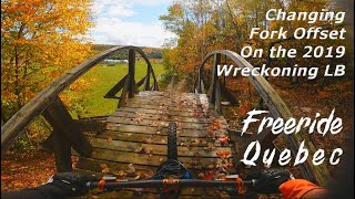
      youtuber Messing with the Fork Offset on the Wreckoning
      mtb
      11:11 | 438 | Oct 26, 2020 , Saint-Raymond
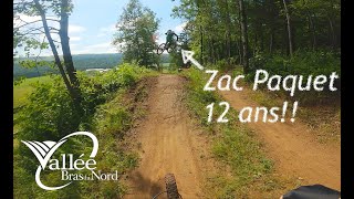
      youtuber Est-ce que je peux whipper autant qu'un kid de...
      mtb
      2:23 | 668 | Jul 20, 2020 , Saint-Raymond
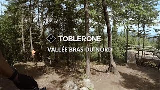
      youtuber Toblerone | Vallée Bras-du-Nord | Quebec City MTB
      mtb
      2593 | Jul 26, 2017 , Saint-Raymond

      Routes with this trail

      13 miles • 1,787 ft • 13 • Loop •
      A fast and flowy mountain bike route located at Vallée Bras-du-Nord Saint-Raymond. The route starts at...
      13 miles • 1,984 ft • 27 •
      Mont Laura : • Sentier Roquemont • Montée Pentecote • Sabot de la vierge • Montée PenteCote •...
      22 miles • 2,662 ft • 23 • Point to Point • Race •
      ENGLISH BELOW Du centre-ville de Saint-Raymond, longez la rivière pour ensuite attaquer l’exigeante et...
      4.6 ★★★★★
      23 Ratings
      5 ★ 65%
      4 ★ 30%
      3 ★ 4%
      2 ★
      1 ★

      1 Review & Comments

      philippelarouche
      Super belle Trail de jump! Les Jumps se trouvent principalement dans la section du bas

      We hope you've been enjoying Trailforks!

      Create a FREE account to view all trail reviews and much more.

      • By zeGGTF Pro QVDM & contributors
      • #94599 - 3,869 views

      Frequently Asked Questions

      ▼ Where is La Tablerone located?
      La Tablerone is located in VBN Secteur Saint-Raymond, Saint-Raymond, Quebec, Canada. It is part of the VBN Secteur Saint-Raymond trail network. The trailhead is located at coordinates 46.92742, -71.80393.
      ▼ How hard is La Tablerone?
      La Tablerone is rated as Black Diamond difficulty. The physical rating is Moderate. The average grade is 10.593%.
      ▼ What is the elevation gain for La Tablerone?
      La Tablerone has 25 ft of elevation gain. The trail has 243 ft of elevation descent. The elevation ranges from 679 ft to 907 ft.
      ▼ Is La Tablerone a point to point trail?
      Yes, La Tablerone is a point to point trail. The direction is Downhill Only. The trail type is machine groomed.
      ▼ How long is La Tablerone?
      La Tablerone is 2,060 ft long. The trail type is machine groomed.
      ▼ Are dogs allowed on La Tablerone?
      There is no information about dogs being allowed on La Tablerone. Check with local trail managers or the trail page for the latest access rules.
      ▼ When is the best time of year to ride La Tablerone?
      Based on activity log data, the most popular months to ride La Tablerone are:
      • August (53 activities)
      • June (40 activities)
      • September (33 activities)
      Check the reports page for current trail conditions.
      ▼ How do I access La Tablerone? Where is the closest parking trailhead?
      The closest parking and trailhead locations to La Tablerone are: View all parking locations in the area.
      ▼ How long does it take to ride La Tablerone?
      Based on recorded activities, it takes an average of 2 minutes to ride La Tablerone. The trail is 2,060 ft long. Actual times will vary based on fitness level, conditions, and pace. View recent activity logs for more details.
      ▼ How busy is La Tablerone?
      La Tablerone is a moderately popular trail. There have been 3,708 recorded activities on this trail. The trail has received 4,394 check-ins. View recent activity on this trail.

      Hit the Trail

      Open in App

      Get this trail on your phone instantly.

      open trail in app

      Download Trail

      Save to wishlist, Garmin & download.
      save the trail

      Find Related Routes

      Find routes and users activities that include this trail.
      find routes for this trail

      You must enter a description before submitting.