
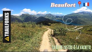
more stats
2.2 miles
Distance
13 ft
Climb
-2,245 ft
Descent
00:23:32
Avg time
-2,232 ft
Altitude change
3,376 ft
Altitude min
5,615 ft
Altitude max
5,608 ft
Altitude start
3,376 ft
Altitude end
-18.8%
Grade
-75.1%
Grade max
10.1%
Grade min
282 ft
Distance climb
2 miles
Distance down
210 ft
Distance flat
00:23:32
Avg time

La Vachette Details

  • Activities
    • Mountain Bike
    • E-Bike
  • Riding Area
  • Difficulty Rating
  • Local Popularity
    100 in Mountain Biking [+]
    • 95 in E-Biking
  • Global Ranking
    #69340 in Mountain Biking [+]
    • #87944 in E-Biking
  • National Ranking
    #3,274 in Mountain Biking · France [+]
    • #6,698 in E-Biking
  • Trail Type
    Singletrack
  • Bike Type
    AM
  • Direction
    Downhill Primary
    Popular Direction Shown
  • Dogs Allowed
    Yes
  • eBike Allowed
    Yes up to Class 1

Enduro itinerary with a small climb from the Col du Pré to reach the starting point
of the descent. First part rolling on
wide path with pebbles. Second part more technical on "single" in earth. Return to the starting point by the road.

Itinéraire enduro avec une petite montée à partir du Col du Pré pour atteindre le point de départ
de la descente. Première partie roulante sur
large sentier avec cailloux. Deuxième partie plus technique sur “single” en terre. Retour au point de départ par la route.

Tags

Recent Activity on Trail

Past Week
  • 0 rides
  •  
6 Months
  • 20 rides
  • 22 miles avg distance
All
  • 64 rides
  • Last: Oct 15, 2026
c1c2c3c4
January
February
March
April
May
June
July
August
September
October
November
December
update trails status or condition

La Vachette Trail Reports

Status:
on Aug 30, 2026
Ideal
Avg: 4.08 (7 votes)
Your vote: 0

view (529)
close
      Directions to la-vachette trailhead (45.694800, 6.585640)

      Photos

      5 more »
      mtb
      430 |
      Aug 31, 2026 @ 2:17am
      Aug 31, 2026
      mtb
      42 |
      Aug 31, 2026 @ 2:17am
      Aug 31, 2026
      mtb
      189 |
      May 28, 2022 @ 11:47pm
      May 28, 2022
      mtb
      119 |
      May 28, 2022 @ 11:24pm
      May 28, 2022

      Videos

      1 more »
      Un petit coin de paradis pour des sentier vtt
      mtb
      4:04 | 145 | Apr 27, 2025 , Beaufort

      Routes with this trail

      ★ 4.0 • 16 miles • 4,558 ft • 3 • Loop •
      Very nice enduro tour. Start in the town of Arêches. The beginning is in a road, some steap parts but...
      29 miles • 8,365 ft • 22 • Point to Point •
      Longue sortie VTT pour découvrir des paysages magnifiques, des sentiers en alpages, d’autres plus...
      4.3 ★★★★★
      7 Ratings
      5 ★ 57%
      4 ★ 14%
      3 ★ 29%
      2 ★
      1 ★

      1 Review & Comments

      Doubleyouess
      Really nice trail, marked on mountain as a red enduro which is accurate except for one tight steel section in middle. Fast in places techy in others.

      We hope you've been enjoying Trailforks!

      Create a FREE account to view all trail reviews and much more.

      • By ThomPowder & contributors
      • #205223 - 1,352 views

      Frequently Asked Questions

      ▼ Where is La Vachette located?
      La Vachette is located in Beaufort, France. It is part of the Beaufort trail network. The trailhead is located at coordinates 45.6948, 6.58564.
      ▼ How hard is La Vachette?
      La Vachette is rated as Red difficulty. The average grade is 18.8%.
      ▼ What is the elevation gain for La Vachette?
      La Vachette has 13 ft of elevation gain. The trail has 2,245 ft of elevation descent. The elevation ranges from 3,376 ft to 5,615 ft.
      ▼ Is La Vachette a point to point trail?
      La Vachette is not a point to point trail. The direction is Downhill Primary. The trail type is singletrack.
      ▼ How long is La Vachette?
      La Vachette is 2.2 miles long. The trail type is singletrack.
      ▼ Are dogs allowed on La Vachette?
      Yes, dogs are allowed on La Vachette. Please keep dogs on a leash where required and clean up after them.
      ▼ How do I access La Vachette? Where is the closest parking trailhead?
      The closest parking and trailhead locations to La Vachette are: View all parking locations in the area.
      ▼ How long does it take to ride La Vachette?
      Based on recorded activities, it takes an average of 24 minutes to ride La Vachette. The trail is 2.2 miles long. Actual times will vary based on fitness level, conditions, and pace. View recent activity logs for more details.
      ▼ How busy is La Vachette?
      La Vachette is a very popular trail. There have been 496 recorded activities on this trail. The trail has received 529 check-ins. View recent activity on this trail.

      Hit the Trail

      Open in App

      Get this trail on your phone instantly.

      open trail in app

      Download Trail

      Save to wishlist, Garmin & download.
      save the trail

      Find Related Routes

      Find routes and users activities that include this trail.
      find routes for this trail

      You must enter a description before submitting.

