

Open in App
Get this trail on your phone instantly.

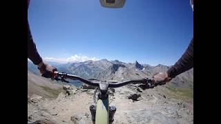
Dalla cima si scende lungo la cresta di confine su un fantastico singletrack ripido e un po scivoloso ma abbastanza flow fino al Col de Saint-Véran (2844 m). Da qui si devia decisamente a destra tuffandosi in territorio francese. La discesa diventa più guidata e tecnica (in buona parte pedalabile), portando rapidamente alla splendida conca glaciale dei Laghetti Blanchet (Superiore e Inferiore), dominati dalla mole della Rocca Bianca.

Service Road Atlas is a free to use, community-driven service for viewing and creating reports on the numerous back-country service roads around B.C. and Alberta.
Save the current map location and zoom level as your default home location whenever this page is loaded.
Save
No reviews yet, be the first to write a review or ask a question.
Use trail reports to comment on trail conditions.
We hope you've been enjoying Trailforks!
Create a FREE account to view all trail reviews and much more.
 & contributors
You must enter a description before submitting.

