Lachi's Track Details
-
Activities
- Mountain Bike
- E-Bike
-
Riding AreaMaryvale Pines
Traralgon -
Difficulty Rating
-
Voted DifficultyBlue (1 vote)
-
Trail TypeSingletrack
-
Bike TypeAM
-
DirectionDownhill OnlyPopular direction shown
-
Climb DifficultyBlue
-
Physical RatingModerate
-
Trail VisibilityAlways easy to follow
-
eBike AllowedYes up to Class 1
-
TTFs on TrailA-Frame, Berm, Bridge, Drop, Jump, Gap Jump
-
Global Ranking
-
Local Popularity80 in Mountain Biking [+]
- 70 in E-Biking
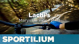
A short, fast and fun flowing descent with banked berms, dirt single jumps, roller doubles, tabletops and A/B Line Hip jumps. All main features have a ride around or safe alternative line (B-line) but are not too large that you would consider them dangerous or at an expert level, all tabletops are safe to roll, and as always it would be recommended to walk & sight the trail features before attempting them.
This trail is unsanctioned.
Traditionally Indigenous Territory
More Stats for Lachi's Track mountain bike trail trail
-
Altitude change-80 ft
-
Altitude min197 ft
-
Altitude max286 ft
-
Altitude start277 ft
-
Altitude end197 ft
-
Grade-4.3%
-
Grade max-18.4%
-
Grade min6.7%
-
Distance climb410 ft
-
Distance down1,230 ft
-
Distance flat217 ft
-
Avg time00:01:16
-
Avg reverse time00:02:48
- view trail stats
-
Layers w
- Map Content
- More Layers
- Pro
- Pro
- Pro
- Pro
- Pro
- Pro
- Pro
- Pro
-
Upgrade to

- Unknown
- Snow Groomed
- Snow Packed
- Snow Covered
- Snow Cover Partial
- Freeze/thaw Cycle
- Icy
- Prevalent Mud
- Wet
- Variable
- Ideal
- Dry
- Very Dry
The colour categories are based on what percentage of riders are riding a trail in its intended direction.
- > 96%
- > 90%
- > 80%
- > 70%
- > 50%
- < 50%
- bi-directional trail
- no data
- < 2 days
- < 1 week
- < 2 weeks
- < 1 month
- < 6 months
- > 6 months
- Downhill Only
- Downhill Primary
- Both Directions
- Uphill Primary
- Uphill Only
- One Direction
- Description
- Photos
- Description & Photos
- Videos
- most popular
- popular
- less popular
- not popular

- mountain biking recent
- mountain biking (>6 month)
- hiking (1 year)
- moto (1 year)
- Downhill Ski
- Backcountry Ski
- Nordic Ski
- Snowmobile
Save the current map location and zoom level as your default home location whenever this page is loaded.
SaveLachi's Track Trail Reports
Recent Ridelog Activity on Trail
- 6 rides
- 11 miles avg distance
- 194 rides
- 11 miles avg distance
- 3,152 rides
- Last: May 18, 2024
Technical Trail Features (TTF)
- Bridge

- Gap Jump (Rollable)
 Gap Jump
 - Hip Jump A/B Line Jump
- Roller Double Jump
- Small Table-Top Jump
- Wood Table-Top Jump
Photos
Reviews / Comments
No reviews yet, be the first to write a review or ask a question.
Use trail reports to comment on trail conditions.
We hope you've been enjoying Trailforks!
Create a FREE account to view trail comments and much more.
Videos


Nearby Trails
- Freddo 92 ft
- Hydroponic Highway 279 ft
- Pine Cones 640 ft
- The Down Hill 814 ft
- The Down Hill (car Park) 814 ft
- #95315 - 1,374 views
- follow/subscribe
- login to download gpx or kml files.
You must enter a description before submitting.