more stats
1.5 miles
Distance
19 ft
Climb
-912 ft
Descent
00:24:44
Avg time
-893 ft
Altitude change
747 ft
Altitude min
1,639 ft
Altitude max
1,639 ft
Altitude start
748 ft
Altitude end
-11.4%
Grade
-54.6%
Grade max
8%
Grade min
607 ft
Distance climb
1 mile
Distance down
413 ft
Distance flat
00:24:44
Avg time

Lager Details

  • Activities
    • Mountain Bike
  • Riding Area
    Velo MSM
    Lac-Sainte-Marie, Quebec
  • Difficulty Rating
  • Voted Difficulty
    Double Black Diamond (1 vote)
  • Local Popularity
    55 in Mountain Biking
  • Global Ranking
    #12624 in Mountain Biking
  • Trail Type
    Singletrack
  • Bike Type
    AM
  • Direction
    Downhill Only
    Popular Direction Shown
  • Physical Rating
    Hard
  • Dogs Allowed
    Yes
  • TTFs on Trail
    Rock Face
  • Land Owner
    Velo MSM

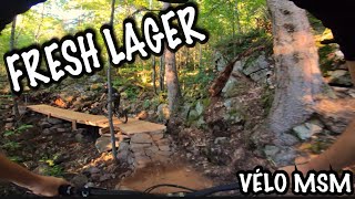
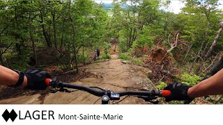
Most difficult decent trail at MSM large rock feature 2/3 of the way down. Tight and steep switchbacks, fast technical riding.

Access Info

From the top of the lift or as a continuation of Pilsner starting after the picnic table

Local Trail Association

Recent Activity on Trail

Past Week
  • 0 rides
  •  
6 Months
  • 9 rides
  • 63 miles avg distance
All
  • 288 rides
  • Last: Jun 28, 2026
c1c2c3c4
January
February
March
April
May
June
July
August
September
October
November
December
update trails status or condition

Lager Trail Reports

statusdatedescription
May 26, 2026 @ 2:56pm (America/Toronto)
May 26, 2026
tree down in the middle after the last climb before you head back down, can duck under. Will need a chainsaw, tree leaning against another tree
Aug 2, 2025 @ 1:09pm
Aug 2, 2025
Jul 1, 2024 @ 7:37am
Jul 1, 2024
Jun 26, 2024 @ 7:20am
Jun 26, 2024
Jun 14, 2024 @ 2:54am
Jun 14, 2024
more »
Status:
on May 26, 2026
Ideal
Avg: 4.4 (25 votes)
Your vote: 0

view (1,692)
close
3D
Trail Conditions
  • Unknown
  • Snow Groomed
  • Snow Packed
  • Snow Covered
  • Snow Cover Partial
  • Freeze/thaw Cycle
  • Icy
  • Prevalent Mud
  • Wet
  • Variable
  • Ideal
  • Dry
  • Very Dry
Trail Flow (Ridden Direction)
Trailforks scans users ridelogs to determine the most popular direction each trail is ridden. A good flowing trail network will have most trails flowing in a single direction according to their intension.
The colour categories are based on what percentage of riders are riding a trail in its intended direction.
  • > 96%
  • > 90%
  • > 80%
  • > 70%
  • > 50%
  • < 50%
  • bi-directional trail
  • no data
Trail Last Ridden
Trailforks scans ridelogs to determine the last time a trail was ridden.
  • < 2 days
  • < 1 week
  • < 2 weeks
  • < 1 month
  • < 6 months
  • > 6 months
Trail Ridden Direction
The intended direction a trail should be ridden.
  • Downhill Only
  • Downhill Primary
  • Both Directions
  • Uphill Primary
  • Uphill Only
  • One Direction
Contribute Details
Colors indicate trail is missing specified detail.
  • Description
  • Photos
  • Description & Photos
  • Videos
Trail Popularity ?
Trailforks scans ridelogs to determine which trails are ridden the most in the last 9 months. Trails are compared with nearby trails in the same city region with a possible 25 colour shades. Think of this as a heatmap, more rides = more kinetic energy = warmer colors.
  • most popular
  • popular
  • less popular
  • not popular
ATV/ORV/OHV Filter
Max Vehicle Width
inches
US Cell Coverage
Legend
cell carrier legend

Radar Time
Activity Recordings
Trailforks uses anonymized public activity data. ?
Activity Recordings
Trailforks uses anonymized public activity data. ?
Personal Heatmap
Activity Types
all / none
Options
2
Date range month
Winter Trails
Warning A routing network for winter maps does not exist. Selecting trails using the winter trails layer has been disabled.
Missing Trails
Most Popular
Least Popular
Trails are colored based on popularity. The more popular a trail is, the more red. Less popular trails trend towards green.
Jump Magnitude Heatmap
Heatmap of where riders jump on trails. Zoom in to see individual jumps, click circles to view jump details.
BC Backroad Status

Service Road Atlas is a free to use, community-driven service for viewing and creating reports on the numerous back-country service roads around B.C. and Alberta.

map legend
Slope Aspect
Direction the slope faces
Flat N NE E SE S SW W NW
Trails Deemphasized
Trails are shown in grey.
disable
Only show trails with no bike usage.
Enable
Suggested Layers
Based on selected activity type

    Save the current map location and zoom level as your default home location whenever this page is loaded.

    Save
        Directions to lager trailhead (45.928400, -75.869100)

        Photos

        5 more »
        40 |
        Jul 30, 2024 @ 6:10am
        Jul 30, 2024
        64 |
        Sep 18, 2023 @ 8:10am
        Sep 18, 2023
        72 |
        Sep 18, 2023 @ 8:09am
        Sep 18, 2023
        145 |
        Oct 15, 2022 @ 7:24am
        Oct 15, 2022

        Videos

        12 more »
        Vélo MSM Lager
        8:33 | 602 | Sep 9, 2022 , Lac-Sainte-Marie
        MTB - Mont-Sainte-Marie - Lager
        15:36 | 481 | Jun 6, 2022 , Lac-Sainte-Marie
        Mont Sainte Marie -  Lager -  Fall 2021 360 VR 4K
        10:57 | 259 | Feb 9, 2022 , Lac-Sainte-Marie
        FAMILY JEWEL & LAGER//MSM QC//2021// what...
        22:44 | 224 | Sep 19, 2021 , Lac-Sainte-Marie

        Routes with this trail

        1.7 6 miles 1,381 ft 5
        The mountain loop. All the way to the top of the radar tower, across to the top of Vanier, and down .

        4 Reviews & Comments


        We hope you've been enjoying Trailforks!

        Create a FREE account to view trail comments and much more.

        Frequently Asked Questions About Lager

        Where is Lager located?
        Lager is located in Velo MSM, Lac-Sainte-Marie, Quebec, Canada. It is part of the Velo MSM trail network. The trailhead is located at coordinates 45.9284, -75.8691.
        How hard is Lager?
        Lager is rated as Double Black Diamond difficulty. The physical rating is Hard. The average grade is 11.4%.
        What is the elevation gain for Lager?
        Lager has 6 m of elevation gain. The trail has 278 m of elevation descent. The elevation ranges from 228 m to 500 m.
        Is Lager a point to point trail?
        Yes, Lager is a point to point trail. The direction is Downhill Only. The trail type is singletrack.

        Hit the Trail

        Open in App

        Get this trail on your phone instantly.
        open trail in app

        Download Trail

        Save to wishlist, Garmin & download.
        save the trail

        Find Related Routes

        Find routes and users activities that include this trail.
        find routes for this trail

        You must enter a description before submitting.