


Open in App
Get this trail on your phone instantly.

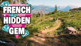
A nice long trail from 1600m, with a mix of technical corners, long fast sections and super rough terrain. Nothing crazy steep on this trail, definitely have a look at the wooden road gap/drop before you hit it as the run out is super short and can be loose. Theres also a small landslide mid-way down thats pretty difficult to ride over so you might need to get off and push. Trail exists onto a road, you can follow the 'Retour Samoens' yellow signs back to the GME, or just take the road all the way down.
Right out the top of the GME, but head West, if you are underneath the GME at the start, you went too far right. Follow the 'Le Chable' black signs from the top and it's fairly easy to follow all the way down.

Service Road Atlas is a free to use, community-driven service for viewing and creating reports on the numerous back-country service roads around B.C. and Alberta.
Save the current map location and zoom level as your default home location whenever this page is loaded.
SaveWe hope you've been enjoying Trailforks!
Create a FREE account to view all trail reviews and much more.
 & contributors
You must enter a description before submitting.

