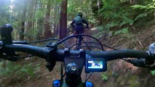


more stats
5,233 ft
Distance
3 ft
Climb
-324 ft
Descent
00:10:05
Avg time
-322 ft
Altitude change
229 ft
Altitude min
551 ft
Altitude max
551 ft
Altitude start
230 ft
Altitude end
-6.1%
Grade
-49%
Grade max
1.5%
Grade min
220 ft
Distance climb
4,846 ft
Distance down
167 ft
Distance flat
00:10:05
Avg time

Lindquist Loops Details

  • Activities
    • Mountain Bike
    • Hike
    • Trail Running
  • Riding Area
    Jackson Demonstration State Forest
    Mendocino, California
  • Difficulty Rating
  • Local Popularity
    90 in Mountain Biking [+]
    • 95 in Trail Running
    • 90 in Hiking
  • Global Ranking
    #71841 in Mountain Biking [+]
    • #92495 in Trail Running
    • #109937 in Hiking
  • State Ranking
    #2,282 in Mountain Biking · California [+]
    • #4,503 in Trail Running
    • #6,130 in Hiking
  • Hiking SAC Scale
    T1 Hiking
  • Trail Type
    Singletrack
  • Bike Type
    AM, XC
  • Climb Difficulty
    Blue
  • Physical Rating
    Moderate
  • Dogs Allowed
    Yes
  • eBike Allowed
  • TTFs on Trail
    Bridge
  • Land Owner
    Jackson Demonstration State Forest

No community description for Lindquist Loops trail has been added yet!

AI Generated Description

Lindquist Loops is a 5,233 ft popular blue difficulty singletrack trail located near Mendocino California. This mountain bike primary trail and has a moderate overall physical rating with a 3 ft blue climb. It features bridge. On average it takes 10 minutes to complete this trail.

Tags
Bridges

Local Trail Association

Traditionally Indigenous Territory

Recent Activity on Trail

Past Week
  • 1 rides
  • 16 miles average
6 Months
  • 51 rides
  • 14 miles avg distance
All
  • 301 rides
  • Last: Oct 25, 2026
c1c2c3c4
January
February
March
April
May
June
July
August
September
October
November
December
update trails status or condition

Lindquist Loops Trail Reports

statusdatedescription
Jun 23, 2026 @ 11:31am (America/Los_Angeles)
Jun 23, 2026
Mar 6, 2026 @ 3:05pm (America/Los_Angeles)
Mar 6, 2026
Very smooth, steep, lots of switchbacks, recommend going downhill.
Sep 27, 2025 @ 9:12am (America/Los_Angeles)
Sep 27, 2025
Wonderful riding conditions.
Jul 7, 2025 @ 4:10pm
Jul 7, 2025
In great shape with more trail and switchbacks added for better flow. Improved and maintained by Mendocino Coast Cyclists in conjunction with...
Jun 9, 2025 @ 10:47am
Jun 9, 2025
Steep switchbacks with great berms on the turns lots of fun
more »
Status:
on Jun 23, 2026
Ideal
Avg: 3.61 (2 votes)
Your vote: 0

view (1,337)
close
      Directions to lindquist-loops trailhead (39.339700, -123.761850)

      Photos

      1 more »
      mtb
      74 |
      Nov 10, 2025 @ 7:55am
      Nov 10, 2025

      Videos

      3 more »
      Lindquist Loops- Jackson Demonstration State...
      mtb
      6:33 | 157 | Oct 31, 2024 , Mendocino
      Purple Skirt
      mtb
      3:22 | 591 | Sep 19, 2020 , Mendocino
      Purple Skirt Trail Guide
      mtb
      3:44 | 327 | Sep 19, 2020 , Mendocino

      Routes with this trail

      ★ 5.0 • 12 miles • 1,686 ft • 4 •
      This route takes on 3 of the crown jewels of Mendocino Coast riding. Park at 409 EOP, drop down Lindquist,...
      ★ 4.0 • 20 miles • 2,965 ft • 16 • Loop •
      This is a big, fun 22 mileloop through the Jackson Demonstration Forest hitting some of the favorite...
      ★ 5.0 • 26 miles • 4,331 ft • 26 •
      This is a route loosely based off of a prior enduro.
      2.5 ★★★★★
      2 Ratings
      5 ★
      4 ★
      3 ★ 50%
      2 ★ 50%
      1 ★

      4 Reviews & Comments

      ravengraham ravengraham
      Lindquist is an uphill switchback coming from sweet pea. But it’s possible if you skip the cutoff! Looks short but too sleep. Go around!!
      alxburr
      This trail needs to get updated. Lindquist loop intersects around it and is way curvier
      Chasebeck734 Chasebeck734
      Trail is open. Major pain going up, pushing half the way. Good to go down of course. Wouldn’t say its better or worse to lose elevation on than ez out, just different. End up on road 410, anywhere you go from there is up.

      We hope you've been enjoying Trailforks!

      Create a FREE account to view all trail reviews and much more.

      • By FRguild & contributors
      • #34727 - 2,370 views

      Frequently Asked Questions

      ▼ Where is Lindquist Loops located?
      Lindquist Loops is located in Jackson Demonstration State Forest, Mendocino, California, United States. It is part of the Jackson Demonstration State Forest trail network. The trailhead is located at coordinates 39.3397, -123.76185.
      ▼ How hard is Lindquist Loops?
      Lindquist Loops is rated as Blue difficulty. The physical rating is Moderate. The average grade is 6.1%. The climb difficulty is rated Blue.
      ▼ What is the elevation gain for Lindquist Loops?
      Lindquist Loops has 3 ft of elevation gain. The trail has 324 ft of elevation descent. The elevation ranges from 229 ft to 551 ft.
      ▼ How long is Lindquist Loops?
      Lindquist Loops is 5,233 ft long. The trail type is singletrack.
      ▼ Are dogs allowed on Lindquist Loops?
      Yes, dogs are allowed on Lindquist Loops. Please keep dogs on a leash where required and clean up after them.
      ▼ How do I access Lindquist Loops? Where is the closest parking trailhead?
      The closest parking and trailhead locations to Lindquist Loops are: View all parking locations in the area.
      ▼ How long does it take to ride Lindquist Loops?
      Based on recorded activities, it takes an average of 10 minutes to ride Lindquist Loops. The trail is 5,233 ft long. Actual times will vary based on fitness level, conditions, and pace. View recent activity logs for more details.
      ▼ How busy is Lindquist Loops?
      Lindquist Loops is a very popular trail. There have been 1,148 recorded activities on this trail. The trail has received 1,337 check-ins. View recent activity on this trail.

      Hit the Trail

      Open in App

      Get this trail on your phone instantly.

      open trail in app

      Download Trail

      Save to wishlist, Garmin & download.
      save the trail

      Find Related Routes

      Find routes and users activities that include this trail.
      find routes for this trail

      You must enter a description before submitting.