

more stats
1.0 mile
Distance
207 ft
Climb
-44 ft
Descent
00:10:21
Avg time
163 ft
Altitude change
992 ft
Altitude min
1,155 ft
Altitude max
992 ft
Altitude start
1,155 ft
Altitude end
3%
Grade
-9.6%
Grade max
28.5%
Grade min
3,127 ft
Distance climb
1,089 ft
Distance down
1,138 ft
Distance flat
00:10:21
Avg time

Link Details

  • Activities
    • Mountain Bike
    • E-Bike
    • Hike
    • Trail Running
  • Riding Area
  • Difficulty Rating
  • Local Popularity
    35 in Mountain Biking [+]
    • 10 in E-Biking
    • 5 in Trail Running
    • 5 in Hiking
  • Trail Type
    Singletrack
  • Bike Type
    DH, AM, XC
  • Direction
    One Direction
    Popular Direction Shown
  • Climb Difficulty
    Blue
  • Trail Visibility
    Always easy to follow
  • eBike Allowed
    Yes up to Class 1
  • Year Opened
    2020
  • Land Owner
    Break O'Day Council

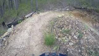
A link trail that will take riders from Send Helens across to another high point trail intersection where the descending trails Icarus and Mack 10 start.

Traditionally Indigenous Territory

Recent Activity on Trail

Past Week
  • 0 rides
  •  
6 Months
  • 8 rides
  • 14 miles avg distance
All
  • 92 rides
  • Last: Sep 11, 2026
Status:
on Apr 26, 2025
Very Dry
no votes yet
Your vote: 0

view (554)
close
      Directions to link-326276 trailhead (-41.370180, 148.231390)

      Photos

      No photos have been added for Link yet, add a photo.

      Videos

      1 more »
      Send Helens Link
      mtb
      7:19 | 137 | Feb 24, 2021 , St Helens

      Routes with this trail

      16 miles • 3,268 ft • 14 • Race •
      Come join us for a fun day of racing and fun activities, pump track challenge and prizes.

      1 Review & Comments

      JeremyWoodhill
      Trail in good nick. Fire road a much quicker but steeper option.

      We hope you've been enjoying Trailforks!

      Create a FREE account to view all trail reviews and much more.

      • By rdlrTF Pro & contributors
      • #326276 - 436 views

      Hit the Trail

      Open in App

      Get this trail on your phone instantly.

      open trail in app

      Download Trail

      Save to wishlist, Garmin & download.
      save the trail

      Find Related Routes

      Find routes and users activities that include this trail.
      find routes for this trail

      You must enter a description before submitting.



