764 ft
Distance
-98 ft
Descent
00:00:58
Avg time
Little Whistler Details
-
Activities
- Mountain Bike
- E-Bike
- Hike
- Trail Running
-
Riding AreaAachener Wald
Aachen -
Difficulty Rating
-
Voted DifficultyBlue (3 votes)
-
Trail TypeSingletrack
-
Bike TypeAM
-
DirectionDownhill PrimaryPopular direction shown
-
Physical RatingModerate
-
SeasonAll year round
-
Dogs AllowedYes
-
eBike AllowedYes up to Class 1
-
TTFs on TrailJump
-
Global Ranking
-
Local Popularity80 in Mountain Biking [+]
- 85 in E-Biking
- 75 in Trail Running
- 5 in Hiking
-
Year Opened2014
Short trail with a little bit of Canada feeling. Some difficult corners and a fun double compression at the end. The trail now starts higher.
Access Info
From the radio tower, go left. take the first road to the right and after 10 meters the trail starts to the right.
More Stats for Little Whistler mountain bike trail trail
-
Altitude change-100 ft
-
Altitude min1,020 ft
-
Altitude max1,120 ft
-
Altitude start1,120 ft
-
Altitude end1,020 ft
-
Grade-13.1%
-
Grade max-23.6%
-
Grade min-1.6%
-
Distance down725 ft
-
Avg time00:00:58
-
Avg reverse time00:05:33
- view trail stats
close
-
Layers w
- Map Content
- More Layers
- Pro
- Pro
- Pro
- Pro
- Pro
- Pro
- Pro
- Pro
-
Upgrade to

3D
Trail Conditions
- Unknown
- Snow Groomed
- Snow Packed
- Snow Covered
- Snow Cover Partial
- Freeze/thaw Cycle
- Icy
- Prevalent Mud
- Wet
- Variable
- Ideal
- Dry
- Very Dry
Trail Flow (Ridden Direction)
Trailforks scans users ridelogs to determine the most popular direction each trail is ridden. A good flowing trail network will have most trails flowing in a single direction according to their intension.
The colour categories are based on what percentage of riders are riding a trail in its intended direction.
The colour categories are based on what percentage of riders are riding a trail in its intended direction.
- > 96%
- > 90%
- > 80%
- > 70%
- > 50%
- < 50%
- bi-directional trail
- no data
Trail Last Ridden
Trailforks scans ridelogs to determine the last time a trail was ridden.
- < 2 days
- < 1 week
- < 2 weeks
- < 1 month
- < 6 months
- > 6 months
Trail Ridden Direction
The intended direction a trail should be ridden.
- Downhill Only
- Downhill Primary
- Both Directions
- Uphill Primary
- Uphill Only
- One Direction
Contribute Details
Colors indicate trail is missing specified detail.
- Description
- Photos
- Description & Photos
- Videos
Trail Popularity ?
Trailforks scans ridelogs to determine which trails are ridden the most in the last 9 months.
Trails are compared with nearby trails in the same city region with a possible 25 colour shades.
Think of this as a heatmap, more rides = more kinetic energy = warmer colors.
- most popular
- popular
- less popular
- not popular
ATV/ORV/OHV Filter
Max Vehicle Width
inches
US Cell Coverage
Legend

Radar Time
x
Activity Recordings
Trailforks users anonymized public ridelogs from the past 6 months.
- mountain biking recent
- mountain biking (>6 month)
- hiking (1 year)
- moto (1 year)
Activity Recordings
Trailforks users anonymized public skilogs from the past 12 months.
- Downhill Ski
- Backcountry Ski
- Nordic Ski
- Snowmobile
Winter Trails
Warning
A routing network for winter maps does not exist. Selecting trails using the winter trails layer has been disabled.
x
Missing Trails
Most Popular
Least Popular
Trails are colored based on popularity. The more popular a trail is, the more red. Less popular trails trend towards green.
Jump Magnitude Heatmap
Heatmap of where riders jump on trails. Zoom in to see individual jumps, click circles to view jump details.
Trails Deemphasized
Trails are shown in grey.
Only show trails with NO bikes.
Save the current map location and zoom level as your default home location whenever this page is loaded.
Save
Directions to little-whistler-9784 trailhead
(50.746410, 6.046690)
update trails status or condition
Little Whistler Trail Reports
view all reports »
Recent Ridelog Activity on Trail
Past Week
- 8 rides
- 18 miles avg distance
6 Months
- 120 rides
- 19 miles avg distance
All
- 1,237 rides
- Last: May 19, 2024
Photos
more »
Routes with this trail
We hope you've been enjoying Trailforks!
Create a FREE account to view trail comments and much more.
Videos
more »
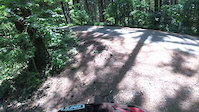
181 |
May 18, 2022 , Aachen
6:05 |
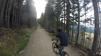
628 |
Dec 4, 2016 , Aachen
Nearby Trails
- Dual Slalom 1,332 ft
- Triple Fun 2,500 ft
- Schützengraben Trail 2,822 ft
- Funkturm 3 2,930 ft
- Römertrail 2,963 ft
- By BastiEnduro & contributors
- #9784 - 3,028 views
- follow/subscribe
- login to download gpx or kml files.
You must enter a description before submitting.